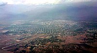
バジェドゥパル
コロンビアの都市
バジェドゥパル(Valledupar)は、コロンビア北部のセサール県の県都。 2017年6月30日の人口は40万5100人[3]。 周辺は綿花の栽培が盛んである。 バジェドゥパルは1550年1月6日にエルナンド・デ・サンタナによって建設された。 1980年代から2000年代初頭にかけては武装勢力の活動が盛んで治安悪化に苦しんだ。
バジェドゥパル | |||
|---|---|---|---|
 | |||
| |||
 セサル県内のバジェドゥパルの位置 | |||
| 座標: 北緯10度29分 西経73度15分 / 北緯10.483度 西経73.250度 | |||
| 国 |
| ||
| 地方 | カリブ地方 | ||
| 県 |
| ||
| 建設 | 1550年1月6日 | ||
| 政府 | |||
| • 市長 | ルイス・ファビアン・フェルナンデス[1] (コロンビア自由党) | ||
| 面積 | |||
| • 合計 | 4,977.66 km2 | ||
| 標高 | 180 m | ||
| 人口 (2017) | |||
| • 合計 | 405,100人 | ||
| • 密度 | 81人/km2 | ||
| [2] | |||
| 等時帯 | UTC-05 (Eastern Time Zone) | ||
| ウェブサイト | valledupar.gov.co | ||
| *Valledupar metropolitan area is yet to be determined. | |||
| バジェドゥパルの気候 | |||||||||||||
|---|---|---|---|---|---|---|---|---|---|---|---|---|---|
| 月 | 1月 | 2月 | 3月 | 4月 | 5月 | 6月 | 7月 | 8月 | 9月 | 10月 | 11月 | 12月 | 年 |
| 平均最高気温 °C (°F) | 34.7 (94.5) |
35.6 (96.1) |
35.9 (96.6) |
35.6 (96.1) |
34.0 (93.2) |
34.2 (93.6) |
35.4 (95.7) |
35.1 (95.2) |
33.8 (92.8) |
32.6 (90.7) |
33.2 (91.8) |
33.6 (92.5) |
35.1 (95.2) |
| 平均最低気温 °C (°F) | 22.4 (72.3) |
23.1 (73.6) |
23.6 (74.5) |
24.1 (75.4) |
24.1 (75.4) |
24.0 (75.2) |
24.2 (75.6) |
24.0 (75.2) |
23.5 (74.3) |
23.6 (74.5) |
23.1 (73.6) |
22.8 (73) |
23.6 (74.5) |
| 降水量 mm (inch) | 12 (0.47) |
10 (0.39) |
26 (1.02) |
71 (2.8) |
154 (6.06) |
82 (3.23) |
63 (2.48) |
116 (4.57) |
122 (4.8) |
199 (7.83) |
89 (3.5) |
28 (1.1) |
972 (38.27) |
| 出典:Weatherbase[4][5] | |||||||||||||
出身者 編集
- ホセ・フェルナンド・クアドラード - サッカー選手
- ファリド・ディアス - サッカー選手
出典 編集
- ^ (スペイン語) Colombian Registry of the Civil State: regional elections 2007
- ^ (スペイン語) DANE 2005 Census: Valledupar
- ^ “City Population”. 2019年1月27日閲覧。
- ^ “Worldweather: Valledupar, Colombia”. Weatherbase (2008年). 2008年4月8日閲覧。 [リンク切れ]
- ^ *Climatological information is based on monthly averages for the 30-year period 1971–2000.
- Precipitation includes both rain and snow.
- Attention: Please note that the averaging period for climatological information and the definition of "Mean Number of Precipitation/Rain Days" quoted in this web site may be different for different countries. Hence, care should be taken when city climatologies are compared.


