ファイル:Clingman's Dome Tower on a Sunny, Snowy Day.JPG

このプレビューのサイズ: 800 × 600 ピクセル。 その他の解像度: 320 × 240 ピクセル | 640 × 480 ピクセル | 1,024 × 768 ピクセル | 1,280 × 960 ピクセル | 2,592 × 1,944 ピクセル。
元のファイル (2,592 × 1,944 ピクセル、ファイルサイズ: 959キロバイト、MIME タイプ: image/jpeg)
ウィキメディア・コモンズのファイルページにある説明を、以下に表示します。
|
概要
| 解説 |
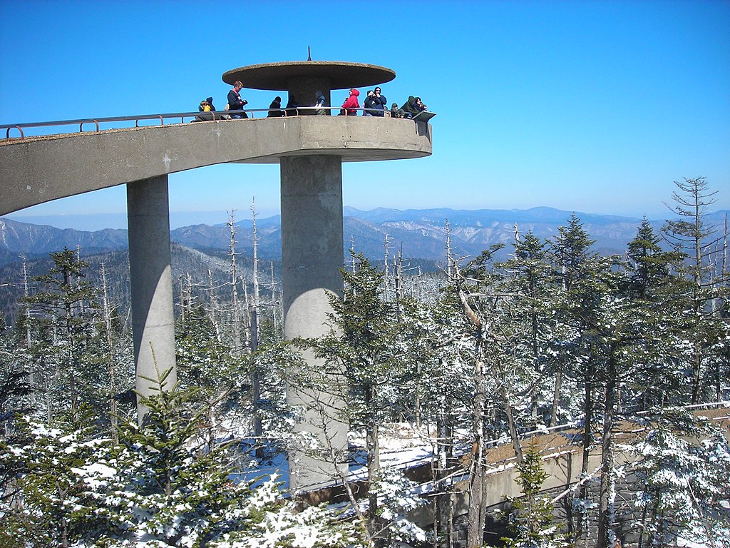
English: The Clingman's Dome Observation Tower rises 50 feet (15 m) from the summit of Clingman's Dome, the highest point both in the state of Tennessee and along the Appalachian Trail, in Great Smoky Mountains National Park. |
| 日付 | |
| 原典 | 投稿者自身による著作物 |
| 作者 | Scott Basford |
| 被写体の位置 | | 以下のサービスでこの位置を確認する: オープンストリートマップ |
|---|
ライセンス
| この著作物は、著作者であるI, Blinutneによって権利が放棄され、パブリックドメインとされました。これは全世界で適用されます。 一部の国では、これが法的に可能ではない場合があります。その場合は、次のように宣言します。 I, Blinutneは、あらゆる人に対して、法により必要とされている条件を除き、如何なる条件も課すことなく、あらゆる目的のためにこの著作物を使用する権利を与えます。 |
ファイルの履歴
過去の版のファイルを表示するには、その版の日時をクリックしてください。
| 日付と時刻 | サムネイル | 寸法 | 利用者 | コメント | |
|---|---|---|---|---|---|
| 現在の版 | 2007年7月23日 (月) 23:37 | | 2,592 × 1,944 (959キロバイト) | Blinutne | {{Information |Description= The Clingman's Dome Observation Tower rises fifty feet from the pinnacle of Clingman's Dome, the highest point both in the state of Tennessee and along the Appalachian Trail, in the Great Smoky Mountains National Park. |Source= |
ファイルの使用状況
以下のページがこのファイルを使用しています:
グローバルなファイル使用状況
以下に挙げる他のウィキがこの画像を使っています:
- ar.wikipedia.org での使用状況
- ca.wikipedia.org での使用状況
- da.wikipedia.org での使用状況
- de.wikipedia.org での使用状況
- en.wikipedia.org での使用状況
- Great Smoky Mountains National Park
- Clingmans Dome
- Mountains-to-Sea Trail
- Mission 66
- National Register of Historic Places listings in Sevier County, Tennessee
- National Register of Historic Places listings in Swain County, North Carolina
- National Register of Historic Places listings in Great Smoky Mountains National Park
- List of federal lands in Tennessee
- Protected areas of North Carolina
- fr.wikipedia.org での使用状況
- he.wikipedia.org での使用状況
- he.wikivoyage.org での使用状況
- hy.wikipedia.org での使用状況
- it.wikipedia.org での使用状況
- kk.wikipedia.org での使用状況
- la.wikipedia.org での使用状況
- nl.wikipedia.org での使用状況
- no.wikipedia.org での使用状況
- pl.wikipedia.org での使用状況
- pt.wikipedia.org での使用状況
- ru.wikipedia.org での使用状況
- tr.wikipedia.org での使用状況
- uk.wikipedia.org での使用状況
- ur.wikipedia.org での使用状況