ファイル:Fort Wayne-Huntington-Auburn CSA.png
高解像度版はありません。
Fort_Wayne-Huntington-Auburn_CSA.png (301 × 456 ピクセル、ファイルサイズ: 10キロバイト、MIME タイプ: image/png)
ウィキメディア・コモンズのファイルページにある説明を、以下に表示します。
|
| 解説 |
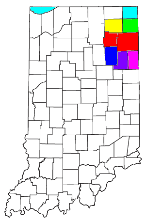
Locator map of the Fort Wayne-Huntington-Auburn Combined Statistical Area in the northeastern part of the U.S. state of Indiana. The seven components of the CSA are colored separately:
|
||
| 日付 | |||
| 原典 | Modified from this United States Census Bureau file, based on this Census definitions list. | ||
| 作者 | User:Nyttend | ||
| 許可 (ファイルの再利用) |
US Government work is public domain, and my work is
|
ファイルの履歴
過去の版のファイルを表示するには、その版の日時をクリックしてください。
| 日付と時刻 | サムネイル | 寸法 | 利用者 | コメント | |
|---|---|---|---|---|---|
| 現在の版 | 2021年8月12日 (木) 10:02 | | 301 × 456 (10キロバイト) | Yassie | Definition as of March 6, 2020, on OMB 20-01 |
| 2008年7月30日 (水) 16:30 |  | 301 × 456 (18キロバイト) | Nyttend | {{Information |Description=Locator map of the {{w|Fort Wayne-Huntington-Auburn, IN CSA|Fort Wayne-Huntington-Auburn}} {{w|Combined Statistical Area}} in the northeastern part of the {{w|U.S. state}} of {{w|Indiana}}. The five components of the CSA are co |
ファイルの使用状況
以下のページがこのファイルを使用しています:
グローバルなファイル使用状況
以下に挙げる他のウィキがこの画像を使っています:
- en.wikipedia.org での使用状況
- Fort Wayne, Indiana
- Adams County, Indiana
- Whitley County, Indiana
- Wells County, Indiana
- Noble County, Indiana
- Huntington County, Indiana
- Allen County, Indiana
- Berne, Indiana
- Decatur, Indiana
- Geneva, Indiana
- Monroe, Adams County, Indiana
- Grabill, Indiana
- Huntertown, Indiana
- Leo-Cedarville, Indiana
- Monroeville, Indiana
- New Haven, Indiana
- Woodburn, Indiana
- Zanesville, Indiana
- Altona, Indiana
- Ashley, Indiana
- Auburn, Indiana
- Butler, Indiana
- Corunna, Indiana
- Garrett, Indiana
- Hamilton, Indiana
- Saint Joe, Indiana
- Waterloo, Indiana
- Andrews, Indiana
- Huntington, Indiana
- Markle, Indiana
- Mount Etna, Indiana
- Roanoke, Indiana
- Warren, Indiana
- Wolcottville, Indiana
- Albion, Indiana
- Avilla, Indiana
- Cromwell, Indiana
- Kendallville, Indiana
- Ligonier, Indiana
- Rome City, Indiana
- Bluffton, Indiana
- Ossian, Indiana
- Poneto, Indiana
- Uniondale, Indiana
- Vera Cruz, Indiana
- Churubusco, Indiana
- Columbia City, Indiana
- Larwill, Indiana
- South Whitley, Indiana
- Fort Wayne metropolitan area, Indiana
このファイルのグローバル使用状況を表示する。