ファイル:Haynesville Shale Map.png
このプレビューのサイズ: 776 × 600 ピクセル。 その他の解像度: 311 × 240 ピクセル | 621 × 480 ピクセル | 994 × 768 ピクセル | 1,280 × 989 ピクセル | 1,650 × 1,275 ピクセル。
元のファイル (1,650 × 1,275 ピクセル、ファイルサイズ: 667キロバイト、MIME タイプ: image/png)
ウィキメディア・コモンズのファイルページにある説明を、以下に表示します。
|
概要
| 解説 |
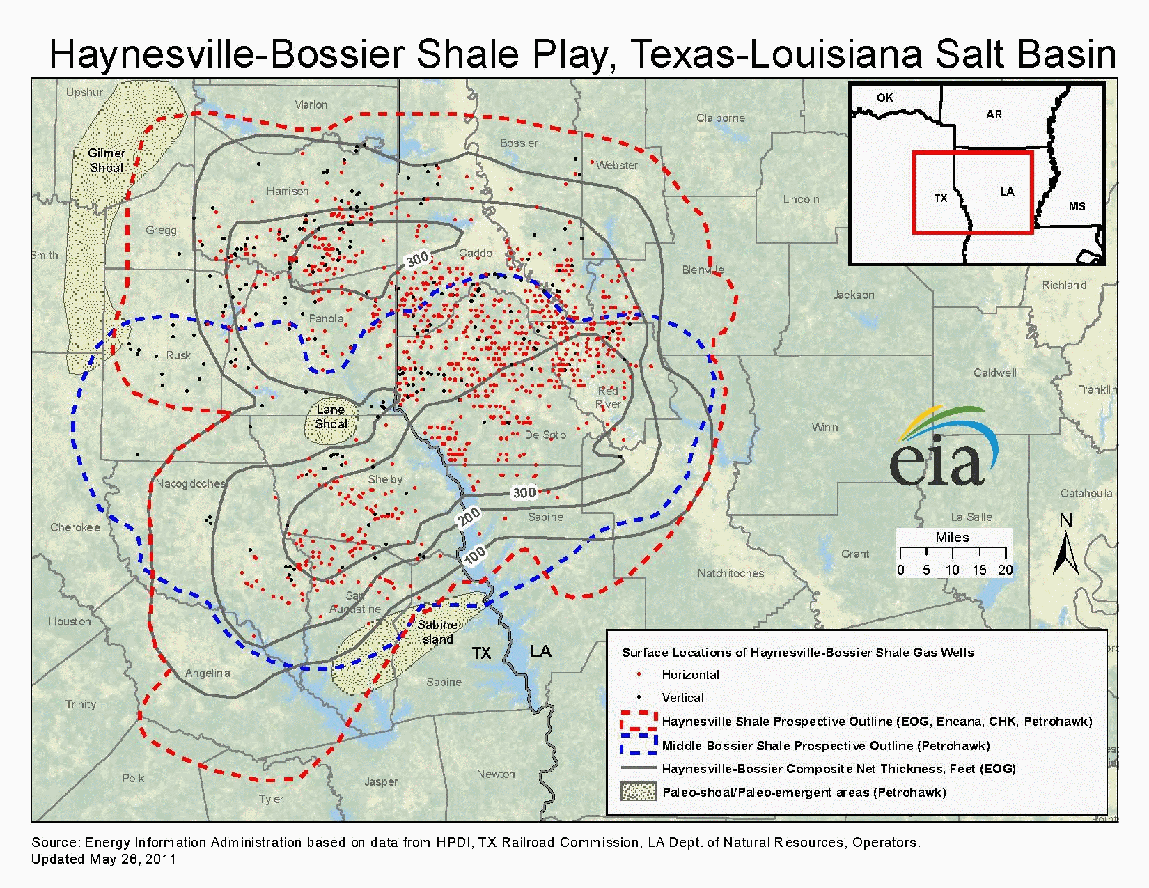
English: Map showing extent of the Haynesville Shale natural gas play in nothwest Louisiana and East Texas |
| 日付 | |
| 原典 | U.S. Energy Information Administration, U.S. Department of Energy |
| 作者 | U.S. Energy Information Administration, U.S. Department of Energy |
| 許可 (ファイルの再利用) |
The original file is a work by United States government, so it is published into public domain. I, Yassie, converted format of this file and hereby release into public domain, too. |
| その他のバージョン | File:Haynesville Shale Map.pdf (original) |
ライセンス
このファイルは、アメリカ合衆国の連邦政府と雇用関係にある公務員がその職務上作成したアメリカ合衆国政府の著作物であり、アメリカ合衆国の著作権法上パブリックドメインに属します (17 U.S.C. §105)。
注意:このライセンスは、アメリカ合衆国政府の著作物についてのみ効力を有します。アメリカ合衆国の各州、郡、その他の地方自治体が作成した著作物に対しては適用できません。
|
 | |
| このファイルは著作権法の既知の制約(隣接権や関連する権利を含む)から自由であると特定されています。 | ||
ファイルの履歴
過去の版のファイルを表示するには、その版の日時をクリックしてください。
| 日付と時刻 | サムネイル | 寸法 | 利用者 | コメント | |
|---|---|---|---|---|---|
| 現在の版 | 2016年9月18日 (日) 11:05 | | 1,650 × 1,275 (667キロバイト) | Yassie | {{Information |description={{en|1=Map showing extent of the Haynesville Shale natural gas play in nothwest Louisiana and East Texas}} |date=2011-09-03 |source=U.S. Energy Information Administration, U.S. Department of Energy |author=U.S. Energy Informa... |
ファイルの使用状況
以下のページがこのファイルを使用しています:
グローバルなファイル使用状況
以下に挙げる他のウィキがこの画像を使っています:
- en.wikipedia.org での使用状況