ファイル:Indianapolis.svg

この SVG ファイルのこの PNG プレビューのサイズ: 629 × 600 ピクセル. その他の解像度: 252 × 240 ピクセル | 504 × 480 ピクセル | 806 × 768 ピクセル | 1,074 × 1,024 ピクセル | 2,149 × 2,048 ピクセル | 1,624 × 1,548 ピクセル。
元のファイル (SVG ファイル、1,624 × 1,548 ピクセル、ファイルサイズ: 723キロバイト)
ウィキメディア・コモンズのファイルページにある説明を、以下に表示します。
|
| この著作物は、著作者であるSPUIによって権利が放棄され、パブリックドメインとされました。これは全世界で適用されます。 一部の国では、これが法的に可能ではない場合があります。その場合は、次のように宣言します。 |
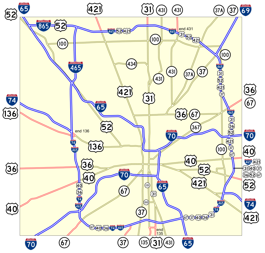
Map of numbered routes in Indianapolis, Indiana. Traced on USGS topos. Information is from the maps and photos on [1].
- Blue: Interstate
- Red: Current route
- Yellow: Former route
If you need a thumbnail use Image:Indianapolis.png.
An alternate version at Image:Indianapolis numbered routes labeled.svg shows street names.
ファイルの履歴
過去の版のファイルを表示するには、その版の日時をクリックしてください。
| 日付と時刻 | サムネイル | 寸法 | 利用者 | コメント | |
|---|---|---|---|---|---|
| 現在の版 | 2006年6月4日 (日) 17:27 | | 1,624 × 1,548 (723キロバイト) | SPUI~commonswiki | {{spuimap}} Map of numbered routes in Indianapolis, Indiana. Traced on USGS topos. Information is from the maps and photos on [http://illi-indi.com/IndianaHighwayList.php]. *Blue: Interstate *Red: Current route *Yellow: Former route If you need a thumbnai |
ファイルの使用状況
以下の 3 ページがこのファイルを使用しています:
グローバルなファイル使用状況
以下に挙げる他のウィキがこの画像を使っています:
- en.wikipedia.org での使用状況
- fi.wikipedia.org での使用状況
- fr.wikipedia.org での使用状況
- nl.wikipedia.org での使用状況
- simple.wikipedia.org での使用状況
- www.wikidata.org での使用状況
- zh.wikipedia.org での使用状況