ファイル:Milpitas view2.JPG

元のファイル (2,104 × 1,580 ピクセル、ファイルサイズ: 872キロバイト、MIME タイプ: image/jpeg)
ウィキメディア・コモンズのファイルページにある説明を、以下に表示します。
|
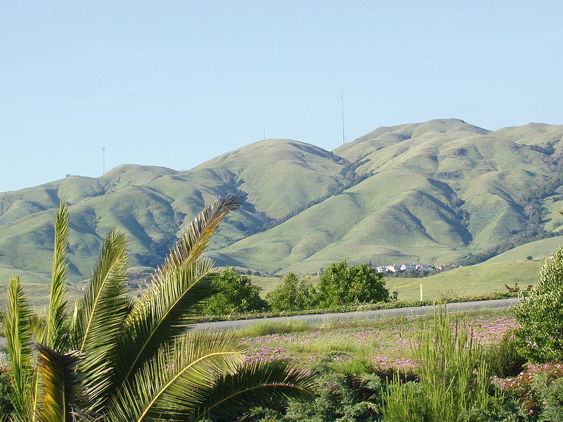
Looking east toward Monument Peak in Milpitas, California. The rightmost (tallest) antenna is Monument Peak, while the leftmost one (second highest, with three "forks" visible) is Mount Allison. The small antenna in the center was recently built. The gully to the far right of the mountainside is Calera Creek. Just to its left is Scott Creek. Most of the area can be accessed via hking trails in Ed R. Levin County Park.
Going right - south. Going left is north. Mount Allison is about a mile north of Monument Peak.
The actual point of Monument Peak is the point lying directly right (south) of the tallest antenna (FCC structure 1019291).
Notice Mount Allison's antenna - it has three "forks" on the top.
Can you see a few hiking trails leading up to Monument Peak?
The houses at the bottom of the mountains are the upper-class Calaveras Ridge Estates on Calaveras Ridge Road.
The hills are golden because of the dry summer season which dehydrates the grass on the hillsides. The hills are considered a high-risk fire hazard region.
| この著作物は、著作者である英語版ウィキペディアのMilpitas guyさんによって権利が放棄され、パブリックドメインとされました。これは全世界で適用されます。 一部の国では、これが法的に可能ではない場合があります。その場合は、次のように宣言します。 Milpitas guyは、あらゆる人に対して、法により必要とされている条件を除き、如何なる条件も課すことなく、あらゆる目的のためにこの著作物を使用する権利を与えます。 |
.JPG)
ファイルの履歴
過去の版のファイルを表示するには、その版の日時をクリックしてください。
| 日付と時刻 | サムネイル | 寸法 | 利用者 | コメント | |
|---|---|---|---|---|---|
| 現在の版 | 2006年12月22日 (金) 15:33 | | 2,104 × 1,580 (872キロバイト) | Nk | Looking east toward Monument Peak in Milpitas, California. The rightmost (tallest) antenna is Monument Peak, while the leftmost one (second highest, with three "forks" visible) is Mount Allison. The small antenna in the center was recently built. The gull |
ファイルの使用状況
以下のページがこのファイルを使用しています:
グローバルなファイル使用状況
以下に挙げる他のウィキがこの画像を使っています:
- arz.wikipedia.org での使用状況
- ceb.wikipedia.org での使用状況
- de.wikipedia.org での使用状況
- en.wikipedia.org での使用状況
- eo.wikipedia.org での使用状況
- es.wikipedia.org での使用状況
- fr.wikipedia.org での使用状況
- he.wikipedia.org での使用状況
- lld.wikipedia.org での使用状況
- pam.wikipedia.org での使用状況
- uz.wikipedia.org での使用状況
- www.wikidata.org での使用状況