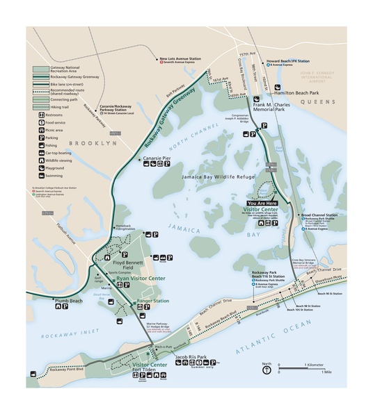
ファイル:NPS jamaica-bay-map.pdf

この PDF ファイルのこの JPG プレビューのサイズ: 536 × 600 ピクセル. その他の解像度: 214 × 240 ピクセル | 429 × 480 ピクセル | 686 × 768 ピクセル | 915 × 1,024 ピクセル | 1,830 × 2,048 ピクセル | 3,612 × 4,043 ピクセル。
元のファイル (3,612 × 4,043 ピクセル、ファイルサイズ: 947キロバイト、MIME タイプ: application/pdf)
ファイルの履歴
過去の版のファイルを表示するには、その版の日時をクリックしてください。
| 日付と時刻 | サムネイル | 寸法 | 利用者 | コメント | |
|---|---|---|---|---|---|
| 現在の版 | 2017年5月16日 (火) 21:29 |  | 3,612 × 4,043 (947キロバイト) | RKBot | =={{int:filedesc}}== {{Information |description= {{en|1=Jamaica Bay map showing an overall view of the entire Jamaica Bay unit of Gateway National Recreation Area.}} |date= 2016-06-17 |source= U.S. National Park Service (http://npmaps.com/wp-content/up... |
ファイルの使用状況
以下のページがこのファイルを使用しています:

