ファイル:PIA10008 Seas and Lakes on Titan.jpg
元のファイル (2,348 × 1,900 ピクセル、ファイルサイズ: 2.62メガバイト、MIME タイプ: image/jpeg)
ウィキメディア・コモンズのファイルページにある説明を、以下に表示します。
|
概要
| 解説 |
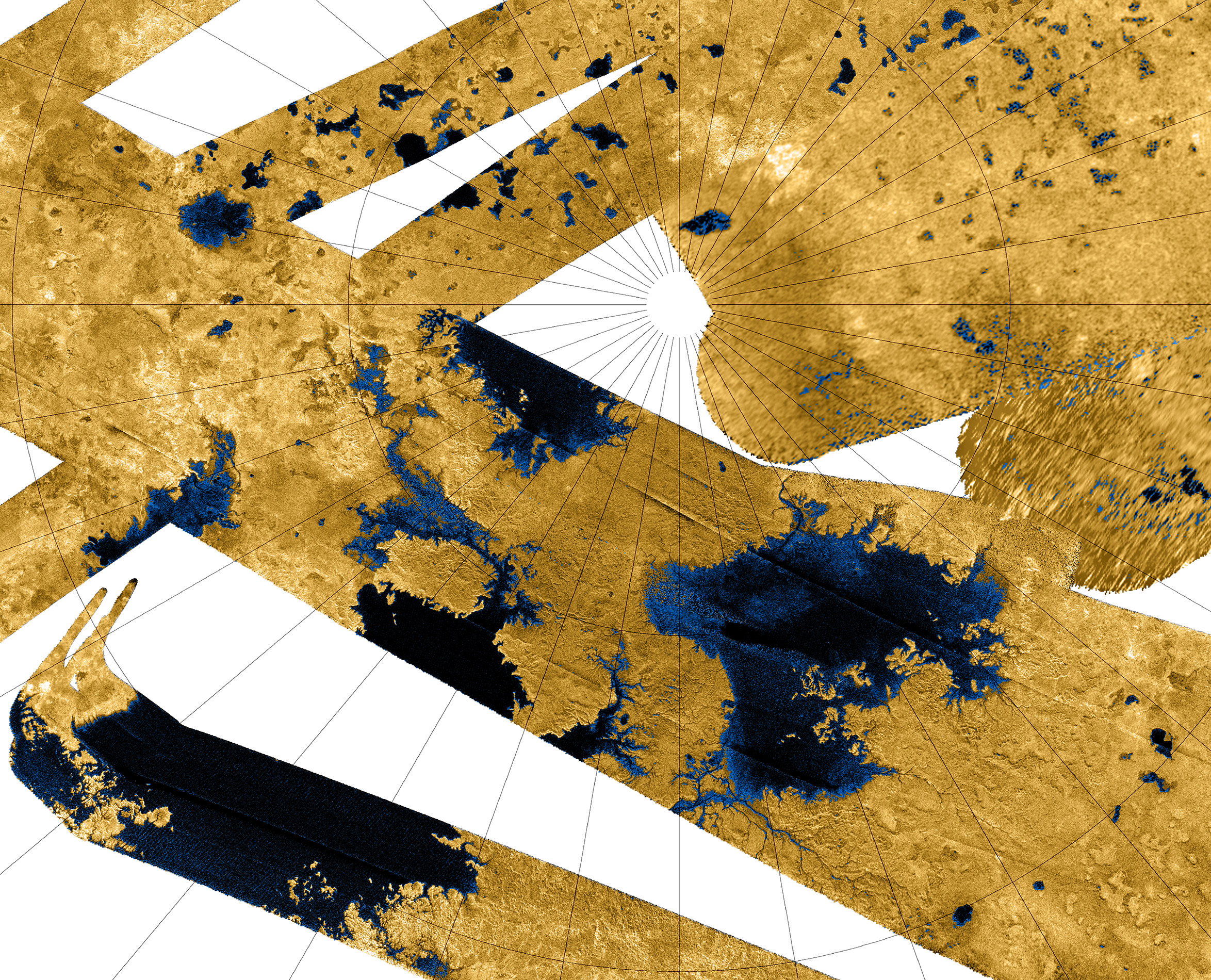
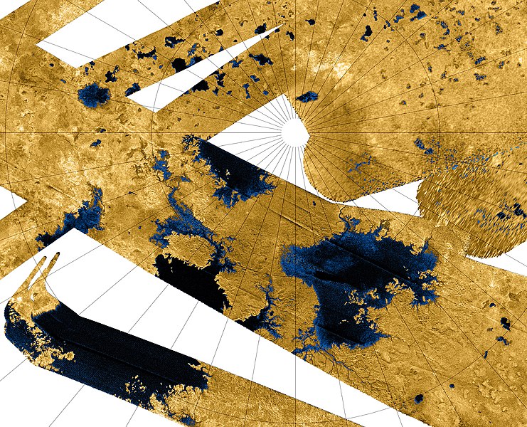
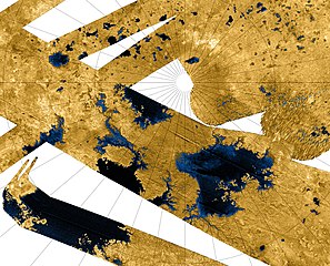
This Cassini false-color mosaic shows all synthetic-aperture radar images to date of Titan's north polar region. Approximately 60 percent of Titan's north polar region, above 60 degrees north latitude, is now mapped with radar. About 14 percent of the mapped region is covered by what is interpreted as liquid hydrocarbon lakes. Features thought to be liquid are shown in blue and black, and the areas likely to be solid surface are tinted brown. The terrain in the upper left of this mosaic is imaged at lower resolution than the remainder of the image Most of the many lakes and seas seen so far are contained in this image, including the largest known body of liquid on Titan. These seas are most likely filled with liquid ethane, methane and dissolved nitrogen. Many bays, islands and presumed tributary networks are associated with the seas. The large feature in the upper right center of this image is at least 100,000 square kilometers (40,000 square miles) in area, greater in extent than Lake Superior (82,000 square kilometers or 32,000 square miles), one of Earth's largest lakes. This Titan feature covers a greater fraction of the surface, at least 0.12 percent, than the Black Sea, Earth's largest terrestrial inland sea, at 0.085 percent. Larger seas may exist, as it is probable that some of these bodies are connected, either in areas unmapped by radar or under the surface (see PIA08365). Of the 400 observed lakes and seas, 70 percent of their area is taken up by large "seas" greater than 26,000 square kilometers (10,000 square miles). The Cassini-Huygens mission is a cooperative project of NASA, the European Space Agency and the Italian Space Agency. The Jet Propulsion Laboratory, a division of the California Institute of Technology in Pasadena, manages the mission for NASA's Science Mission Directorate, Washington, D.C. The Cassini orbiter was designed, developed and assembled at JPL. The radar instrument was built by JPL and the Italian Space Agency, working with team members from the United States and several European countries. For more information about the Cassini-Huygens mission, visit http://saturn.jpl.nasa.gov/home/index.cfm. The original NASA image has been modified by rotating 90 degrees clockwise, cropping and reduction in size (the linear pixel density was reduced 50%). Some of the features in this image have been annotated in Wikimedia Commons. |
| 日付 | |
| 原典 | http://photojournal.jpl.nasa.gov/catalog/?IDNumber=PIA10008 |
| 作者 | NASA / JPL-Caltech / USGS |
| その他のバージョン |
PIA10008 Seas and Lakes on Titan full size.jpg - larger, higher resolution version (4696 × 4696 pixels, 10.4 MB) |
| このタグは、添付された著作物の著作権状況を示すものではありません。通常の著作権タグも必要です。Commons:ライセンシングもご覧ください。 他言語での翻訳:
|
ライセンス
| このファイルはアメリカ航空宇宙局(NASA)によって作成されたものです。NASAの著作権の方針では、特記事項が無い場合、NASAの資料はパブリックドメインとなります。 (詳しくはTemplate:PD-USGov、NASAの著作権の方針について(英語)又はジェット推進研究所(JPL)の画像使用に関するガイドライン(英語)をご覧ください。) |
||
 |
注意事項:
|
| 注釈 | この画像には注釈がついています: コモンズで注釈を見る |
ファイルの履歴
過去の版のファイルを表示するには、その版の日時をクリックしてください。
| 日付と時刻 | サムネイル | 寸法 | 利用者 | コメント | |
|---|---|---|---|---|---|
| 現在の版 | 2013年11月12日 (火) 03:01 | | 2,348 × 1,900 (2.62メガバイト) | WolfmanSF | Slightly wider view on top and right |
| 2012年4月8日 (日) 09:44 |  | 2,280 × 1,840 (2.1メガバイト) | WolfmanSF | Tweak cropping; add 40 pixels at upper margin to fully display several lakes | |
| 2007年12月16日 (日) 00:18 |  | 2,280 × 1,800 (2.05メガバイト) | WolfmanSF | {{Information |Description=This Cassini false-color mosaic shows all synthetic-aperture radar images to date of Titan's north polar region. Approximately 60 percent of Titan's north polar region, above 60 degrees north latitude, is now mapped with radar. |
ファイルの使用状況
以下の 3 ページがこのファイルを使用しています:
グローバルなファイル使用状況
以下に挙げる他のウィキがこの画像を使っています:
- an.wikipedia.org での使用状況
- ar.wikipedia.org での使用状況
- be.wikipedia.org での使用状況
- ca.wikipedia.org での使用状況
- cs.wikipedia.org での使用状況
- de.wikipedia.org での使用状況
- en.wikipedia.org での使用状況
- en.wikiversity.org での使用状況
- User:Marshallsumter/Radiation astronomy2/Radios
- Solar System, technical/Titan
- Draft:Original research/Titan
- User:Marshallsumter/Radiation astronomy2/Radios/Quiz
- User:Marshallsumter/Radiation astronomy/Courses/Principles/Hourly 3
- User:Marshallsumter/Radiation astronomy2/Radars
- Astronomy college course/Miranda and Titan
- User:Marshallsumter/Radiation astronomy/Courses/Principles/Final quiz
- Titan/Quiz
- Moon/Quiz
- Stars/Sun/Heliology/Quiz
- Earth/Quiz
- Stars/Reds/Quiz
- User:Marshallsumter/Radiation astronomy1/Millimeters/Quiz
- fi.wikipedia.org での使用状況
- fr.wikipedia.org での使用状況
- gl.wikipedia.org での使用状況
- hy.wikipedia.org での使用状況
- id.wikipedia.org での使用状況
- it.wikipedia.org での使用状況
- mk.wikipedia.org での使用状況
- nn.wikipedia.org での使用状況
- no.wikipedia.org での使用状況
- pl.wikipedia.org での使用状況
このファイルのグローバル使用状況を表示する。