ファイル:Pamir Highway Route.jpg

このプレビューのサイズ: 592 × 600 ピクセル。 その他の解像度: 237 × 240 ピクセル | 474 × 480 ピクセル | 758 × 768 ピクセル | 1,052 × 1,066 ピクセル。
元のファイル (1,052 × 1,066 ピクセル、ファイルサイズ: 200キロバイト、MIME タイプ: image/jpeg)
ウィキメディア・コモンズのファイルページにある説明を、以下に表示します。
|
| 解説 |
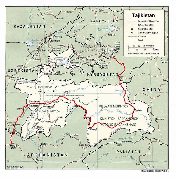
English: Map showing the route of the Pamir Highway through Afghanistan, Uzbekistan, Tajikistan, and Kyrgyzstan. |
| 日付 | |
| 原典 |
http://www.lib.utexas.edu/maps/tajikistan.html
|
| 作者 | Derived from CIA map by Bantman at en.wikipedia, transferred to Commons by User:Man77 using CommonsHelper. |
| 許可 (ファイルの再利用) |
PD-USGOV; PD-AUTHOR. |
ライセンス
このファイルは、アメリカ合衆国の連邦政府と雇用関係にある公務員がその職務上作成したアメリカ合衆国政府の著作物であり、アメリカ合衆国の著作権法上パブリックドメインに属します (17 U.S.C. §105)。
注意:このライセンスは、アメリカ合衆国政府の著作物についてのみ効力を有します。アメリカ合衆国の各州、郡、その他の地方自治体が作成した著作物に対しては適用できません。
|
 | |
| このファイルは著作権法の既知の制約(隣接権や関連する権利を含む)から自由であると特定されています。 | ||
| この著作物は、著作者であるBantmanによって権利が放棄され、パブリックドメインとされました。これは全世界で適用されます。 一部の国では、これが法的に可能ではない場合があります。その場合は、次のように宣言します。 Bantmanは、あらゆる人に対して、法により必要とされている条件を除き、如何なる条件も課すことなく、あらゆる目的のためにこの著作物を使用する権利を与えます。
|
元のアップロードログ
元のファイルページはこちら。以下の利用者は全てen.wikipediaに属します。
- 2005-08-30 22:02 Bantman 1052×1066× (204866 bytes) Map showing the route of the Pamir Highway through Afghanistan, Tajikistan, and Kyrgyzstan. Derived by me from a CIA map located at the [[University_of_Texas_at_Austin#Facilities|Perry-Castañeda Library (PCL) of the University of Tex
ファイルの履歴
過去の版のファイルを表示するには、その版の日時をクリックしてください。
| 日付と時刻 | サムネイル | 寸法 | 利用者 | コメント | |
|---|---|---|---|---|---|
| 現在の版 | 2009年4月11日 (土) 13:36 | | 1,052 × 1,066 (200キロバイト) | File Upload Bot (Magnus Manske) | {{BotMoveToCommons|en.wikipedia|year={{subst:CURRENTYEAR}}|month={{subst:CURRENTMONTHNAME}}|day={{subst:CURRENTDAY}}}} {{Information |Description={{en|Map showing the route of the en:Pamir Highway through en:Afghanistan, en:Tajikistan, |
ファイルの使用状況
以下の 3 ページがこのファイルを使用しています:
グローバルなファイル使用状況
以下に挙げる他のウィキがこの画像を使っています:
- ca.wikipedia.org での使用状況
- cs.wikipedia.org での使用状況
- de.wikipedia.org での使用状況
- en.wikipedia.org での使用状況
- es.wikipedia.org での使用状況
- fa.wikipedia.org での使用状況
- fr.wikipedia.org での使用状況
- hu.wikipedia.org での使用状況
- it.wikipedia.org での使用状況
- ko.wikipedia.org での使用状況
- lt.wikipedia.org での使用状況
- lv.wikipedia.org での使用状況
- nl.wikipedia.org での使用状況
- pt.wikipedia.org での使用状況
- ru.wikipedia.org での使用状況
- sl.wikipedia.org での使用状況
- sv.wikipedia.org での使用状況
- uk.wikipedia.org での使用状況
- www.wikidata.org での使用状況
- zh.wikipedia.org での使用状況