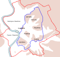
ファイル:Roma Plan.jpg

このプレビューのサイズ: 754 × 600 ピクセル。 その他の解像度: 302 × 240 ピクセル | 604 × 480 ピクセル | 966 × 768 ピクセル | 1,280 × 1,018 ピクセル | 1,840 × 1,463 ピクセル。
元のファイル (1,840 × 1,463 ピクセル、ファイルサイズ: 2.5メガバイト、MIME タイプ: image/jpeg)
ファイルの履歴
過去の版のファイルを表示するには、その版の日時をクリックしてください。
| 日付と時刻 | サムネイル | 寸法 | 利用者 | コメント | |
|---|---|---|---|---|---|
| 現在の版 | 2015年3月30日 (月) 16:14 |  | 1,840 × 1,463 (2.5メガバイト) | Jonstevn | Reverted to version as of 19:01, 28 August 2006 |
| 2015年3月30日 (月) 16:10 |  | 1,840 × 1,463 (2.5メガバイト) | Jonstevn | Reverted to version as of 19:01, 28 August 2006 | |
| 2015年3月30日 (月) 16:10 |  | 1,840 × 1,463 (2.5メガバイト) | Jonstevn | Reverted to version as of 19:01, 28 August 2006 | |
| 2008年7月27日 (日) 06:40 |  | 1,840 × 1,463 (3.38メガバイト) | Amadscientist | {{Information |Description= |Source= |Date= |Author= |Permission= |other_versions= }} | |
| 2008年7月27日 (日) 04:57 |  | 4,000 × 3,180 (12.21メガバイト) | Amadscientist | {{Information |Description= |Source= |Date= |Author= |Permission= |other_versions= }} | |
| 2006年8月28日 (月) 19:01 |  | 1,840 × 1,463 (2.5メガバイト) | Nikephoros | {{Information |Description=Plan Roms im Altertum / Map of Rome during Antiquity |Source=G. Droysens Allgemeiner Historischer Handatlas |Date=1886 |Author=? |Permission= not needed |other_versions= no }} |
ファイルの使用状況
以下の 74 ページがこのファイルを使用しています:
- アウグストゥスのフォルム
- アウグストゥスの家
- アウグストゥス廟
- アグリッパ浴場
- アジナリア門
- アントニヌス・ピウスとファウスティナ神殿
- アントニヌス・ピウスの記念柱
- ウェスタ神殿
- ウェスパシアヌスとティトゥス神殿
- ウェスパシアヌスのフォルム
- ウェヌスとローマ神殿
- エンポリウム (ローマ)
- カストルとポルックス神殿
- カストレンセ円形闘技場
- カペーナ門
- カラカラ浴場
- ガイウス・ケスティウスのピラミッド
- クリア・オスティリア
- クリア・ユリア
- ケスティウス橋
- コロッセオ
- コンコルディア神殿
- コンスタンティヌスの凱旋門
- サエプタ・ユリア
- サラリア門
- サン・セバスティアーノ門
- サン・パオロ門
- サートゥルヌス神殿
- スタディオン (パラティヌス)
- セプティミウス・セウェルスの凱旋門
- タブラリウム
- チルコ・マッシモ
- ティトゥスの凱旋門
- ティトゥス浴場
- ティブルティーナ門
- ディウウス・カエサル神殿
- ディオクレティアヌス浴場
- トラヤヌスのフォルム
- トラヤヌスの市場
- トラヤヌスの記念柱
- トラヤヌス浴場
- ドミティアヌス競技場
- ドムス・アウグスターナ
- ドムス・セプティミ・セウェリ
- ドムス・フラウィア
- ニンファエウム・アレクサンドリ
- ネルウァのフォルム
- ネロ浴場
- バシリカ・アエミリア
- バシリカ・ユリア
- バジリカ・ウルピア
- パラティーノ
- ファブリキウス橋
- フォルム・ボアリウム
- フォロ・ジュリアーノ
- フォロ・ロマーノ
- ヘラクレス・ウィクトール神殿
- ポンペイウス劇場
- マクセンティウスのバシリカ
- マッジョーレ門
- マルケッルス劇場
- ミネルウァ・メディカ神殿
- メトロニア門
- ヤヌス神殿
- ヤヌス門
- ユトゥルナの泉
- ラピス・ニゲル
- レギア
- 帝都ローマ基準点
- 皇帝たちのフォルム
- 黄金の里程標
- Template:Ancient monuments in Rome
- モジュール:Location map/data/Italy Rome Antiquity
- モジュール:Location map/data/Italy Rome Antiquity/doc
グローバルなファイル使用状況
以下に挙げる他のウィキがこの画像を使っています:
- ar.wikipedia.org での使用状況
- as.wikipedia.org での使用状況
- azb.wikipedia.org での使用状況
- beta.wikiversity.org での使用状況
- bg.wikipedia.org での使用状況
- bn.wikipedia.org での使用状況
- bs.wikipedia.org での使用状況
- bxr.wikipedia.org での使用状況
- ca.wikipedia.org での使用状況
- ceb.wikipedia.org での使用状況
- cs.wikipedia.org での使用状況
このファイルのグローバル使用状況を表示する。


