ファイル:SPSM.05.jpg

元のファイル (2,756 × 2,000 ピクセル、ファイルサイズ: 3.99メガバイト、MIME タイプ: image/jpeg)
ウィキメディア・コモンズのファイルページにある説明を、以下に表示します。
|
| 解説 |
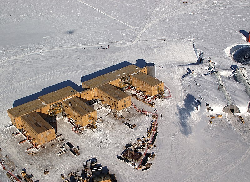
English: Buildings (Amundsen-Scott South Pole Station pictured) under construction. They have to be built on stilts at the South Pole to prevent snow buildup. The ceremonial pole and flags can be seen in the background, slightly to the left of center, below the tracks behind the buildings. The actual geographic pole is a few more metres to the left.
Flags and pole are more visible in en:Image:Amundsen-scott-south pole station 2006.jpg and en:Image:Ceremonial South Pole.jpg.
|
|||
| 日付 | ||||
| 原典 | U.S. Antarctic Program, National Science Foundation, image SPSM.05.5.JPG. | |||
| 作者 | Bill Henriksen, National Science Foundation | |||
| 許可 (ファイルの再利用) |
|

元のアップロードログ
This image was originally uploaded at the English Wikipedia.
(All user names refer to en.wikipedia)
- 2006-03-09 16:46 Rebroad 2756×2000×8 (4188033 bytes)
ファイルの履歴
過去の版のファイルを表示するには、その版の日時をクリックしてください。
| 日付と時刻 | サムネイル | 寸法 | 利用者 | コメント | |
|---|---|---|---|---|---|
| 現在の版 | 2007年3月27日 (火) 22:03 | | 2,756 × 2,000 (3.99メガバイト) | Evrik | {{Information |Description=Buildings (en:Amundsen-Scott South Pole Station pictured) have to be built on en:stilts at the en:South Pole to prevent en:snow buildup. The ceremonial pole and flags can be seen in the background, slightly t |
ファイルの使用状況
以下の 2 ページがこのファイルを使用しています:
グローバルなファイル使用状況
以下に挙げる他のウィキがこの画像を使っています:
- af.wikipedia.org での使用状況
- als.wikipedia.org での使用状況
- ar.wikipedia.org での使用状況
- az.wikipedia.org での使用状況
- ba.wikipedia.org での使用状況
- be.wikipedia.org での使用状況
- bg.wikipedia.org での使用状況
- ca.wikipedia.org での使用状況
- ceb.wikipedia.org での使用状況
- cs.wikipedia.org での使用状況
- cv.wikipedia.org での使用状況
- cy.wikipedia.org での使用状況
- da.wikipedia.org での使用状況
- de.wikipedia.org での使用状況
- de.wikivoyage.org での使用状況
- en.wikipedia.org での使用状況
- en.wikivoyage.org での使用状況
- eo.wikipedia.org での使用状況
- es.wikipedia.org での使用状況
- et.wikipedia.org での使用状況
このファイルのグローバル使用状況を表示する。