ファイル:1777BurgoyneTiconderoga.jpg
このプレビューのサイズ: 318 × 599 ピクセル。 その他の解像度: 127 × 240 ピクセル | 255 × 480 ピクセル | 408 × 768 ピクセル | 544 × 1,024 ピクセル | 1,382 × 2,602 ピクセル。
元のファイル (1,382 × 2,602 ピクセル、ファイルサイズ: 1.22メガバイト、MIME タイプ: image/jpeg)
ウィキメディア・コモンズのファイルページにある説明を、以下に表示します。
|
| 解説 |
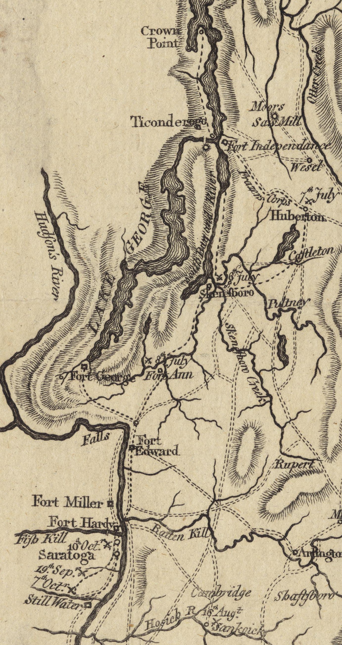
English: This is a detail from the source map, which shows the geographic area of John Burgoyne's 1777 Saratoga campaign. This detail shows the area around Fort Ticonderoga, including the roads and approaches used by the British and American forces before and after the Battle of Ticonderoga. |
||||
| 日付 | |||||
| 原典 | Boston Public Library Digital Map collection (call number: G3801.S3 1777 .N49) | ||||
| 作者 | |||||
| 許可 (ファイルの再利用) |
|
||||
ファイルの履歴
過去の版のファイルを表示するには、その版の日時をクリックしてください。
| 日付と時刻 | サムネイル | 寸法 | 利用者 | コメント | |
|---|---|---|---|---|---|
| 現在の版 | 2009年6月21日 (日) 17:08 | | 1,382 × 2,602 (1.22メガバイト) | Magicpiano | Cleaner version of map from [http://maps.bpl.org/details_11085/ Boston Public Library Map collection] |
| 2009年3月27日 (金) 14:14 |  | 1,036 × 1,592 (601キロバイト) | Magicpiano | {{Information |Description={{en|1=This is a detail from the first map in the original source, which contains maps showing the areas and military movements of w:John Burgoyne's 1777 w:Saratoga campaign. This detail shows the area around [[w:Fort |
ファイルの使用状況
以下の 3 ページがこのファイルを使用しています:
グローバルなファイル使用状況
以下に挙げる他のウィキがこの画像を使っています:
- de.wikipedia.org での使用状況
- en.wikipedia.org での使用状況
- fr.wikipedia.org での使用状況
- it.wikipedia.org での使用状況
- nl.wikipedia.org での使用状況
- www.wikidata.org での使用状況