ファイル:Aerial view of Crenshaw Boulevard, Los Angeles County, California.jpg
元のファイル (4,000 × 3,000 ピクセル、ファイルサイズ: 4.17メガバイト、MIME タイプ: image/jpeg)
ウィキメディア・コモンズのファイルページにある説明を、以下に表示します。
|
概要
| 解説 |
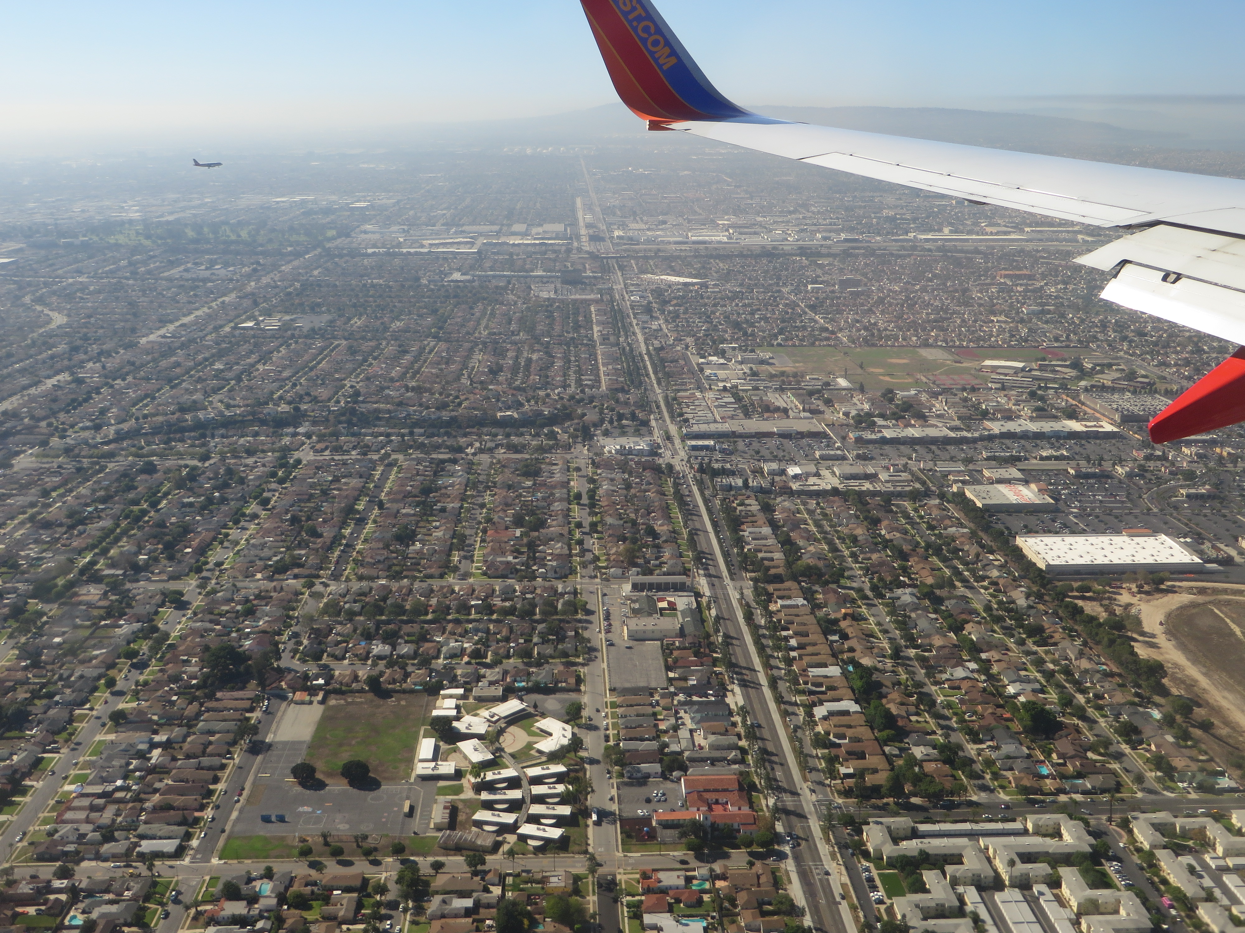
Crenshaw Boulevard is a major thoroughfare street in Los Angeles, California that runs through, and outside, the Crenshaw district. The street starts at Wilshire Boulevard in Hancock Park and runs through several demographically diverse areas to end in Rolling Hills. Tracks for the No. 5 Los Angeles Railway "yellow" streetcars in the 1920s through 1950s ran in the median between Leimert Boulevard on the north to near Florence Ave on the south. Since the abandonment of the streetcars, the former railway median has been narrowed, the driving lanes improved and the street reconfigured. Many local residents were disappointed to see 71 mature trees chopped down to make way for the Space Shuttle Endeavour to be moved from LAX to the California Science Center. Additional trees were to be removed for the under construction Crenshaw/LAX Line, but various officials have promised an aesthetically cohesive boulevard with more trees being planted than were removed. The name "Crenshaw" has become associated with African-American culture because it traverses as a large black community. Crenshaw Boulevard has been mentioned in hip hop songs by artists such as Eminem, Eazy-E, Nas, 2Pac, Montell Jordan, DJ Quik, Raekwon from the Wu-Tang Clan, Skee-Lo, Dr. Dre, The Game, Nipsey Hussle, Dom Kennedy, MC Allergy, and The Pharcyde. The street was named in 1904 after banker and real estate developer George Lafayette Crenshaw. The street also has a history of Sunday night "gatherings", where a large number of cars would meet up. However, due to a police crackdown, this tradition has now declined. en.wikipedia.org/wiki/Crenshaw_Boulevard en.wikipedia.org/wiki/Wikipedia:Text_of_Creative_Commons_... |
| 日付 | |
| 原典 | Crenshaw Boulevard, Inglewood, California |
| 作者 | Ken Lund from Reno, Nevada, USA |
| カメラの位置 | | 以下のサービスでこの位置を確認する: オープンストリートマップ |
|---|
ライセンス
- あなたは以下の条件に従う場合に限り、自由に
- 共有 – 本作品を複製、頒布、展示、実演できます。
- 再構成 – 二次的著作物を作成できます。
- あなたの従うべき条件は以下の通りです。
- 表示 – あなたは適切なクレジットを表示し、ライセンスへのリンクを提供し、変更があったらその旨を示さなければなりません。これらは合理的であればどのような方法で行っても構いませんが、許諾者があなたやあなたの利用行為を支持していると示唆するような方法は除きます。
- 継承 – もしあなたがこの作品をリミックスしたり、改変したり、加工した場合には、あなたはあなたの貢献部分を元の作品とこれと同一または互換性があるライセンスの下に頒布しなければなりません。
| この画像は当初、Ken Lund によって Flickr の https://flickr.com/photos/75683070@N00/21399133140 に投稿されたものです。2015-12-27、FlickreviewR ボットによってレビューされ、cc-by-sa-2.0 のライセンスで提供されていることが確認されました。 |
ファイルの履歴
過去の版のファイルを表示するには、その版の日時をクリックしてください。
| 日付と時刻 | サムネイル | 寸法 | 利用者 | コメント | |
|---|---|---|---|---|---|
| 現在の版 | 2015年12月27日 (日) 22:59 | | 4,000 × 3,000 (4.17メガバイト) | Kingofthedead | Transferred from Flickr via Flickr2Commons |
ファイルの使用状況
以下のページがこのファイルを使用しています:
グローバルなファイル使用状況
以下に挙げる他のウィキがこの画像を使っています:
- he.wikipedia.org での使用状況