ファイル:AncientEgyptJamesRennell01.jpg

このプレビューのサイズ: 541 × 599 ピクセル。 その他の解像度: 217 × 240 ピクセル | 433 × 480 ピクセル | 693 × 768 ピクセル | 924 × 1,024 ピクセル | 1,548 × 1,715 ピクセル。
元のファイル (1,548 × 1,715 ピクセル、ファイルサイズ: 384キロバイト、MIME タイプ: image/jpeg)
ウィキメディア・コモンズのファイルページにある説明を、以下に表示します。
|
概要
| 解説 |
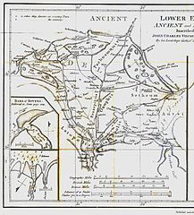
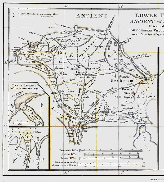
English: Map of ancient Egypt created by James Rennell as an insert for his book "The geographical system of Herodotus examined and explained" (published 1800 and 1830). This map shows Rennell's understanding of the geography of Egypt's Nile delta during the Greek Classical period (510 BC - 323 BC) based on the writings of Herodotus (484 BC - 425 BC). |
| 日付 | |
| 原典 | Book "The geographical system of Herodotus examined and explained", by James Rennell (published 1800 and 1830). |
| 作者 | Carl Drews scanned the map and enhanced the color contrast. |
ライセンス
|
この著作物は、著作権の保護期間が著作者の死後100年以下である国・地域においてパブリックドメインの状態にあります。 | |
| このファイルは著作権法の既知の制約(隣接権や関連する権利を含む)から自由であると特定されています。 | |
ファイルの履歴
過去の版のファイルを表示するには、その版の日時をクリックしてください。
| 日付と時刻 | サムネイル | 寸法 | 利用者 | コメント | |
|---|---|---|---|---|---|
| 現在の版 | 2010年8月12日 (木) 19:23 | | 1,548 × 1,715 (384キロバイト) | CarlDrews~commonswiki | {{Information |Description={{en|1=Map of ancient Egypt created by James Rennell as an insert for his book "The geographical system of Herodotus examined and explained" (published 1800 and 1830). This map shows Rennell's understanding of the geography of E |
ファイルの使用状況
以下のページがこのファイルを使用しています:
グローバルなファイル使用状況
以下に挙げる他のウィキがこの画像を使っています:
- ar.wikipedia.org での使用状況
- bg.wikipedia.org での使用状況
- de.wikipedia.org での使用状況
- el.wikipedia.org での使用状況
- en.wikipedia.org での使用状況
- es.wikipedia.org での使用状況
- fr.wikipedia.org での使用状況
- he.wikipedia.org での使用状況
- ja.wikibooks.org での使用状況
- nl.wikipedia.org での使用状況
- sl.wikipedia.org での使用状況
- uk.wikipedia.org での使用状況
- zh.wikipedia.org での使用状況