ファイル:Charlotte amalie airport diagram.jpg
このプレビューのサイズ: 393 × 599 ピクセル。 その他の解像度: 157 × 240 ピクセル | 315 × 480 ピクセル | 504 × 768 ピクセル | 1,205 × 1,837 ピクセル。
元のファイル (1,205 × 1,837 ピクセル、ファイルサイズ: 390キロバイト、MIME タイプ: image/jpeg)
ウィキメディア・コモンズのファイルページにある説明を、以下に表示します。
|
概要
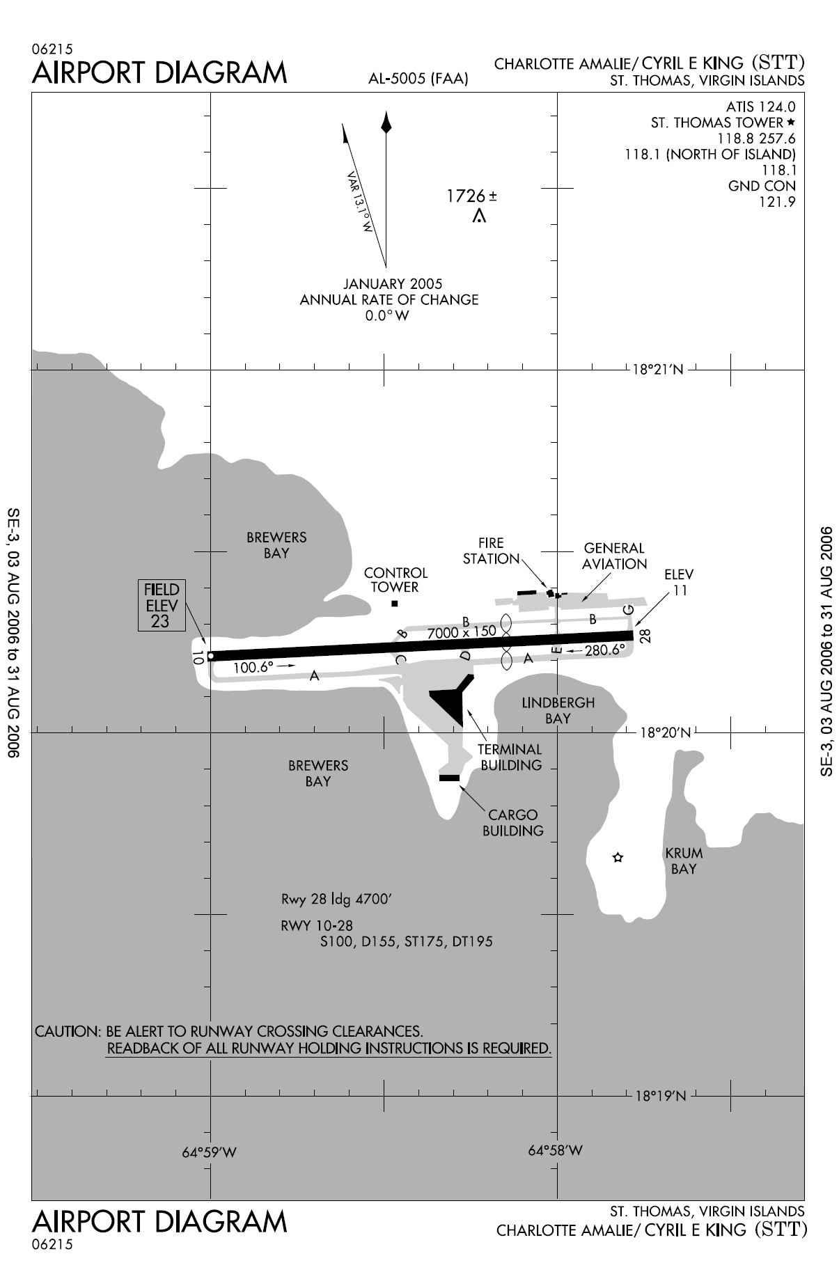
| 解説 | FAA diagram for Cyril E. King Airport (FAA: STT, ICAO: TIST) in Charlotte Amalie, Saint Thomas, U.S. Virgin Islands. |
| 日付 | 13 August 2006 |
| 原典 | http://naco.faa.gov/d-tpp/0608/05005AD.PDF (effective 03 AUG 2006 to 31 AUG 2006). Note: this URL changes monthly, see airport article's external links for a link to the current FAA diagram. |
| 作者 | National Aeronautical Charting Office (NACO), a department of the Federal Aviation Administration (FAA) in the United States. |
| 許可 (ファイルの再利用) |
Public Domain |
ライセンス
This image or file is a work of a Federal Aviation Administration employee, taken or made as part of that person's official duties. As a work of the U.S. federal government, the image is in the public domain in the United States.
|
 |
en:Cyril E. King Airport de:Cyril E. King Airport no:Cyril E. King Airport
ファイルの履歴
過去の版のファイルを表示するには、その版の日時をクリックしてください。
| 日付と時刻 | サムネイル | 寸法 | 利用者 | コメント | |
|---|---|---|---|---|---|
| 現在の版 | 2006年8月13日 (日) 11:10 | | 1,205 × 1,837 (390キロバイト) | Co-flens~commonswiki | {{Information |Description=Cyril E. King Airport, island of St. Thomas, United States Virgin Islands. |Source= |Date= |Author= |Permission= |other_versions= }} |
ファイルの使用状況
このファイルを使用しているページはありません。
グローバルなファイル使用状況
以下に挙げる他のウィキがこの画像を使っています:
- de.wikipedia.org での使用状況
- en.wikipedia.org での使用状況
- es.wikipedia.org での使用状況
- fa.wikipedia.org での使用状況
- no.wikipedia.org での使用状況
- tg.wikipedia.org での使用状況