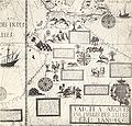
ファイル:Desceliers 1550 map - Australia detail.jpg

このプレビューのサイズ: 628 × 600 ピクセル。 その他の解像度: 251 × 240 ピクセル | 503 × 480 ピクセル | 804 × 768 ピクセル | 1,072 × 1,024 ピクセル | 2,145 × 2,048 ピクセル | 2,711 × 2,589 ピクセル。
元のファイル (2,711 × 2,589 ピクセル、ファイルサイズ: 1.1メガバイト、MIME タイプ: image/jpeg)
ファイルの履歴
過去の版のファイルを表示するには、その版の日時をクリックしてください。
| 日付と時刻 | サムネイル | 寸法 | 利用者 | コメント | |
|---|---|---|---|---|---|
| 現在の版 | 2008年5月2日 (金) 01:03 |  | 2,711 × 2,589 (1.1メガバイト) | Hesperian | colour balanced |
| 2008年2月20日 (水) 12:34 |  | 2,711 × 2,589 (920キロバイト) | Hesperian | much higher resolution | |
| 2007年12月28日 (金) 12:18 |  | 732 × 696 (191キロバイト) | Hesperian | {{Information |Description=This is a detail from a 1550 world map by Pierre Desceliers, from the location where Australia would be, and purportedly showing Australian features. It is one of the Dieppe maps, which are commonly put forward as eviden |
ファイルの使用状況
以下のページがこのファイルを使用しています:
グローバルなファイル使用状況
以下に挙げる他のウィキがこの画像を使っています:
- ca.wikipedia.org での使用状況
- en.wikipedia.org での使用状況
- es.wikipedia.org での使用状況
- fr.wikipedia.org での使用状況
- id.wikipedia.org での使用状況
- it.wikipedia.org での使用状況
- nl.wikipedia.org での使用状況
- pt.wikipedia.org での使用状況
- www.wikidata.org での使用状況
