ファイル:Floods Recede around the Wabash-Ohio Confluence.jpg
このプレビューのサイズ: 466 × 600 ピクセル。 その他の解像度: 186 × 240 ピクセル | 373 × 480 ピクセル | 596 × 768 ピクセル | 795 × 1,024 ピクセル | 1,591 × 2,048 ピクセル | 2,968 × 3,821 ピクセル。
元のファイル (2,968 × 3,821 ピクセル、ファイルサイズ: 3.38メガバイト、MIME タイプ: image/jpeg)
ウィキメディア・コモンズのファイルページにある説明を、以下に表示します。
|
概要
| 解説 |
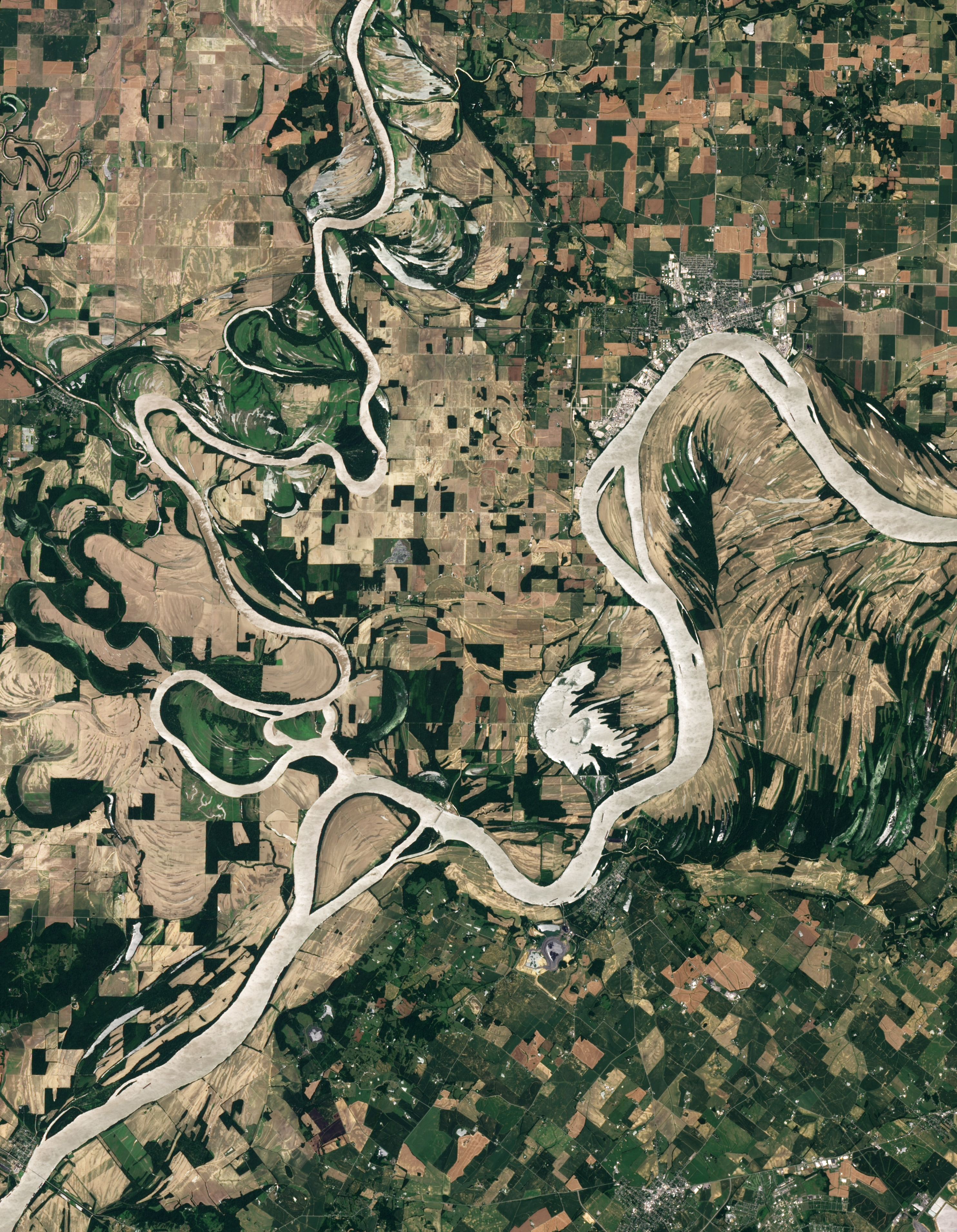
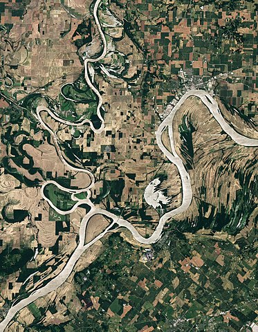
Afrikaans: Beeld in natuurlike kleur van die Wabash-Ohio-samevloeiing. Albei riviere, sowel as die Hoveymeer, vertoon silwergrys in hierdie beeld, waarskynlik weens die weerkaatsing van sonlig op die wateroppervlak. Op hoër grond lewer landboubedrywighede 'n lappieskombers van saailande, en in die waaie van die rivierkrommings is onbewerkte vloedvlaktes wat oorlopende riviere uitgelewer is.
English: Natural-colour image of the Wabash-Ohio confluence. Both rivers, as well as Hovey Lake, appear silver-grey in this image, probably due to the reflection of sunlight off the water surface (sunglint). Away from the water, the land is a patchwork of croplands shaped by human design, and floodplains shaped by overflowing rivers. |
| 日付 | |
| 原典 | NASA Earth Observatory |
| 作者 | Robert Simmon |
Image captured by the Advanced Land Imager (ALI) on NASA’s Earth Observing-1 (EO-1) satellite. EO-1 ALI data provided courtesy of the NASA EO-1 team.
ライセンス
| このファイルはアメリカ航空宇宙局(NASA)によって作成されたものです。NASAの著作権の方針では、特記事項が無い場合、NASAの資料はパブリックドメインとなります。 (詳しくはTemplate:PD-USGov、NASAの著作権の方針について(英語)又はジェット推進研究所(JPL)の画像使用に関するガイドライン(英語)をご覧ください。) |
||
 |
注意事項:
|
| 注釈 | この画像には注釈がついています: コモンズで注釈を見る |
ファイルの履歴
過去の版のファイルを表示するには、その版の日時をクリックしてください。
| 日付と時刻 | サムネイル | 寸法 | 利用者 | コメント | |
|---|---|---|---|---|---|
| 現在の版 | 2011年7月4日 (月) 18:35 | | 2,968 × 3,821 (3.38メガバイト) | Originalwana | {{Information |Description ={{en|1=Natural-colour image of the Wabash-Ohio confluence. Both rivers, as well as Hovey Lake, appear silver-grey in this image, probably due to the reflection of sunlight off the water surface |
ファイルの使用状況
以下のページがこのファイルを使用しています:
グローバルなファイル使用状況
以下に挙げる他のウィキがこの画像を使っています:
- ast.wikipedia.org での使用状況
- en.wikipedia.org での使用状況
- es.wikipedia.org での使用状況
- fa.wikipedia.org での使用状況
- fi.wikipedia.org での使用状況
- fy.wikipedia.org での使用状況
- it.wikipedia.org での使用状況
- ta.wikipedia.org での使用状況