ファイル:Francophone Africa.png
このプレビューのサイズ: 600 × 599 ピクセル。 その他の解像度: 240 × 240 ピクセル | 480 × 480 ピクセル | 997 × 996 ピクセル。
元のファイル (997 × 996 ピクセル、ファイルサイズ: 158キロバイト、MIME タイプ: image/png)
ウィキメディア・コモンズのファイルページにある説明を、以下に表示します。
|

|
このファイルのベクター画像 (SVG) が利用できます。 使う目的に対し、元画像よりもSVGがより優れている場合、SVG画像を使用して下さい。
File:Francophone Africa.png → File:Francophone Africa.svg
|
 |
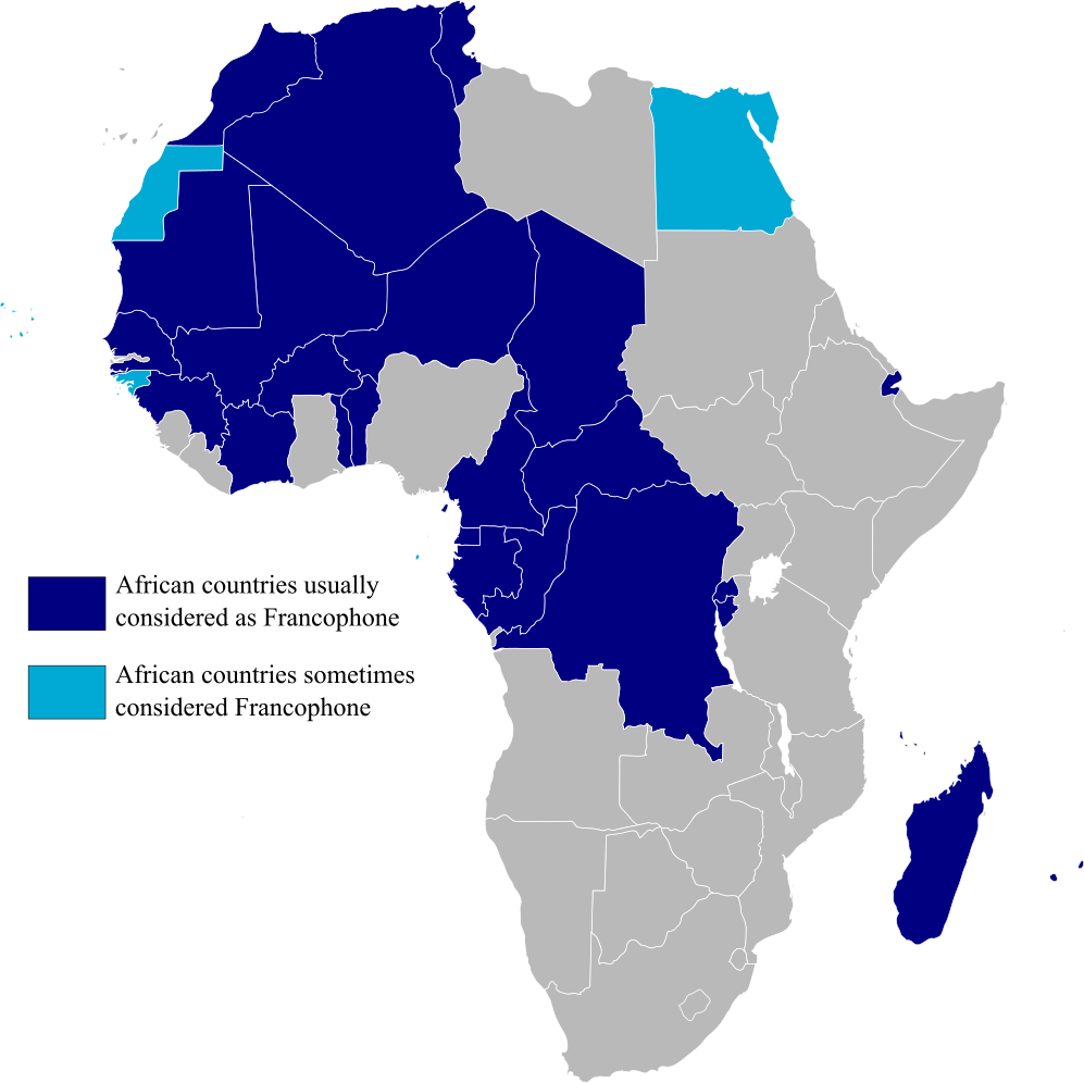
Map highlighting Francophone Africa, made by myself.
| この著作物の著作権者である私は、この著作物における権利を放棄しパブリックドメインとします。これは全世界で適用されます。 一部の国では、これが法的に可能ではない場合があります。その場合は、次のように宣言します。 私は、あらゆる人に対して、法により必要とされている条件を除き、如何なる条件も課すことなく、あらゆる目的のためにこの著作物を使用する権利を与えます。 |
ファイルの履歴
過去の版のファイルを表示するには、その版の日時をクリックしてください。
| 日付と時刻 | サムネイル | 寸法 | 利用者 | コメント | |
|---|---|---|---|---|---|
| 現在の版 | 2023年2月11日 (土) 15:29 | | 997 × 996 (158キロバイト) | +JMJ+ | rephrased the text |
| 2023年2月11日 (土) 15:21 |  | 997 × 996 (157キロバイト) | +JMJ+ | Better base map - File:BlankMap-Africa.svg | |
| 2011年7月19日 (火) 21:57 |  | 360 × 388 (14キロバイト) | Rosss | Added South Sudan | |
| 2007年8月15日 (水) 01:09 |  | 360 × 392 (14キロバイト) | Rosss | Added Réunion, Mauritius, Seychelles, Comoros, Mayotte, Scattered Islands, Cape Verde, Guinea Bisau, Sao Tome e Principe, and the insular part of Equatorial Guinea. | |
| 2006年11月20日 (月) 17:37 |  | 360 × 392 (13キロバイト) | Aaker | Map highlighting Francophone Africa. Made by myself. | |
| 2006年11月20日 (月) 17:36 |  | 360 × 392 (13キロバイト) | Aaker | Map highlighting Francophone Africa, made by myself. | |
| 2006年11月20日 (月) 17:33 |  | 360 × 392 (13キロバイト) | Aaker | Map highlighting Francophone Africa, made by myself, 2006. Carte marquant l'Afrique francophone. | |
| 2006年11月20日 (月) 17:32 |  | 360 × 392 (13キロバイト) | Aaker | Map highlighting Francophone Africa, made by myself, 2006. Carte marquant l'Afrique francophone. | |
| 2006年11月11日 (土) 15:46 |  | 360 × 392 (13キロバイト) | Aaker | Map highlighting Francophone Africa, made by myself. |
ファイルの使用状況
以下のページがこのファイルを使用しています:
グローバルなファイル使用状況
以下に挙げる他のウィキがこの画像を使っています:
- ar.wikipedia.org での使用状況
- ast.wikipedia.org での使用状況
- de.wikipedia.org での使用状況
- en.wikipedia.org での使用状況
- es.wikipedia.org での使用状況
- fa.wikipedia.org での使用状況
- he.wikipedia.org での使用状況
- hy.wikipedia.org での使用状況
- hyw.wikipedia.org での使用状況
- it.wikipedia.org での使用状況
- mr.wikipedia.org での使用状況
- pt.wikipedia.org での使用状況
- tl.wikipedia.org での使用状況
- tr.wiktionary.org での使用状況
- ur.wikipedia.org での使用状況
- zh.wikipedia.org での使用状況