ファイル:Gibraltar and Bay map 1750.jpg

このプレビューのサイズ: 447 × 600 ピクセル。 その他の解像度: 179 × 240 ピクセル | 358 × 480 ピクセル | 572 × 768 ピクセル | 763 × 1,024 ピクセル | 2,049 × 2,750 ピクセル。
元のファイル (2,049 × 2,750 ピクセル、ファイルサイズ: 877キロバイト、MIME タイプ: image/jpeg)
ウィキメディア・コモンズのファイルページにある説明を、以下に表示します。
|
概要
| 解説 |
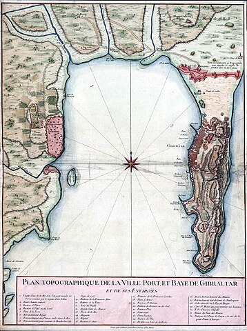
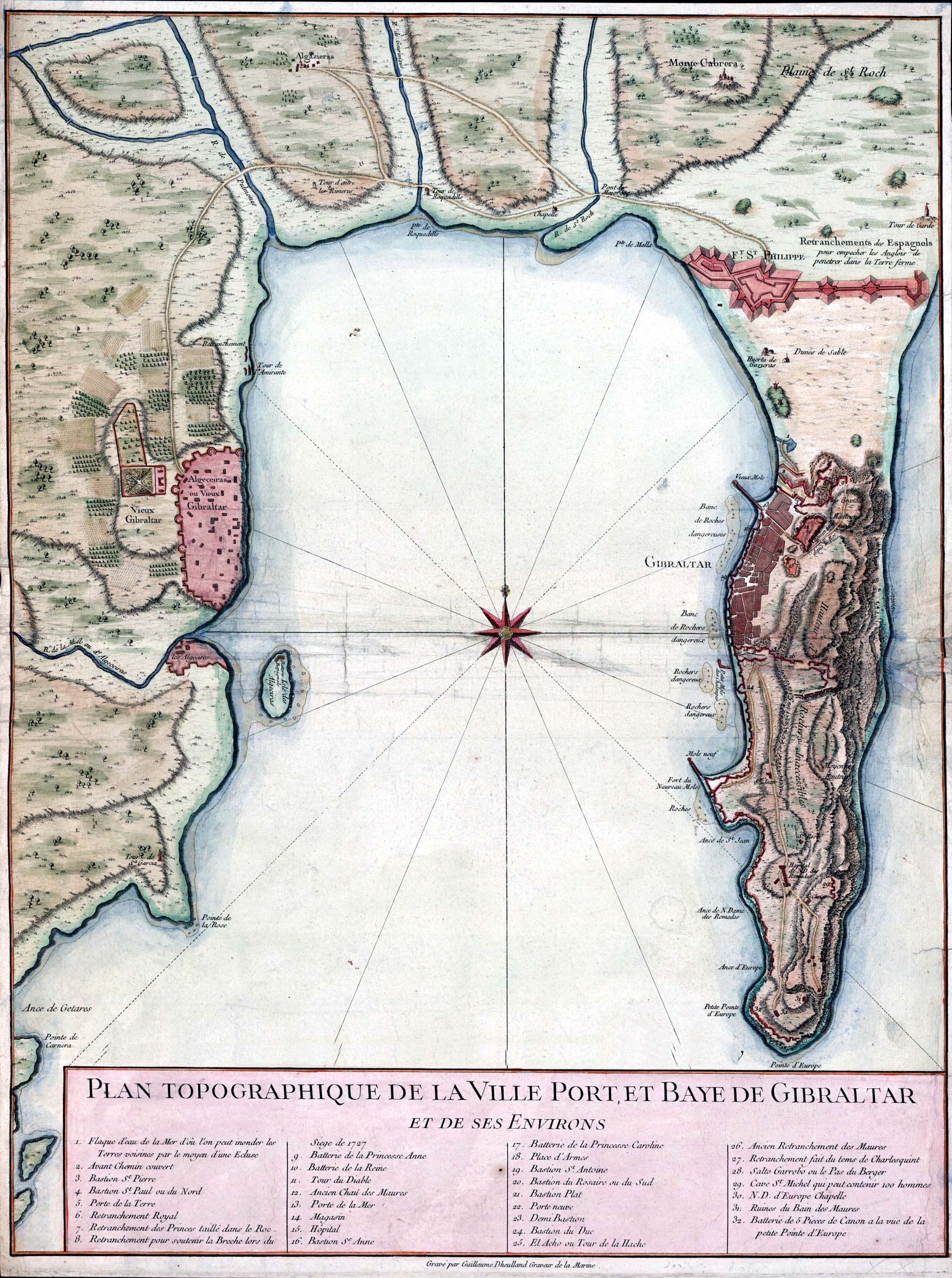
English: Topographic map of Gibraltar and the Bay of Gibraltar, circa 1750
Français : Plan Topographique De La Ville Port, Et Baye De Gibraltar, Et De Ses Environs.
Español: Plano de la Bahía de Algeciras datado en 1750. Se observan las ciudades de Algeciras y Gibraltar así como la Línea de Contravalación, fortificación construida en el istmo durante la década de 1730. |
| 日付 | 1750年頃 |
| 原典 | http://www.britishempire.co.uk/images3/gibraltar1750.jpg |
| 作者 | Guillaume Dheulland (1700–1770) |
ライセンス
|
このファイルは、パブリックドメインの状態にある平面的な美術の著作物を写真術によって忠実に複製したものです。このような複製はアメリカ合衆国においてパブリックドメインの状態にあります。その他の地域では再利用に制限がかかる場合があります。詳しくはReuse of PD-Art photographsをご覧ください。美術の著作物としての原図は、次の理由によりパブリックドメインの状態にあります。
{{PD-Art}} template without license parameter: please specify why the underlying work is public domain in both the source country and the United States
(Usage: {{PD-Art|1=|deathyear=''year of author's death''|country=''source country''}}, where parameter #1 can be PD-old-auto, PD-old-auto-expired, PD-old-auto-1996, PD-old-100 or similar. See Commons:Multi-license copyright tags for more information.) | ||||
ファイルの履歴
過去の版のファイルを表示するには、その版の日時をクリックしてください。
| 日付と時刻 | サムネイル | 寸法 | 利用者 | コメント | |
|---|---|---|---|---|---|
| 現在の版 | 2007年8月31日 (金) 15:41 | | 2,049 × 2,750 (877キロバイト) | RedCoat | {{Information |Description=18th century engraving of Gibraltar and the Bay of Gibraltar |Source=http://www.britishempire.co.uk/images3/gibraltar1750.jpg |Date=circa 1750 |Author=No illustrator given |Permission= |other_versions= }} |
ファイルの使用状況
以下のページがこのファイルを使用しています:
グローバルなファイル使用状況
以下に挙げる他のウィキがこの画像を使っています:
- azb.wikipedia.org での使用状況
- br.wikipedia.org での使用状況
- cs.wikipedia.org での使用状況
- da.wikipedia.org での使用状況
- en.wikipedia.org での使用状況
- es.wikipedia.org での使用状況
- fr.wikipedia.org での使用状況
- it.wikipedia.org での使用状況
- nl.wikipedia.org での使用状況
- no.wikipedia.org での使用状況
- pl.wikipedia.org での使用状況
- zh.wikipedia.org での使用状況