ファイル:Greece in 1210.svg

この SVG ファイルのこの PNG プレビューのサイズ: 800 × 456 ピクセル. その他の解像度: 320 × 182 ピクセル | 640 × 365 ピクセル | 1,024 × 584 ピクセル | 1,280 × 730 ピクセル | 2,560 × 1,460 ピクセル | 3,508 × 2,000 ピクセル。
元のファイル (SVG ファイル、3,508 × 2,000 ピクセル、ファイルサイズ: 1.12メガバイト)
ウィキメディア・コモンズのファイルページにある説明を、以下に表示します。
|
概要
| 解説 |
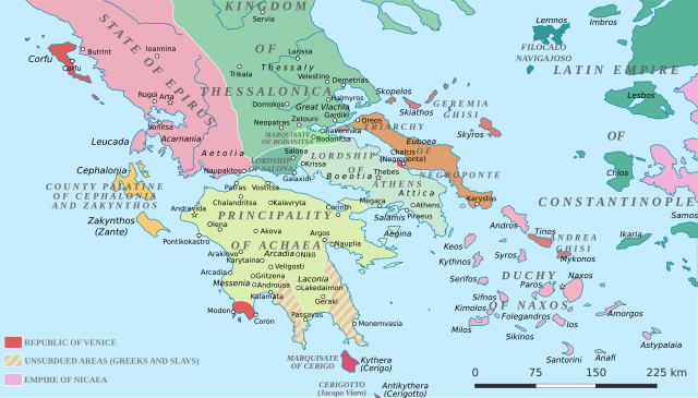
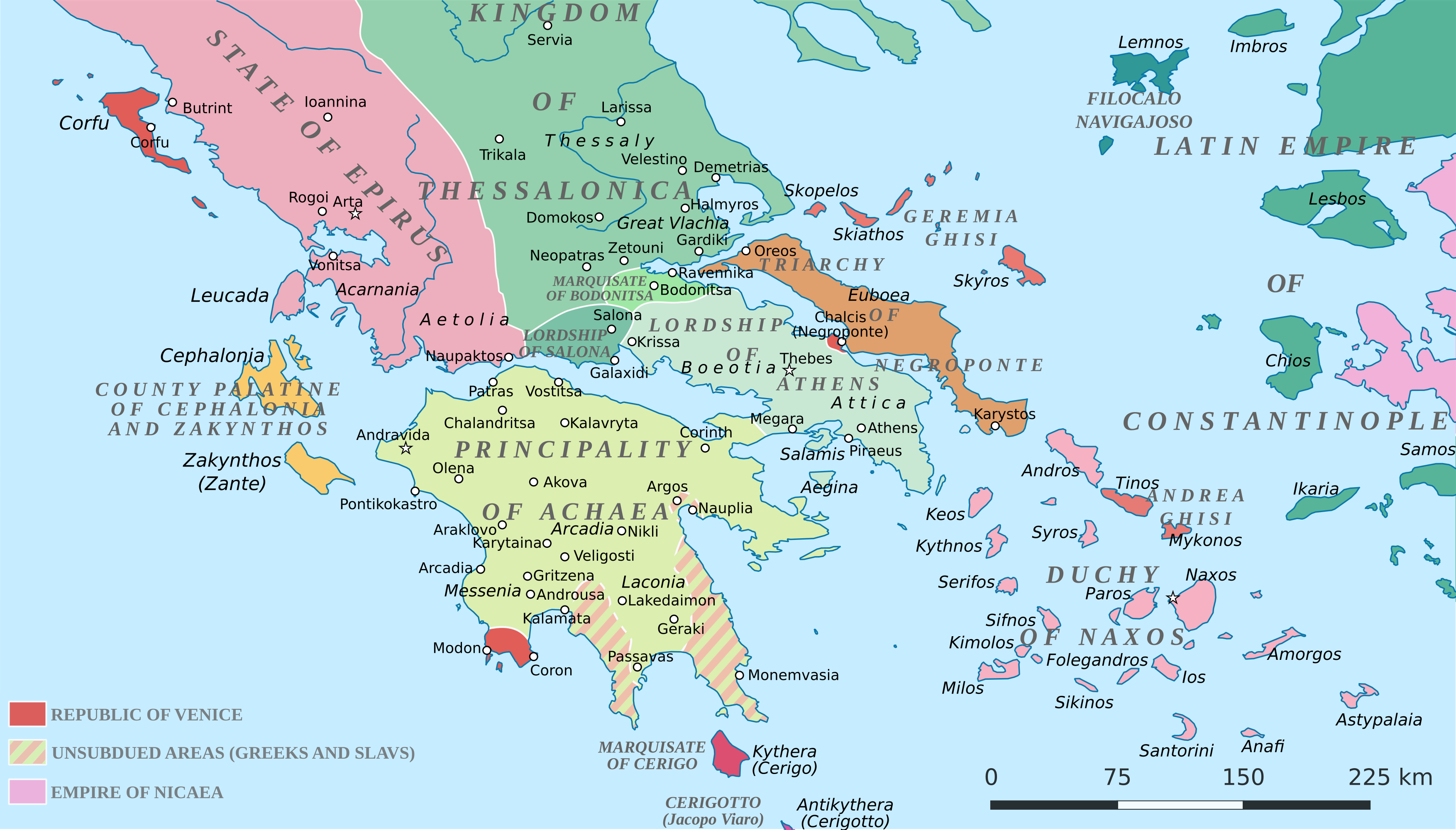
English: Political map of southern Greece in c. 1210, after the establishment of the Crusader states following the Fourth Crusade. |
| 日付 | |
| 原典 |
SVG base from File:Greece in 1210V1.svg; based on the original political map by William Miller (1908), with changes and corrections to account for newer scholarship:
|
| 作者 | Cplakidas |
| その他のバージョン |
|


ライセンス
この作品の著作権者である私は、この作品を以下のライセンスで提供します。
このファイルはクリエイティブ・コモンズ 表示-継承 4.0 国際ライセンスのもとに利用を許諾されています。
- あなたは以下の条件に従う場合に限り、自由に
- 共有 – 本作品を複製、頒布、展示、実演できます。
- 再構成 – 二次的著作物を作成できます。
- あなたの従うべき条件は以下の通りです。
- 表示 – あなたは適切なクレジットを表示し、ライセンスへのリンクを提供し、変更があったらその旨を示さなければなりません。これらは合理的であればどのような方法で行っても構いませんが、許諾者があなたやあなたの利用行為を支持していると示唆するような方法は除きます。
- 継承 – もしあなたがこの作品をリミックスしたり、改変したり、加工した場合には、あなたはあなたの貢献部分を元の作品とこれと同一または互換性があるライセンスの下に頒布しなければなりません。
ファイルの履歴
過去の版のファイルを表示するには、その版の日時をクリックしてください。
| 日付と時刻 | サムネイル | 寸法 | 利用者 | コメント | |
|---|---|---|---|---|---|
| 現在の版 | 2017年6月23日 (金) 19:59 | | 3,508 × 2,000 (1.12メガバイト) | Cplakidas | fixed three names to paths |
| 2017年4月11日 (火) 12:08 |  | 3,508 × 2,000 (1.1メガバイト) | Cplakidas | colour changes | |
| 2017年4月11日 (火) 11:48 |  | 3,508 × 2,000 (1.11メガバイト) | Cplakidas | tweak around Coron | |
| 2017年2月11日 (土) 10:39 |  | 3,508 × 2,000 (1.11メガバイト) | Cplakidas | tweaks in Negroponte, unsubdued areas | |
| 2017年2月8日 (水) 17:57 |  | 3,508 × 2,000 (1.11メガバイト) | Cplakidas | tweaking the Morea | |
| 2017年2月8日 (水) 13:40 |  | 3,508 × 2,000 (1.11メガバイト) | Cplakidas | slight tweaks | |
| 2017年2月8日 (水) 13:14 |  | 3,508 × 2,000 (1.11メガバイト) | Cplakidas | User created page with UploadWizard |
ファイルの使用状況
以下の 3 ページがこのファイルを使用しています:
グローバルなファイル使用状況
以下に挙げる他のウィキがこの画像を使っています:
- ar.wikipedia.org での使用状況
- az.wikipedia.org での使用状況
- bg.wikipedia.org での使用状況
- ca.wikipedia.org での使用状況
- da.wikipedia.org での使用状況
- de.wikipedia.org での使用状況
- el.wikipedia.org での使用状況
- en.wikipedia.org での使用状況
- eo.wikipedia.org での使用状況
- eu.wikipedia.org での使用状況
- fa.wikipedia.org での使用状況
- fr.wikipedia.org での使用状況
- gl.wikipedia.org での使用状況
- hr.wikipedia.org での使用状況
- id.wikipedia.org での使用状況
- it.wikipedia.org での使用状況
- ko.wikipedia.org での使用状況
- ro.wikipedia.org での使用状況
- ru.wikipedia.org での使用状況
- sk.wikipedia.org での使用状況
- sr.wikipedia.org での使用状況
- tr.wikipedia.org での使用状況
このファイルのグローバル使用状況を表示する。