ファイル:Herford-Physisch.png
高解像度版はありません。
Herford-Physisch.png (556 × 501 ピクセル、ファイルサイズ: 43キロバイト、MIME タイプ: image/png)
ウィキメディア・コモンズのファイルページにある説明を、以下に表示します。
|
| 解説 |
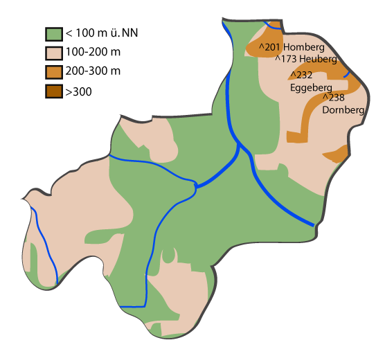
Deutsch: Topographische Karte von Herford (Nordrhein-Westfalen). |
| 日付 |
2007年7月16日 (当初のアップロード日) |
| 原典 | Based on Google Earth and Geoserver NRW |
| 作者 | Me, myself and I: de:Benutzer:TUBS |
| 許可 (ファイルの再利用) |
Use it and improve it |
| その他のバージョン | Adobe Illustator vector graphics available |
| 被写体の位置 | | 以下のサービスでこの位置を確認する: オープンストリートマップ |
|---|
ライセンス
| この著作物の著作権者である私は、この著作物における権利を放棄しパブリックドメインとします。これは全世界で適用されます。 一部の国では、これが法的に可能ではない場合があります。その場合は、次のように宣言します。 私は、あらゆる人に対して、法により必要とされている条件を除き、如何なる条件も課すことなく、あらゆる目的のためにこの著作物を使用する権利を与えます。 |
元のアップロードログ
元のファイルページはこちら。以下の利用者は全てde.wikipediaに属します。
- 2007-07-16 23:44 TUBS 556×501× (43833 bytes) {{Information |Beschreibung = Maps of [[Kreis Herford]] (Germany) series. Shows various kinds of information including topographical, demographical, and use of land information for all communities of Kreis Herford and the district of Herford itstelf. |Que
ファイルの履歴
過去の版のファイルを表示するには、その版の日時をクリックしてください。
| 日付と時刻 | サムネイル | 寸法 | 利用者 | コメント | |
|---|---|---|---|---|---|
| 現在の版 | 2008年12月21日 (日) 15:44 | | 556 × 501 (43キロバイト) | TUBS | {{Information |Description={{de|Topographische Karte von Herford (Nordrhein-Westfalen).}} |Source=Transferred from [http://de.wikipedia.org de.wikipedia]<br/> (Original text : ''Based on Google Earth and Geoserver NRW'') |Date=2007-07-16 ( |
ファイルの使用状況
以下のページがこのファイルを使用しています:
グローバルなファイル使用状況
以下に挙げる他のウィキがこの画像を使っています:
- de.wikipedia.org での使用状況