ファイル:Map hamburg rail 1910.jpg

このプレビューのサイズ: 799 × 600 ピクセル。 その他の解像度: 320 × 240 ピクセル | 640 × 480 ピクセル | 1,024 × 768 ピクセル | 1,280 × 961 ピクセル | 2,488 × 1,867 ピクセル。
元のファイル (2,488 × 1,867 ピクセル、ファイルサイズ: 1.29メガバイト、MIME タイプ: image/jpeg)
ウィキメディア・コモンズのファイルページにある説明を、以下に表示します。
|
概要
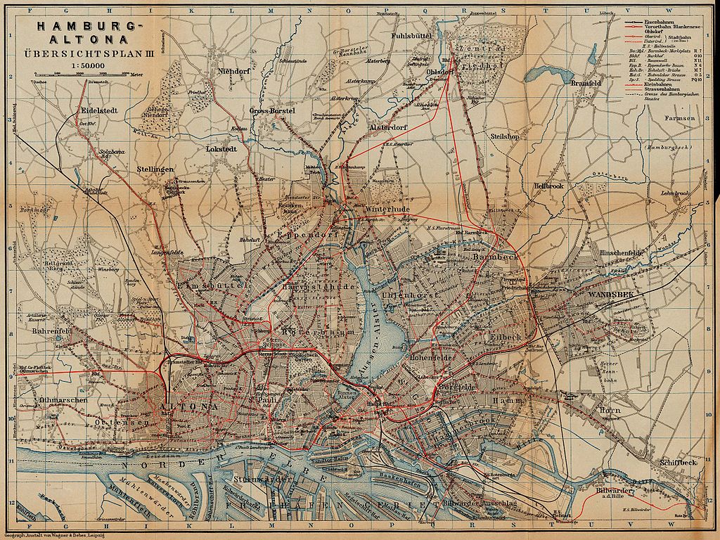
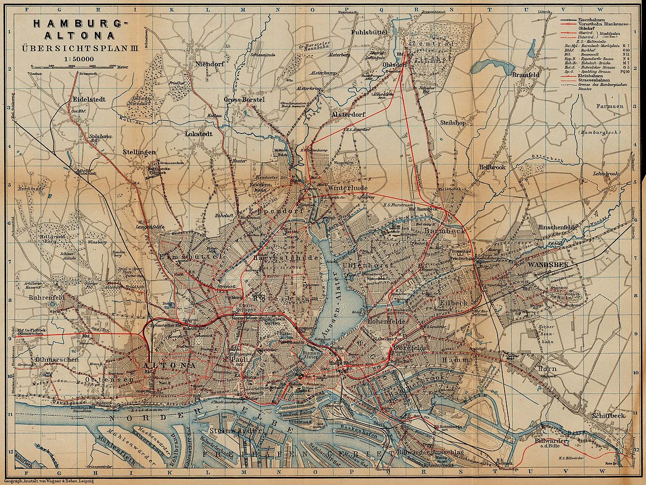
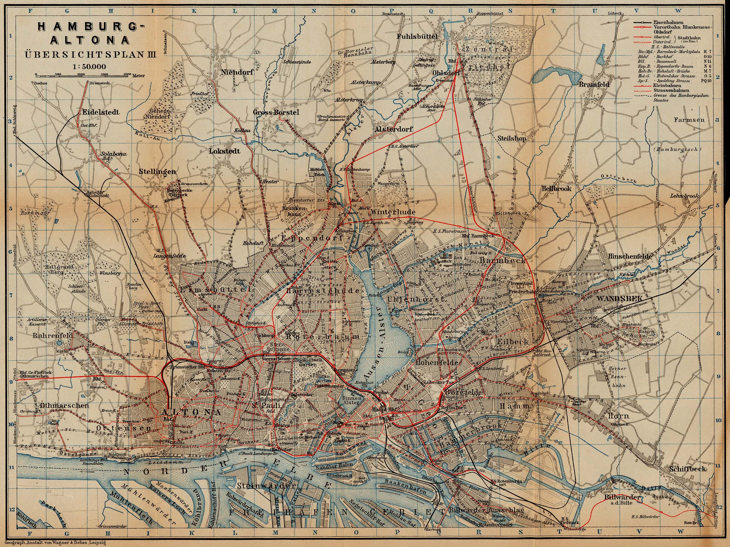
| 解説 | Railway and tramway map of Hamburg and Altona, about 1910 |
| 日付 | |
| 原典 | http://www.lib.utexas.edu/maps/historical/baedeker_n_germany_1910/hamburg_rail_1910.jpg |
| 作者 | "Northern Germany as far as the Bavarian and Austrian Frontiers; Handbook for Travellers" by Karl Baedeker. Fifteenth Revised Edition. Leipzig, Karl Baedeker; New York, Charles Scribner's Sons 1910. |
| 許可 (ファイルの再利用) |
"Courtesy of the University of Texas Libraries, The University of Texas at Austin." http://www.lib.utexas.edu/maps/map_sites/hist_sites.html |
ライセンス
|
この著作物は、著作権の保護期間が著作者の死後70年以下である国・地域においてパブリックドメインの状態にあります。
| |
| このファイルは著作権法の既知の制約(隣接権や関連する権利を含む)から自由であると特定されています。 | |
ファイルの履歴
過去の版のファイルを表示するには、その版の日時をクリックしてください。
| 日付と時刻 | サムネイル | 寸法 | 利用者 | コメント | |
|---|---|---|---|---|---|
| 現在の版 | 2006年4月23日 (日) 00:41 | | 2,488 × 1,867 (1.29メガバイト) | 700 MB | {{Information| |Description=Hamburg and Altona (railway and tramway map) |Source=http://www.lib.utexas.edu/maps/historical/baedeker_n_germany_1910/hamburg_rail_1910.jpg |Date=1910 |Author="Northern Germany as far as the Bavarian and Austrian Frontiers; H |
ファイルの使用状況
以下のページがこのファイルを使用しています:
グローバルなファイル使用状況
以下に挙げる他のウィキがこの画像を使っています:
- de.wikipedia.org での使用状況
- en.wikipedia.org での使用状況
- nl.wikipedia.org での使用状況
- ru.wikipedia.org での使用状況