ファイル:National-atlas-louisiana.png
高解像度版はありません。
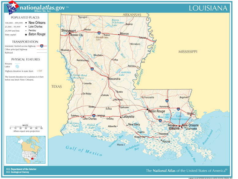
National-atlas-louisiana.png (778 × 584 ピクセル、ファイルサイズ: 117キロバイト、MIME タイプ: image/png)
ウィキメディア・コモンズのファイルページにある説明を、以下に表示します。
|
概要
| 解説 | Louisiana map |
| 原典 | Originally from Image%3ANational-atlas-louisiana.PNG. |
| 作者 |
ライセンス
This map was obtained from an edition of the National Atlas of the United States. Like almost all works of the U.S. federal government, works from the National Atlas are in the public domain in the United States.
Online access: NationalAtlas.gov | 1970 print edition: Library of Congress, Perry-Castañeda Library
|
Wikipedia upload log
(All user names refer to en.wikipedia)
- 2004-11-05 01:28 Queson 778×584×8 (120201 bytes) National Atlas map of Louisiana {{PD-USGov}}
ファイルの履歴
過去の版のファイルを表示するには、その版の日時をクリックしてください。
| 日付と時刻 | サムネイル | 寸法 | 利用者 | コメント | |
|---|---|---|---|---|---|
| 現在の版 | 2007年5月9日 (水) 12:05 | | 778 × 584 (117キロバイト) | Hbk33 | {{Information |Description=en:Category:Louisiana maps |Source=Originally from [http://en.wikipedia.org en.wikipedia]; description page is/was [http://en.wikipedia.org/w/index.php?title=Image%3ANational-atlas-louisiana.PNG here]. |Date=2004-11-05 (ori |
ファイルの使用状況
以下のページがこのファイルを使用しています:
グローバルなファイル使用状況
以下に挙げる他のウィキがこの画像を使っています:
- ar.wikipedia.org での使用状況
- en.wikivoyage.org での使用状況
- eu.wikipedia.org での使用状況
- fr.wikipedia.org での使用状況
- gu.wikipedia.org での使用状況
- he.wikipedia.org での使用状況
- hr.wiktionary.org での使用状況
- kn.wikipedia.org での使用状況
- nl.wikipedia.org での使用状況
- pam.wikipedia.org での使用状況
- pl.wikivoyage.org での使用状況
- ro.wikipedia.org での使用状況
- sw.wikipedia.org での使用状況
- tr.wikipedia.org での使用状況
- zh-yue.wikipedia.org での使用状況