ファイル:Paris 16th arrondissement map with listings.png

このプレビューのサイズ: 690 × 600 ピクセル。 その他の解像度: 276 × 240 ピクセル | 552 × 480 ピクセル | 883 × 768 ピクセル | 1,178 × 1,024 ピクセル | 2,356 × 2,048 ピクセル | 3,460 × 3,008 ピクセル。
元のファイル (3,460 × 3,008 ピクセル、ファイルサイズ: 1.01メガバイト、MIME タイプ: image/png)
ウィキメディア・コモンズのファイルページにある説明を、以下に表示します。
|
概要
| 解説 |
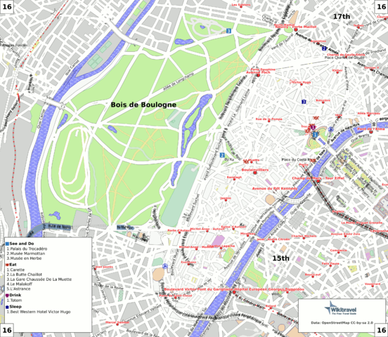
English: Map of the 16st arrondissement of Paris.
Deutsch: Karte des 16. Bezirkes von Paris. |
| 日付 | |
| 原典 | Map created by Mark Jaroski for Wikitravel (see at http://wikitravel.org/en/Paris/Maps). Generated from OSM data and Wikitravel listings using this code. |
| 作者 | Mark Jaroski |
| 許可 (ファイルの再利用) |
ShareAlike 1.0 |
ライセンス
This file is licensed under Creative Commons ShareAlike 1.0 License.
Creative Commons has retired this legal tool and does not recommend that it be applied to works.
|
元のアップロードログ
| This file was imported from Wikivoyage WTS. |
元のファイルページはこちら。以下の利用者は全てwts.wikivoyage-oldに属します。
- 2008-08-19 21:04 (WT-shared) Mark[dead link] 3460×3008 (4833173 bytes) Generated from OSM and Wikitravel data using [http://wikevent.org/repository/wtp-maps this code]. (Import from wikitravel.org/shared)
- 2008-09-27 12:01 (WT-shared) Mark[dead link] 3460×3008 (779749 bytes) (Import from wikitravel.org/shared)
- 2008-09-27 17:06 (WT-shared) Mark[dead link] 3460×3008 (1004113 bytes) (Import from wikitravel.org/shared)
- 2008-10-30 08:39 (WT-shared) Mark[dead link] 3460×3008 (1100476 bytes) (Import from wikitravel.org/shared)
- 2009-01-10 18:41 (WT-shared) Mark[dead link] 3460×3008 (1033117 bytes) (Import from wikitravel.org/shared)
- 2009-01-10 18:55 (WT-shared) Mark[dead link] 3460×3008 (977366 bytes) (Import from wikitravel.org/shared)
- 2009-01-11 08:45 (WT-shared) Mark[dead link] 3460×3008 (1055712 bytes) (Import from wikitravel.org/shared)
- 2009-03-01 21:32 (WT-shared) Mark[dead link] 3460×3008 (1037078 bytes) (Import from wikitravel.org/shared)
- 2009-05-23 06:52 (WT-shared) Mark[dead link] 3460×3008 (393298 bytes) (Import from wikitravel.org/shared)
- 2009-05-23 07:07 (WT-shared) Mark[dead link] 3460×3008 (1295611 bytes) (Import from wikitravel.org/shared)
- 2009-09-09 20:26 (WT-shared) Mark[dead link] 3460×3008 (1124473 bytes) (Import from wikitravel.org/shared)
- 2009-09-09 21:21 (WT-shared) Mark[dead link] 3460×3008 (1322661 bytes) (Import from wikitravel.org/shared)
- 2009-09-10 06:55 (WT-shared) Mark[dead link] 3460×3008 (1295102 bytes) (Import from wikitravel.org/shared)
- 2012-09-10 19:35 Atsirlin[dead link] 3460×3008 (1735873 bytes) cleanup
ファイルの履歴
過去の版のファイルを表示するには、その版の日時をクリックしてください。
| 日付と時刻 | サムネイル | 寸法 | 利用者 | コメント | |
|---|---|---|---|---|---|
| 現在の版 | 2009年2月16日 (月) 11:05 | | 3,460 × 3,008 (1.01メガバイト) | NatiSythen | {{Information |Description={{en|1=Map of the 16st arrondissement of Paris. }} {{de|1=Karte des 16. Bezirkes von Paris. }} |Source=Map created by Mark Jaroski for Wikitravel (see at http://wikitravel.org/en/Paris/Maps). Generated from OSM data and Wikitrav |
ファイルの使用状況
グローバルなファイル使用状況
以下に挙げる他のウィキがこの画像を使っています:
- de.wikipedia.org での使用状況
- es.wikipedia.org での使用状況
- fa.wikipedia.org での使用状況
- fi.wikivoyage.org での使用状況
- fr.wikipedia.org での使用状況
- nl.wikipedia.org での使用状況