ファイル:South Lanarkshire council.PNG

このプレビューのサイズ: 480 × 599 ピクセル。 その他の解像度: 192 × 240 ピクセル | 384 × 480 ピクセル | 615 × 768 ピクセル | 820 × 1,024 ピクセル | 1,641 × 2,048 ピクセル | 2,733 × 3,411 ピクセル。
元のファイル (2,733 × 3,411 ピクセル、ファイルサイズ: 208キロバイト、MIME タイプ: image/png)
ウィキメディア・コモンズのファイルページにある説明を、以下に表示します。
|
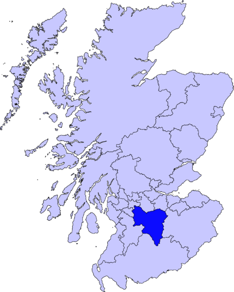
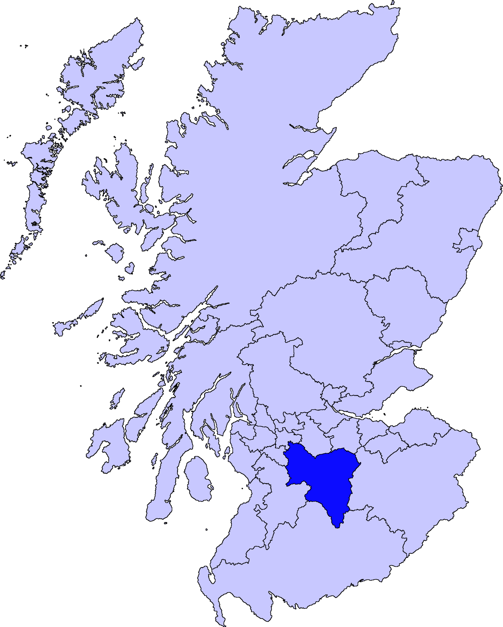
| 解説 | map of South Lanarkshire | ||||||||
| 日付 | |||||||||
| 原典 |
この作品の著作権者であるBarryobは、この作品を以下のライセンスで提供しています。
|
||||||||
| 作者 | User:Barryob |

ファイルの履歴
過去の版のファイルを表示するには、その版の日時をクリックしてください。
| 日付と時刻 | サムネイル | 寸法 | 利用者 | コメント | |
|---|---|---|---|---|---|
| 現在の版 | 2007年4月10日 (火) 04:57 | | 2,733 × 3,411 (208キロバイト) | Barryob | |
| 2007年4月8日 (日) 21:55 |  | 2,733 × 3,411 (209キロバイト) | Barryob | ||
| 2007年4月3日 (火) 00:09 |  | 2,733 × 3,411 (209キロバイト) | Barryob | {{Information |Description=map of South Lanarkshire |Source={{GFDL-user|Barryob}} |Date=2006-03-31 |Author=User:Barryob |Permission= |other_versions= }} Category:Maps of unitary councils of Scotland |
ファイルの使用状況
以下のページがこのファイルを使用しています:
グローバルなファイル使用状況
以下に挙げる他のウィキがこの画像を使っています:
- en.wikipedia.org での使用状況
- Hamilton, South Lanarkshire
- South Lanarkshire
- Rutherglen
- Lanark
- East Kilbride
- Cambuslang
- Biggar, South Lanarkshire
- University of the West of Scotland
- Blantyre, South Lanarkshire
- Lesmahagow
- Kirkmuirhill
- Blackwood, South Lanarkshire
- Larkhall
- Bothwell
- Strathaven
- Carluke
- Leadhills
- Uddingston
- Burnbank
- Walston, South Lanarkshire
- Abington, South Lanarkshire
- Carnwath
- Coulter, South Lanarkshire
- Forth, South Lanarkshire
- Law, South Lanarkshire
- Braidwood, South Lanarkshire
- Lanark Grammar School
- Dalserf
- Carstairs Junction
- Crawford, South Lanarkshire
- Douglas, South Lanarkshire
- Carstairs
- Stonehouse, South Lanarkshire
- Crawfordjohn
- Trinity High School, Rutherglen
- Nerston
- Tillietudlem
- Hamilton Grammar School
- Coalburn
- Stonelaw High School
- Thankerton
- Hamilton College, South Lanarkshire
- Fernhill School, Rutherglen
- Tarbrax
- Auchengray
- Newbigging, South Lanarkshire
- Saint John Ogilvie High School
- Kilncadzow
- Auchenheath
- Elsrickle
このファイルのグローバル使用状況を表示する。