ファイル:1924 BMT dual contracts map.jpg
元のファイル (978 × 696 ピクセル、ファイルサイズ: 163キロバイト、MIME タイプ: image/jpeg)
ウィキメディア・コモンズのファイルページにある説明を、以下に表示します。
|
概要
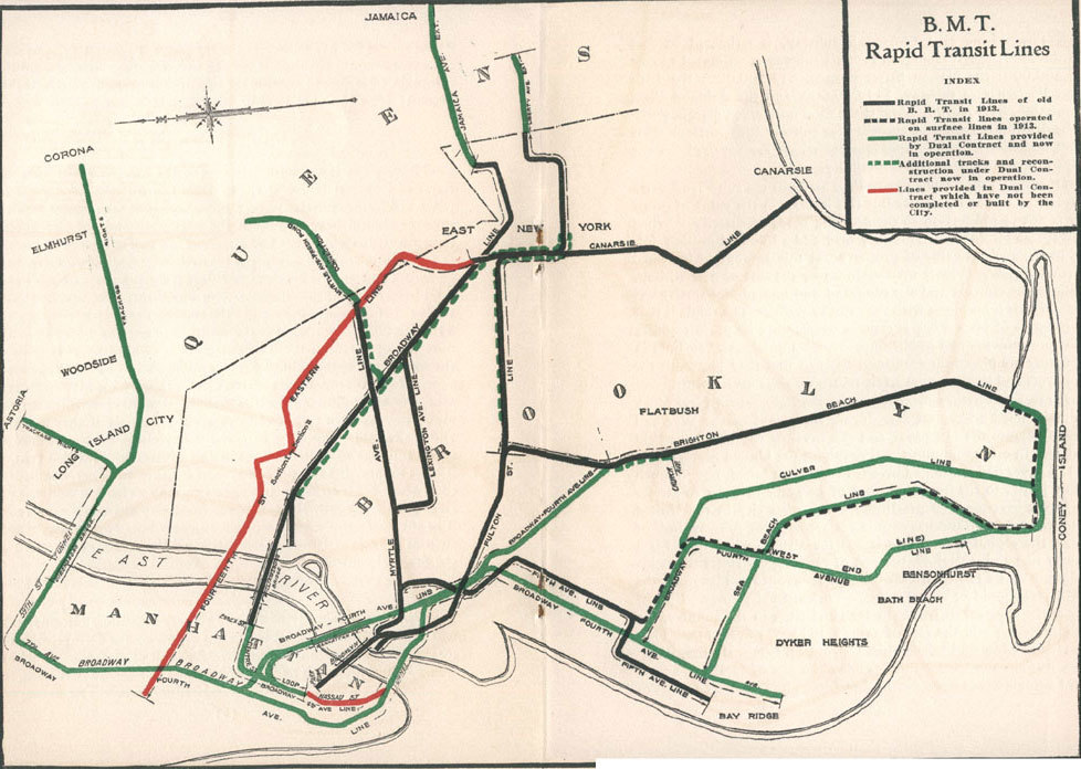
1924 map of the BMT, showing construction done under the Dual Contracts. From [1] アーカイブされたコピー at the Wayback Machine, public domain according to [2] アーカイブされたコピー at the Wayback Machine:
"According to the Library of Congress Copyright Office for works copyrighted prior to January 1, 1964 the copyright endured for a period of 28 years unless it was renewed. A search of copyright office records disclosed no registration or renewal for this title or author, therefore it is my understanding that I can make these scans available."
ライセンス
|
この著作物は、著作権の保護期間が著作者の死後70年以下である国・地域においてパブリックドメインの状態にあります。
| |
| このファイルは著作権法の既知の制約(隣接権や関連する権利を含む)から自由であると特定されています。 | |
ファイルの履歴
過去の版のファイルを表示するには、その版の日時をクリックしてください。
| 日付と時刻 | サムネイル | 寸法 | 利用者 | コメント | |
|---|---|---|---|---|---|
| 現在の版 | 2020年9月27日 (日) 16:12 | | 978 × 696 (163キロバイト) | IagoQnsi | Rotated -90° using CropTool with precise mode. |
| 2005年2月15日 (火) 06:13 |  | 696 × 978 (155キロバイト) | SPUI~commonswiki | {{PD}}1924 map of the BMT. From [http://www.bmt-lines.com/history.html], public domain according to [http://www.bmt-lines.com/TTruths.html]. |
ファイルの使用状況
以下の 2 ページがこのファイルを使用しています:
グローバルなファイル使用状況
以下に挙げる他のウィキがこの画像を使っています:
- de.wikipedia.org での使用状況
- en.wikipedia.org での使用状況
- Dual Contracts
- BMT Fourth Avenue Line
- Portal:Trains/Selected article/2014 archive
- Portal:Trains/Selected article/Week 23, 2014
- User:Kew Gardens 613
- New York City Subway map
- User:Kew Gardens 613/sandbox
- User:Kew Gardens 613/sandbox 2
- User:Kew Gardens 613/sandbox 3
- User:Kew Gardens 613/sandbox 4
- User:Kew Gardens 613/sandbox 5
- User:Kew Gardens 613/sandbox 6
- User:Kew Gardens 613/sandbox 7
- User:Kew Gardens 613/Tabs/sandbox
- User:Kew Gardens 613/sandbox 8
- User:Kew Gardens 613/sandbox 9
- User:Kew Gardens 613/sandbox 10
- User:Kew Gardens 613/sandbox 12
- en.wikibooks.org での使用状況
- es.wikipedia.org での使用状況
- fr.wikipedia.org での使用状況