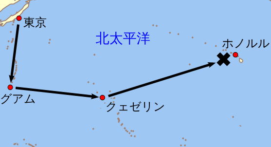
ファイル:B-17 Plane Crash over the Pacific on August 17, 1947.ja.svg

この SVG ファイルのこの PNG プレビューのサイズ: 557 × 301 ピクセル. その他の解像度: 320 × 173 ピクセル | 640 × 346 ピクセル | 1,024 × 553 ピクセル | 1,280 × 692 ピクセル | 2,560 × 1,383 ピクセル。
元のファイル (SVG ファイル、557 × 301 ピクセル、ファイルサイズ: 94キロバイト)
ウィキメディア・コモンズのファイルページにある説明を、以下に表示します。
|
| 解説 |
English: An orthographic projection of the pacific ocean, showing land outlines (resolution ~0.5 degrees) and the Polynesian triangle between Hawai'i, Rapa Nui and Aotearoa. Created using a custom perl script (http://user.interface.org.nz/~gringer/hacking/wdb2svg.txt, rename to .pl) to convert wdb2 vector data (from http://www.evl.uic.edu/pape/data/WDB/) into an SVG file (including combining segments into longer paths). Some tweaking was then done in Inkscape to fix up vector location errors, combine paths, then colour as suggested in Wikipedia:WikiProject_Maps/Conventions. |
| 日付 | (UTC) |
| 原典 | |
| 作者 |
|
| その他のバージョン |
|

この画像には画像編集が施されています。原本に対してデジタル的な変更が行われました。
|
このファイルはクリエイティブ・コモンズ 表示 3.0 非移植ライセンスのもとに利用を許諾されています。
- あなたは以下の条件に従う場合に限り、自由に
- 共有 – 本作品を複製、頒布、展示、実演できます。
- 再構成 – 二次的著作物を作成できます。
- あなたの従うべき条件は以下の通りです。
- 表示 – あなたは適切なクレジットを表示し、ライセンスへのリンクを提供し、変更があったらその旨を示さなければなりません。これらは合理的であればどのような方法で行っても構いませんが、許諾者があなたやあなたの利用行為を支持していると示唆するような方法は除きます。
元のアップロードログ
This image is a derivative work of the following images:
- File:Polynesian_triangle.svg licensed with Cc-by-3.0
- 2009-11-24T03:01:49Z Gringer 542x542 (91941 Bytes) {{Information |Description={{en|1=An orthographic projection of the pacific ocean, showing land outlines (resolution ~0.5 degrees) and the Polynesian triangle between Hawai'i, Rapa Nui and Aotearoa. Created using a custom per
Uploaded with derivativeFX
ファイルの履歴
過去の版のファイルを表示するには、その版の日時をクリックしてください。
| 日付と時刻 | サムネイル | 寸法 | 利用者 | コメント | |
|---|---|---|---|---|---|
| 現在の版 | 2010年2月21日 (日) 06:52 | | 557 × 301 (94キロバイト) | Miyamaki | 表示エリアからはみ出した文字列の位置を修正 |
| 2010年2月21日 (日) 06:50 |  | 557 × 301 (94キロバイト) | Miyamaki | 文字列を訂正 | |
| 2010年2月21日 (日) 06:30 |  | 557 × 301 (99キロバイト) | Miyamaki | {{Information |Description={{en|1=An orthographic projection of the pacific ocean, showing land outlines (resolution ~0.5 degrees) and the Polynesian triangle between Hawai'i, Rapa Nui and Aotearoa. Created using a custom perl script (http://user.interfac |
ファイルの使用状況
以下のページがこのファイルを使用しています: