ファイル:BlankMap-USA-states-Canada-provinces, HI closer.svg

この SVG ファイルのこの PNG プレビューのサイズ: 512 × 512 ピクセル. その他の解像度: 240 × 240 ピクセル | 480 × 480 ピクセル | 768 × 768 ピクセル | 1,024 × 1,024 ピクセル | 2,048 × 2,048 ピクセル。
元のファイル (SVG ファイル、512 × 512 ピクセル、ファイルサイズ: 104キロバイト)
ウィキメディア・コモンズのファイルページにある説明を、以下に表示します。
|
| 解説 |
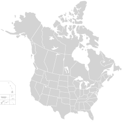
English: Blank SVG map of USA and Canada with state and province borders. Hawaii has been moved closer to the mainland USA to reduce width of image.
Non-contiguous parts of a states/provinces are "grouped" together with the main area of the state/provinces, so any state/provinces can be coloured in completion with one click anywhere on the state/provinces's area. Also, all states/provinces have a "id" attached to them, making them easy to find. Select "find" and then enter in the state/provinces's ISO 3166-2 code in the "id" field to find it. The codes can be found here (Canada) and here (USA). |
| 日付 | |
| 原典 |
|
| 作者 | Lokal_Profil |
| 許可 (ファイルの再利用) |
このファイルはクリエイティブ・コモンズ 表示-継承 2.5 一般ライセンスのもとに利用を許諾されています。 帰属: Lokal_Profil
|
| その他のバージョン |
The same as this map with the two-letter state or province name label for each one |
ファイルの履歴
過去の版のファイルを表示するには、その版の日時をクリックしてください。
| 日付と時刻 | サムネイル | 寸法 | 利用者 | コメント | |
|---|---|---|---|---|---|
| 現在の版 | 2020年11月23日 (月) 01:48 | | 512 × 512 (104キロバイト) | Ponderosapine210 | Accidentally uploaded wrong version. Here is the correct one. |
| 2020年11月23日 (月) 01:38 |  | 512 × 596 (132キロバイト) | Ponderosapine210 | Added the prominent islands of Manitoulin (Ontario) and Isle Royale (Michigan) to the Great Lakes. | |
| 2019年6月1日 (土) 22:59 |  | 512 × 512 (99キロバイト) | Fluffy89502 | added territories | |
| 2007年12月8日 (土) 21:18 |  | 1,730 × 1,730 (212キロバイト) | Lokal Profil | Code trimming | |
| 2007年7月3日 (火) 04:21 |  | 1,730 × 1,730 (213キロバイト) | Lokal Profil | {{Information |Description={{en|Blank SVG map of USA and Canada with state and province borders. Hawaii has been moved closer to the mainland USA to reduce width of image.}} Non-contiguous parts of a states/provinces are "grouped" together with the main a |
ファイルの使用状況
このファイルを使用しているページはありません。
グローバルなファイル使用状況
以下に挙げる他のウィキがこの画像を使っています:
- en.wikipedia.org での使用状況
- fr.wikipedia.org での使用状況