ファイル:Blank Map World Secondary Political Divisions.svg

この SVG ファイルのこの PNG プレビューのサイズ: 512 × 260 ピクセル. その他の解像度: 320 × 163 ピクセル | 640 × 325 ピクセル | 1,024 × 520 ピクセル | 1,280 × 650 ピクセル | 2,560 × 1,300 ピクセル。
元のファイル (SVG ファイル、512 × 260 ピクセル、ファイルサイズ: 9.25メガバイト)
ウィキメディア・コモンズのファイルページにある説明を、以下に表示します。
|
概要
| 解説 |
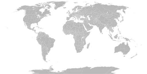
English: A detailed Robinson projection SVG map of the world with secondary political units grouped for easy coloring. |
| 日付 | |
| 原典 | |
| 作者 |
|
ライセンス
この作品の著作権者である私は、この作品を以下のライセンスで提供します。
| このファイルはクリエイティブ・コモンズ CC0 1.0 全世界 パブリック・ドメイン提供のもとで利用可能にされています。 | |
| ある作品に本コモンズ証を関連づけた者は、その作品について世界全地域において著作権法上認められる、その者が持つすべての権利(その作品に関する権利や隣接する権利を含む。)を、法令上認められる最大限の範囲で放棄して、パブリック・ドメインに提供しています。
この作品は、たとえ営利目的であっても、許可を得ずに複製、改変・翻案、配布、上演・演奏することが出来ます。 |
ファイルの履歴
過去の版のファイルを表示するには、その版の日時をクリックしてください。
| 日付と時刻 | サムネイル | 寸法 | 利用者 | コメント | |
|---|---|---|---|---|---|
| 現在の版 | 2024年6月25日 (火) 08:02 | | 512 × 260 (9.25メガバイト) | ClaveScottPH | Fixed. |
| 2024年6月22日 (土) 02:08 |  | 512 × 260 (3.45メガバイト) | ClaveScottPH | Fixed colors for comoros, fixed overlapping for Abkhazia, and added subdivisions for Bahrain. | |
| 2024年6月20日 (木) 14:06 |  | 512 × 260 (2.47メガバイト) | ClaveScottPH | Fixed division for the Central African Republic, Montenegro, and Thailand; fixed overlapping divisions for Morocco, Nigeria, Palestine, South Ossetia (disputed), and Taiwan (disputed). | |
| 2024年6月10日 (月) 06:50 |  | 512 × 260 (2.42メガバイト) | ClaveScottPH | Fixed | |
| 2024年6月10日 (月) 04:01 |  | 3,413 × 1,752 (5.9メガバイト) | ClaveScottPH | {{subst:update-note|1=File:Blank Map World Secondary Political Divisions.svg|2=new cantons in Luxembourg, municipalities in Latvia, new regions in Chile, Tanzania, the Philippines, Mali, Kazakhstan, Ghana, and Ethiopia, new prefectures in the Central African Republic, new provinces in Equatorial Guinea, Burundi, Algeria, Laos, Indonesia, Nepal, and the Democratic Republic of the Congo, new governorates in Lebanon and Oman, new administrative area in South Sudan have been created.}} ~~~~ | |
| 2022年5月28日 (土) 19:10 |  | 2,560 × 1,314 (4.59メガバイト) | Betseg | Reverted to version as of 00:32, 13 March 2022 (UTC). Nearly double the size because of the high detailed divisions, and the colours were broken. | |
| 2022年5月7日 (土) 21:47 |  | 2,560 × 1,314 (7.27メガバイト) | Abbasi786786 | Made Pakistan and Nigeria more precise; Added new Congolese provinces | |
| 2022年3月13日 (日) 00:32 |  | 2,560 × 1,314 (4.59メガバイト) | Abbasi786786 | Merged KPK and former FATA, Pakistan | |
| 2021年12月13日 (月) 11:20 |  | 2,560 × 1,314 (4.59メガバイト) | W0nderhat | Reverted to version as of 18:26, 6 June 2020 (UTC); removal of Chilean Patagonia unnecessary and confusing, ISO codes an unfortunate casualty (will look into how to restore them) | |
| 2020年9月20日 (日) 20:39 |  | 2,560 × 1,314 (4.27メガバイト) | Hoehermann | Added or adjusted ISO-3166 codes for Mexico, Morocco, USA, Antarctica, Cuba, Greenland. Separated Antarctica from Chile. Removed comments. |
ファイルの使用状況
以下のページがこのファイルを使用しています:
グローバルなファイル使用状況
以下に挙げる他のウィキがこの画像を使っています:
- bn.wikipedia.org での使用状況
- bs.wikipedia.org での使用状況
- en.wikipedia.org での使用状況
- Government
- Administrative division
- Wikipedia:Blank maps
- Wikipedia:Graphics Lab/Map workshop/Archive/May 2011
- User:Naqsh-e hJahan/List of provinces
- User talk:Naqsh-e hJahan/List of provinces
- Wikipedia:Graphics Lab/Illustration workshop/Archive/Jun 2023
- Wikipedia:Graphics Lab/Map workshop/Archive/Jul 2023
- ne.wikipedia.org での使用状況
- sq.wikipedia.org での使用状況
- sr.wikipedia.org での使用状況
- te.wikipedia.org での使用状況
- tr.wikipedia.org での使用状況
- zh.wikipedia.org での使用状況