ファイル:Dakotatribesmap.jpg
このプレビューのサイズ: 800 × 583 ピクセル。 その他の解像度: 320 × 233 ピクセル | 640 × 466 ピクセル | 891 × 649 ピクセル。
元のファイル (891 × 649 ピクセル、ファイルサイズ: 212キロバイト、MIME タイプ: image/jpeg)
ウィキメディア・コモンズのファイルページにある説明を、以下に表示します。
|
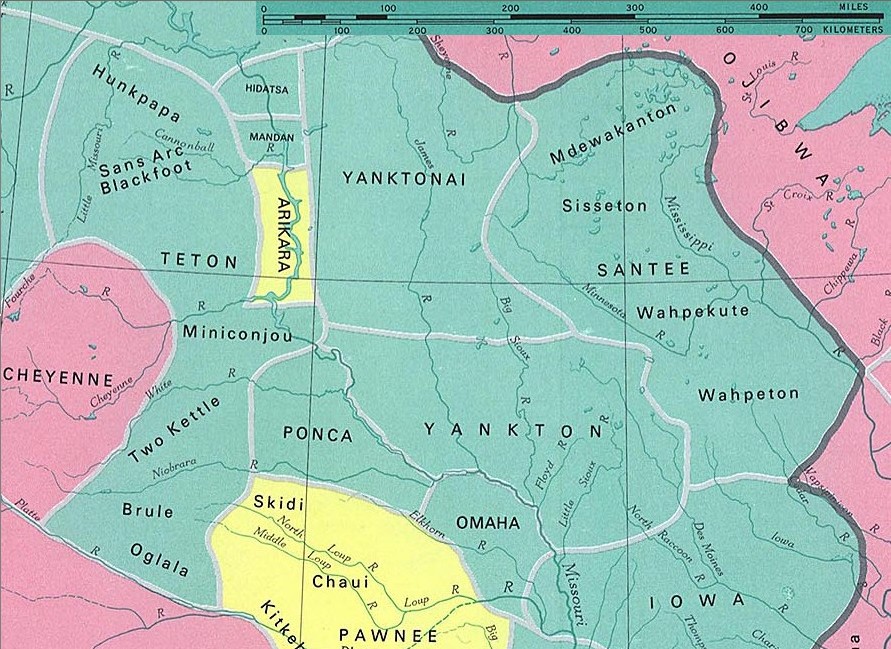
Dakota tribes
fragment from: http://www.lib.utexas.edu/maps/national_atlas_1970/ca000097.jpg
Most of the maps scanned by the University of Texas Libraries and served from this web site are in the public domain. No permissions are needed to copy them. You may download them and use them as you wish.
この作品は、次の理由でパブリックドメインに属します。Most of the maps scanned by the University of Texas Libraries and served from this web site (www.lib.utexas.edu) are in the public domain. No permissions are needed to copy them. You may download them and use them as you wish.
パブリックドメインの適用が法的に不可能な場合: 誰でも、いかなる目的であっても、法令によって要求される条件以外のいかなる条件も課されることなしに、この作品を利用する権利が認められます。 上記で説明されている理由が、コモンズのライセンス方針に準拠しているかどうか検証してください。
|
also see

ファイルの履歴
過去の版のファイルを表示するには、その版の日時をクリックしてください。
| 日付と時刻 | サムネイル | 寸法 | 利用者 | コメント | |
|---|---|---|---|---|---|
| 現在の版 | 2006年1月10日 (火) 23:37 | | 891 × 649 (212キロバイト) | Pitert | Dakota tribes fragment from: http://www.lib.utexas.edu/maps/national_atlas_1970/ca000097.jpg {{PD}} |
ファイルの使用状況
以下のページがこのファイルを使用しています:
グローバルなファイル使用状況
以下に挙げる他のウィキがこの画像を使っています:
- ca.wikipedia.org での使用状況
- cs.wikipedia.org での使用状況
- es.wikipedia.org での使用状況
- fi.wikipedia.org での使用状況
- fr.wikipedia.org での使用状況
- pl.wikipedia.org での使用状況