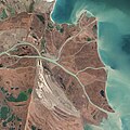
ファイル:Danubedelta chilia lobe satellite image.jpg

このプレビューのサイズ: 600 × 600 ピクセル。 その他の解像度: 240 × 240 ピクセル | 480 × 480 ピクセル | 768 × 768 ピクセル | 1,024 × 1,024 ピクセル | 2,048 × 2,048 ピクセル | 3,679 × 3,679 ピクセル。
元のファイル (3,679 × 3,679 ピクセル、ファイルサイズ: 3.95メガバイト、MIME タイプ: image/jpeg)
ファイルの履歴
過去の版のファイルを表示するには、その版の日時をクリックしてください。
| 日付と時刻 | サムネイル | 寸法 | 利用者 | コメント | |
|---|---|---|---|---|---|
| 現在の版 | 2014年7月4日 (金) 22:10 |  | 3,679 × 3,679 (3.95メガバイト) | Gretarsson | {{Information |Description ={{en|1=Original image caption (excerpt): The image above was acquired on February 5, 2013, by the Advanced Land Imager (ALI) on NASA’s Earth Observing-1 (EO-1) satellite. The Danube Delta has a number of lobes formed ov... |
ファイルの使用状況
以下のページがこのファイルを使用しています:
グローバルなファイル使用状況
以下に挙げる他のウィキがこの画像を使っています:
- cy.wikipedia.org での使用状況
- da.wikipedia.org での使用状況
- de.wikipedia.org での使用状況
- fa.wikipedia.org での使用状況
- fi.wikipedia.org での使用状況
- mk.wikipedia.org での使用状況
- ru.wikipedia.org での使用状況
- sl.wikipedia.org での使用状況
- ta.wikipedia.org での使用状況
- th.wikipedia.org での使用状況
- uk.wikipedia.org での使用状況
- vi.wikipedia.org での使用状況

