ファイル:Eurasian steppe belt.jpg
このプレビューのサイズ: 800 × 597 ピクセル。 その他の解像度: 320 × 239 ピクセル | 640 × 478 ピクセル | 1,024 × 765 ピクセル | 1,280 × 956 ピクセル | 2,048 × 1,529 ピクセル。
元のファイル (2,048 × 1,529 ピクセル、ファイルサイズ: 1.62メガバイト、MIME タイプ: image/jpeg)
ウィキメディア・コモンズのファイルページにある説明を、以下に表示します。
|
概要
| 解説 |
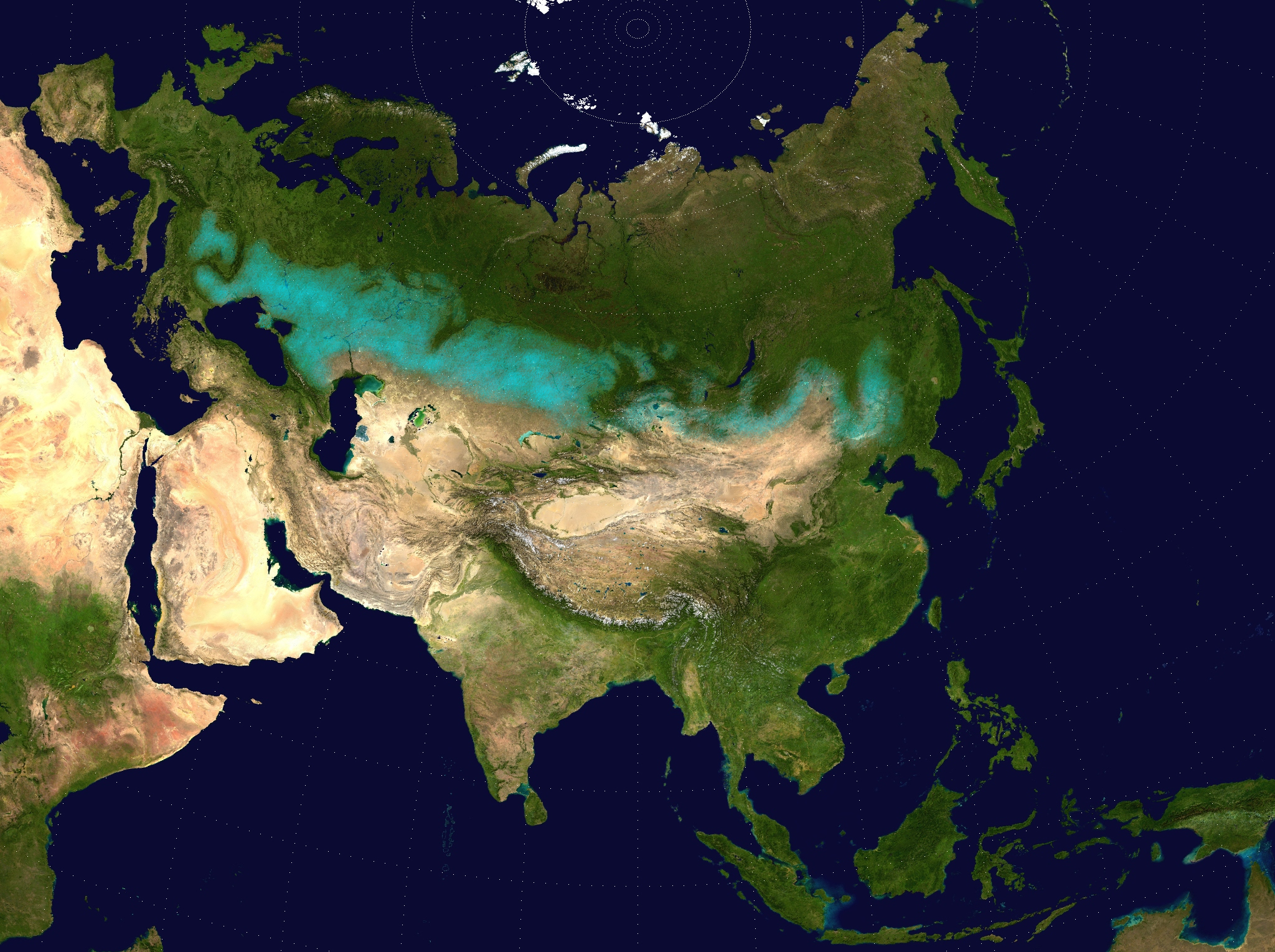
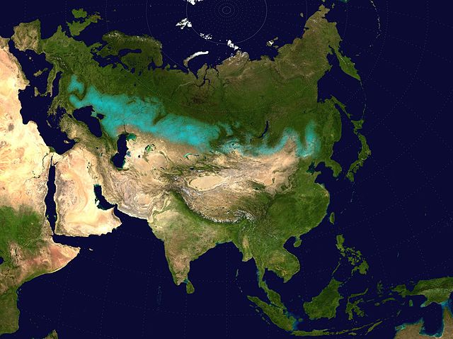
English: Approximate extent of the Eurasian Steppe grasslands ecoregion, and Eurasia cultural region.
|
| 日付 | (UTC) |
| 原典 | |
| 作者 |
|
| 許可 (ファイルの再利用) |
Source map released into public domain. |
この画像には画像編集が施されています。原本に対して次のデジタル的な変更が行われました。
|
ライセンス
この作品の著作権者である私は、この作品を以下のライセンスで提供します。
| この著作物の著作権者である私は、この著作物における権利を放棄しパブリックドメインとします。これは全世界で適用されます。 一部の国では、これが法的に可能ではない場合があります。その場合は、次のように宣言します。 私は、あらゆる人に対して、法により必要とされている条件を除き、如何なる条件も課すことなく、あらゆる目的のためにこの著作物を使用する権利を与えます。 |
ファイルの履歴
過去の版のファイルを表示するには、その版の日時をクリックしてください。
| 日付と時刻 | サムネイル | 寸法 | 利用者 | コメント | |
|---|---|---|---|---|---|
| 現在の版 | 2017年4月6日 (木) 17:24 | | 2,048 × 1,529 (1.62メガバイト) | Clivius | The area was adjusted in accordance with the actual geographic location. |
| 2016年6月10日 (金) 00:48 |  | 1,640 × 1,320 (296キロバイト) | Shattered Gnome | New coloration of source image; DarkPink highlight is now Cyan. Somewhat cropped. | |
| 2009年5月26日 (火) 14:37 |  | 2,048 × 1,529 (1.64メガバイト) | Cp6 | {{Information |Description=Approximate pathway of the Eurasian steppe belt. Based on file Two-point-equidistant-asia, see below. |Source=*File:Two-point-equidistant-asia.jpg |Date=2009-05-26 15:24 (UTC) |Author=*[[:File:Two-point-equidistant-asia.j |
ファイルの使用状況
以下の 2 ページがこのファイルを使用しています:
グローバルなファイル使用状況
以下に挙げる他のウィキがこの画像を使っています:
- ar.wikipedia.org での使用状況
- azb.wikipedia.org での使用状況
- az.wikipedia.org での使用状況
- ba.wikipedia.org での使用状況
- be-tarask.wikipedia.org での使用状況
- be.wikipedia.org での使用状況
- bg.wikipedia.org での使用状況
- bh.wikipedia.org での使用状況
- bn.wikipedia.org での使用状況
- ca.wikipedia.org での使用状況
- cs.wikipedia.org での使用状況
- cy.wikipedia.org での使用状況
- de.wikipedia.org での使用状況
- de.wikibooks.org での使用状況
- de.wikiversity.org での使用状況
- el.wikipedia.org での使用状況
- en.wikipedia.org での使用状況
- eo.wikipedia.org での使用状況
- es.wikipedia.org での使用状況
- eu.wikipedia.org での使用状況
- fa.wikipedia.org での使用状況
- fa.wikibooks.org での使用状況
- fi.wikipedia.org での使用状況
- frr.wikipedia.org での使用状況
- fr.wikivoyage.org での使用状況
- ga.wikipedia.org での使用状況
- glk.wikipedia.org での使用状況
- he.wikipedia.org での使用状況
- hi.wikipedia.org での使用状況
- hr.wikipedia.org での使用状況
- hu.wikipedia.org での使用状況
- hy.wikipedia.org での使用状況
このファイルのグローバル使用状況を表示する。