ファイル:FortStPhilipAir1935.jpg

このプレビューのサイズ: 744 × 600 ピクセル。 その他の解像度: 298 × 240 ピクセル | 596 × 480 ピクセル | 953 × 768 ピクセル | 1,270 × 1,024 ピクセル | 1,708 × 1,377 ピクセル。
元のファイル (1,708 × 1,377 ピクセル、ファイルサイズ: 600キロバイト、MIME タイプ: image/jpeg)
ウィキメディア・コモンズのファイルページにある説明を、以下に表示します。
|
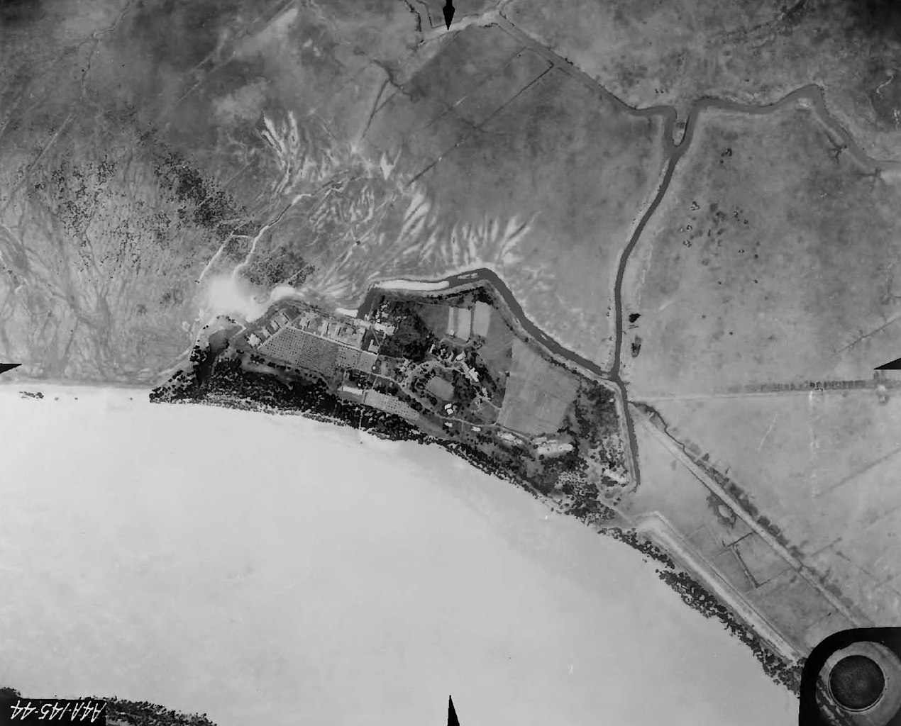
| 解説 | Fort St. Philip, Plaquemines Parish, Louisiana. Air view, 1935, showing condition of the Fort at the time, and the surrounding area, with farmland, bend in the Mississippi River. | |||
| 日付 | ||||
| 原典 | 1935 U.S. Army Corps of Engineers photo, extracted from PDF at [1] | |||
| 作者 |
|
ファイルの履歴
過去の版のファイルを表示するには、その版の日時をクリックしてください。
| 日付と時刻 | サムネイル | 寸法 | 利用者 | コメント | |
|---|---|---|---|---|---|
| 現在の版 | 2021年12月16日 (木) 09:34 | | 1,708 × 1,377 (600キロバイト) | Sebastian Wallroth | Rotated 180° using CropTool with lossless mode. |
| 2009年10月24日 (土) 17:01 |  | 1,708 × 1,377 (576キロバイト) | Infrogmation | {{Information |Description= Fort St. Philip, Plaquemines Parish, Louisiana. Air view, 1935, showing condition of the Fort at the time, and the surrounding area, with farmland, bend in the Mississippi River. |Source= 1935 U.S. Army Corps of Engineers photo |
ファイルの使用状況
以下のページがこのファイルを使用しています:
グローバルなファイル使用状況
以下に挙げる他のウィキがこの画像を使っています:
- en.wikipedia.org での使用状況
- fr.wikipedia.org での使用状況