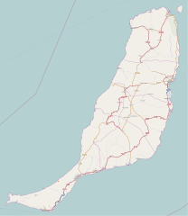
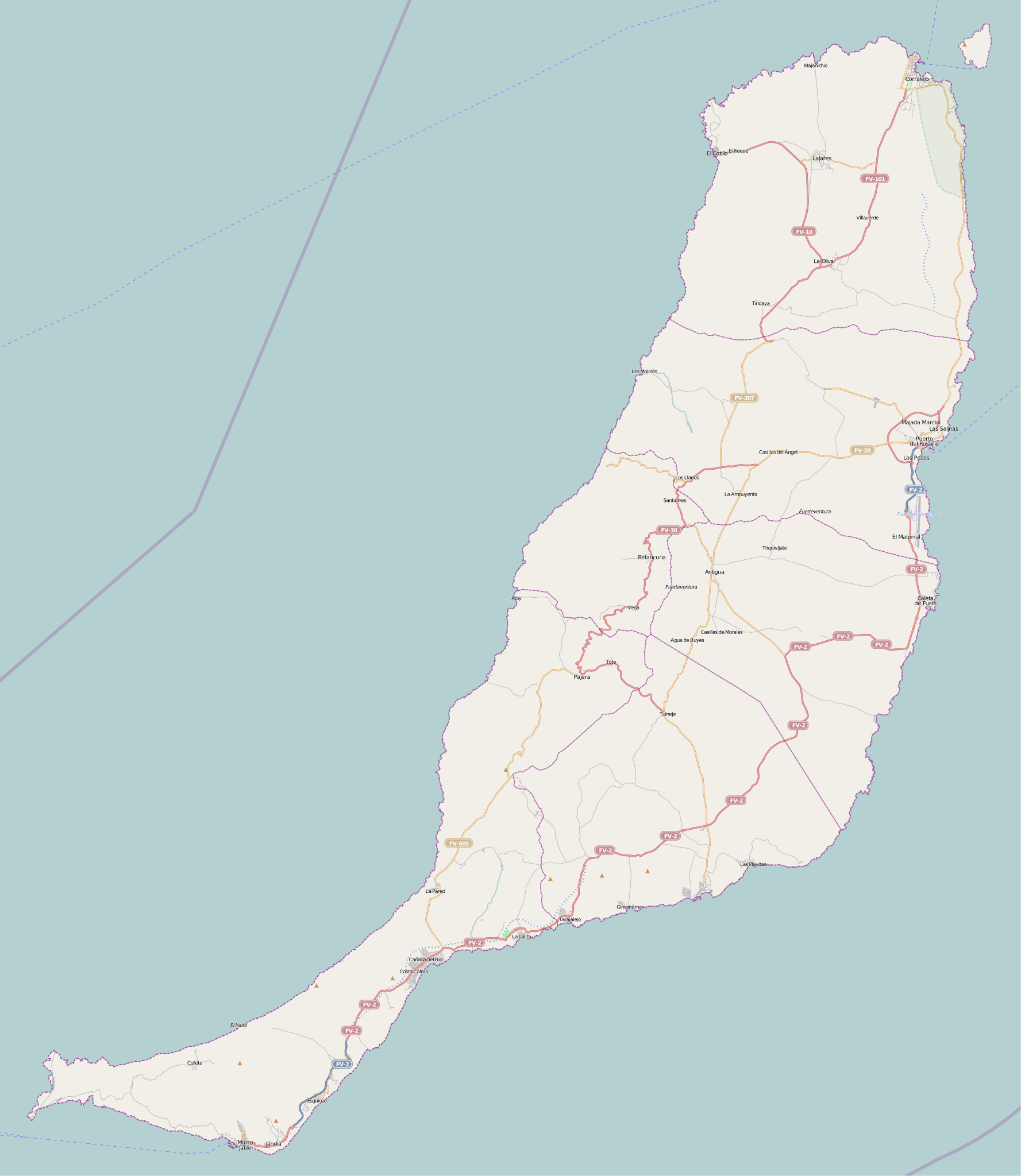
ファイル:Fuerteventura (Canary Islands) - OSM Mapnik.svg

この SVG ファイルのこの PNG プレビューのサイズ: 520 × 599 ピクセル. その他の解像度: 208 × 240 ピクセル | 416 × 480 ピクセル | 666 × 768 ピクセル | 889 × 1,024 ピクセル | 1,777 × 2,048 ピクセル | 2,298 × 2,648 ピクセル。
元のファイル (SVG ファイル、2,298 × 2,648 ピクセル、ファイルサイズ: 2.01メガバイト)
ウィキメディア・コモンズのファイルページにある説明を、以下に表示します。
|
_-_OSM_Mapnik.svg?uselang=ja)
_-_OSM_Mapnik.svg?uselang=ja)
_-_OSM_Mapnik.svg?uselang=ja&action=history)
_-_OSM_Mapnik.svg)
| 記述 |
この地図は、オープン・ストリート・マップ・プロジェクトのコミュニティが集めたデータを元に作成されました。この地図は未完成であり、誤りを含んでいる可能性があります。この地図のみを頼りに移動・案内・計画立案等を行うことはおやめください。 |
| 日付 | ファイルの履歴を見て下さい。 |
| 原典 | openstreetmap.org |
| 作者 |
OpenStreetMapへの協力者 |
| 許可 (ファイルの再利用) |
オープンストリートマップのデータと地図は、クリエイティブ・コモンズ表示 - 継承 2.0 (CC-BY-SA 2.0) によりライセンスされています。 このファイルはクリエイティブ・コモンズ 表示-継承 2.0 一般ライセンスのもとに利用を許諾されています。
|
| Georeferencing | If inappropriate please set warp_status = skip to hide. |
ファイルの履歴
過去の版のファイルを表示するには、その版の日時をクリックしてください。
| 日付と時刻 | サムネイル | 寸法 | 利用者 | コメント | |
|---|---|---|---|---|---|
| 現在の版 | 2010年11月25日 (木) 13:49 | | 2,298 × 2,648 (2.01メガバイト) | Muro de Aguas | updating |
| 2010年7月2日 (金) 14:25 |  | 2,298 × 2,648 (1.9メガバイト) | Muro de Aguas | updating | |
| 2010年4月16日 (金) 17:10 |  | 2,298 × 2,648 (1.89メガバイト) | Muro de Aguas | updating | |
| 2010年2月27日 (土) 17:18 |  | 2,298 × 2,648 (1.89メガバイト) | Muro de Aguas | {{OpenStreetMap|name=Fuerteventura|source=http://www.openstreetmap.org/?lat=28.4165&lon=-14.1515&zoom=10&layers=B000FTFTT}} Category:OpenStreetMap maps of the Canary Islands Category:Maps of Fuerteventura Category:Maps of the Canary Islands |
ファイルの使用状況
以下のページがこのファイルを使用しています:
グローバルなファイル使用状況
以下に挙げる他のウィキがこの画像を使っています:
- ar.wikipedia.org での使用状況
- ast.wikipedia.org での使用状況
- en.wikipedia.org での使用状況
- Puerto del Rosario
- Fuerteventura Airport
- Tostón Lighthouse
- Punta La Entallada Lighthouse
- Morro Jable Lighthouse
- Punta Jandía Lighthouse
- Punta Martiño Lighthouse
- Module:Location map/data/Spain Fuerteventura
- Module:Location map/data/Spain Fuerteventura/doc
- Puerto del Rosario Lighthouse
- Template:Lighthouses of the Canary Islands map
- es.wikipedia.org での使用状況
- Playa del Matorral
- Faro de Morro Jable
- Faro de Punta La Entallada
- Hornos de cal de la Guirra
- Montaña de Tindaya
- Ajuy
- Playa de la Goleta (Corralejo)
- Cofete
- Castillo de El Cotillo
- El Cotillo
- Faro del Puerto del Rosario
- Faro de Punta Jandía
- Faro Tostón
- Faro de Punta Martiño
- Castillo de Fuste
- Lajares (La Oliva)
- Plantilla:Mapa de localización de Fuerteventura
- Casillas del Ángel
- Tetir
- El Matorral (Fuerteventura)
- Tarajalejo
- fr.wikipedia.org での使用状況
- Tuineje
- Pájara
- La Oliva
- Antigua (Fuerteventura)
- Puerto del Rosario
- Betancuria
- Corralejo
- Caleta de Fuste
- Morro Jable
- Péninsule de Jandía
- Modèle:Géolocalisation/Fuerteventura
- Wikipédia:Atelier graphique/Cartes/Archives/juin 2015
- Wikipédia:Atelier modèle de géolocalisation/Archives/2015
- Parc naturel de Corralejo
このファイルのグローバル使用状況を表示する。
_-_OSM_Mapnik.svg)
_-_OSM_Mapnik.svg)