ファイル:Overview of West Lancaster.jpg

このプレビューのサイズ: 800 × 596 ピクセル。 その他の解像度: 320 × 239 ピクセル | 640 × 477 ピクセル | 1,024 × 763 ピクセル | 1,280 × 954 ピクセル | 2,576 × 1,920 ピクセル。
元のファイル (2,576 × 1,920 ピクセル、ファイルサイズ: 2.02メガバイト、MIME タイプ: image/jpeg)
ウィキメディア・コモンズのファイルページにある説明を、以下に表示します。
|
| 解説 |
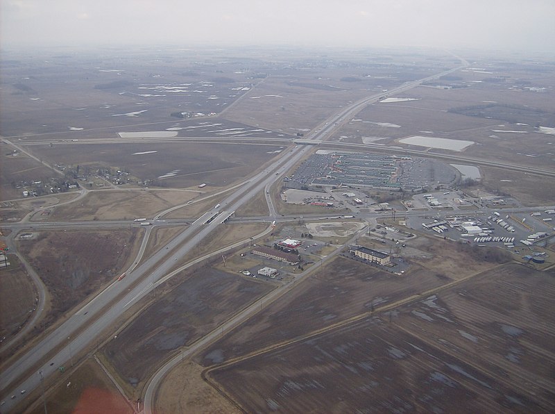
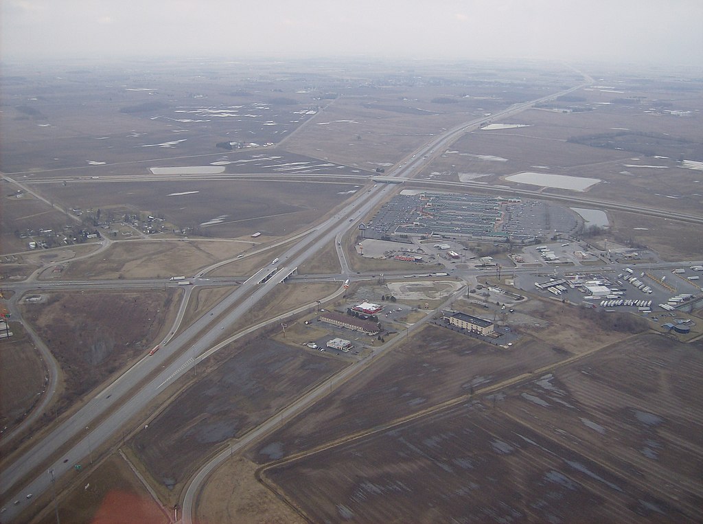
English: Aerial view of West Lancaster, a community in southern Jefferson Township, Fayette County, Ohio, United States. The village of Octa lies primarily just off the bottom edge of the picture, although its village limits extend along the road that appears from the picture's bottom edge. Picture taken from a Diamond Eclipse light airplane at an altitude of 2,500 feet MSL at an bearing of approximately 5º. The interchange is Interstate 71 over State Route 435, and the divided highway's overpass in the background is U.S. Route 35 passing over the interstate. |
||
| 日付 | 撮影日:2008年3月6日 | ||
| 原典 | 投稿者自身による著作物 | ||
| 作者 | Nyttend | ||
| 許可 (ファイルの再利用) |
|
| 注釈 | この画像には注釈がついています: コモンズで注釈を見る |
ファイルの履歴
過去の版のファイルを表示するには、その版の日時をクリックしてください。
| 日付と時刻 | サムネイル | 寸法 | 利用者 | コメント | |
|---|---|---|---|---|---|
| 現在の版 | 2008年5月26日 (月) 03:42 | | 2,576 × 1,920 (2.02メガバイト) | Nyttend | {{Information |Description=Aerial view of {{w|West Lancaster, Ohio|West Lancaster}}, a community in southern {{w|Jefferson Township, Fayette County, Ohio|Jefferson Township}}, {{w|Fayette County, Ohio|Fayette County}}, {{w|Ohio}}, {{w|United States}}. Pi |
ファイルの使用状況
以下のページがこのファイルを使用しています:
グローバルなファイル使用状況
以下に挙げる他のウィキがこの画像を使っています:
- ar.wikipedia.org での使用状況
- arz.wikipedia.org での使用状況
- ca.wikipedia.org での使用状況
- en.wikipedia.org での使用状況
- es.wikipedia.org での使用状況
- eu.wikipedia.org での使用状況
- fr.wikipedia.org での使用状況
- ht.wikipedia.org での使用状況
- it.wikipedia.org での使用状況
- lld.wikipedia.org での使用状況
- pl.wikipedia.org での使用状況
- pt.wikipedia.org での使用状況
- sh.wikipedia.org での使用状況
- sr.wikipedia.org での使用状況
- uk.wikipedia.org での使用状況
- vi.wikipedia.org での使用状況
- www.wikidata.org での使用状況
- zh-min-nan.wikipedia.org での使用状況
- zh.wikipedia.org での使用状況