ファイル:Rottnest Island.jpg
このプレビューのサイズ: 800 × 399 ピクセル。 その他の解像度: 320 × 159 ピクセル | 857 × 427 ピクセル。
元のファイル (857 × 427 ピクセル、ファイルサイズ: 47キロバイト、MIME タイプ: image/jpeg)
ウィキメディア・コモンズのファイルページにある説明を、以下に表示します。
|
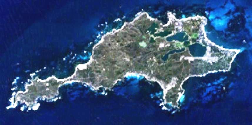
| 解説 | This is a map of the Rottnest Island, Western Australia. | |||
| 原典 | It was made by the uploader using NASA World Wind using Landsat 7 data. | |||
| 作者 | Created by the uploader. Any IP involved in the creation of this image is released into the public domain. | |||
| 許可 (ファイルの再利用) |
|

ファイルの履歴
過去の版のファイルを表示するには、その版の日時をクリックしてください。
| 日付と時刻 | サムネイル | 寸法 | 利用者 | コメント | |
|---|---|---|---|---|---|
| 現在の版 | 2008年6月23日 (月) 23:28 | | 857 × 427 (47キロバイト) | Hesperian | Reverted to version as of 01:37, 1 May 2007 |
| 2007年5月1日 (火) 01:37 |  | 857 × 427 (47キロバイト) | Moondyne | {{Information |Description=This is a map of the Rottnest Island, Western Australia, made with World Wind using Landsat 7 data. (Adjusted for contrast) |Source= |Date= |Author=Created by the uploader. Any IP involved in the creation of this image is relea | |
| 2006年11月16日 (木) 03:16 |  | 857 × 427 (38キロバイト) | Hesperian | {{Information |Description=This is a map of the Rottnest Island, Western Australia, made with World Wind using Landsat 7 data. |Source= |Date= |Author=Created by the uploader. Any IP involved in the creation of this image is released into the public domai |
ファイルの使用状況
以下のページがこのファイルを使用しています:
グローバルなファイル使用状況
以下に挙げる他のウィキがこの画像を使っています:
- cs.wikipedia.org での使用状況
- en.wikipedia.org での使用状況
- fa.wikipedia.org での使用状況
- fi.wikipedia.org での使用状況
- fr.wikipedia.org での使用状況
- gl.wikipedia.org での使用状況
- he.wikipedia.org での使用状況
- id.wikipedia.org での使用状況
- ru.wikipedia.org での使用状況
- ur.wikipedia.org での使用状況
- www.wikidata.org での使用状況
- zh-yue.wikipedia.org での使用状況
- zh.wikipedia.org での使用状況