ファイル:Saola 2005-09-23 0110Z.jpg
このプレビューのサイズ: 480 × 600 ピクセル。 その他の解像度: 192 × 240 ピクセル | 384 × 480 ピクセル | 614 × 768 ピクセル | 819 × 1,024 ピクセル | 1,638 × 2,048 ピクセル | 6,400 × 8,000 ピクセル。
元のファイル (6,400 × 8,000 ピクセル、ファイルサイズ: 7.77メガバイト、MIME タイプ: image/jpeg)
ウィキメディア・コモンズのファイルページにある説明を、以下に表示します。
|
概要
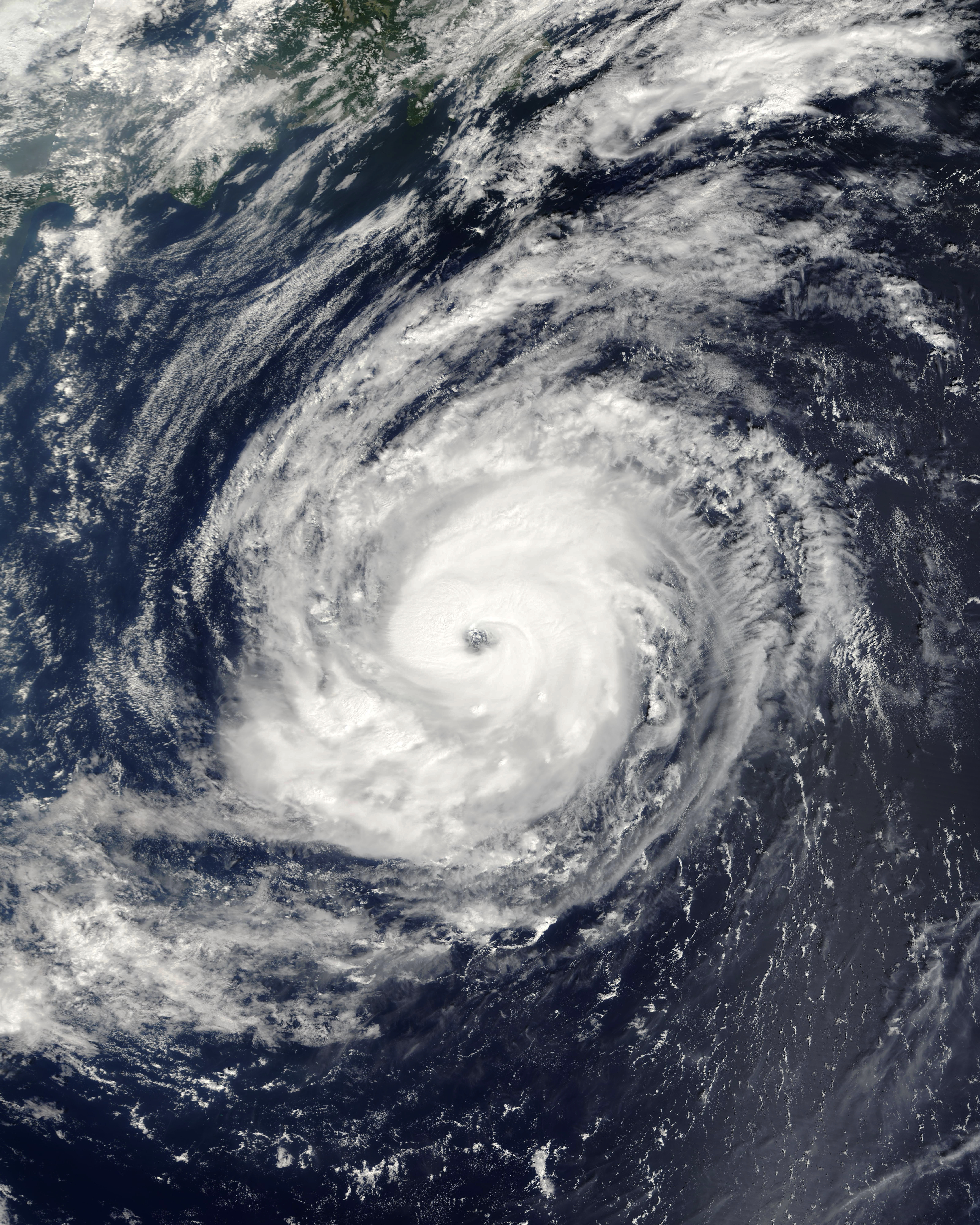
| 解説 | Typhoon Saola formed north of the Marianas Islands on September 20, 2005. It gradually built up power and became a well-organized typhoon with a strong spiral pattern and distinct central eye over the next two days. By the time the Moderate Resolution Imaging Spectroradiometer (MODIS) on NASA’s Terra satellite captured this image of Typhoon Saola at 10:10 a.m. local time on September 23, the storm had sustained wind speeds of 165 kilometers per hour (105 miles per hour). It was located 800 kilometers from Tokyo at the time of the MODIS pass. | |||||
| 日付 | ||||||
| 原典 | http://earthobservatory.nasa.gov/NaturalHazards/natural_hazards_v2.php3?img_id=13156 | |||||
| 作者 | NASA image created by Jesse Allen, Earth Observatory, using data obtained courtesy of the MODIS Rapid Response team. | |||||
| 許可 (ファイルの再利用) |
|

ファイルの履歴
過去の版のファイルを表示するには、その版の日時をクリックしてください。
| 日付と時刻 | サムネイル | 寸法 | 利用者 | コメント | |
|---|---|---|---|---|---|
| 現在の版 | 2020年9月29日 (火) 15:58 | | 6,400 × 8,000 (7.77メガバイト) | FleurDeOdile | correct colors |
| 2006年9月6日 (水) 22:57 |  | 4,800 × 4,800 (3.75メガバイト) | Good kitty | == Summary == {{Information |Description=Typhoon Saola formed north of the Marianas Islands on September 20, 2005. It gradually built up power and became a well-organized typhoon with a strong spiral pattern and distinct central eye over the next two days |
ファイルの使用状況
以下のページがこのファイルを使用しています:
グローバルなファイル使用状況
以下に挙げる他のウィキがこの画像を使っています:
- en.wikipedia.org での使用状況
- es.wikipedia.org での使用状況
- ko.wikipedia.org での使用状況
- pt.wikipedia.org での使用状況
- vi.wikipedia.org での使用状況
- zh.wikipedia.org での使用状況