ファイル:Topographic map of Budapest.png
高解像度版はありません。
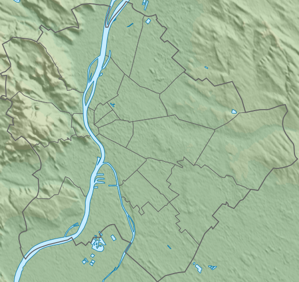
Topographic_map_of_Budapest.png (600 × 566 ピクセル、ファイルサイズ: 420キロバイト、MIME タイプ: image/png)
ウィキメディア・コモンズのファイルページにある説明を、以下に表示します。
|
概要
| 解説 |
English: Topographic map of Budapest, Hungary with detailed borders. |
| 日付 | (UTC) |
| 原典 |
このファイルの派生元: Budapest districts map.svg:
|
| 作者 |
|
ライセンス
この作品の著作権者である私は、この作品を以下のライセンスで提供します。
| この著作物の著作権者である私は、この著作物における権利を放棄しパブリックドメインとします。これは全世界で適用されます。 一部の国では、これが法的に可能ではない場合があります。その場合は、次のように宣言します。 私は、あらゆる人に対して、法により必要とされている条件を除き、如何なる条件も課すことなく、あらゆる目的のためにこの著作物を使用する権利を与えます。 |
元のアップロードログ
This image is a derivative work of the following images:
- File:Budapest_districts_map.svg licensed with PD-self
- 2009-07-27T14:06:04Z Droo 600x566 (31885 Bytes) további pontosítás
- 2009-05-14T09:44:47Z Droo 600x566 (32606 Bytes)
- 2008-10-30T14:41:19Z Droo 512x488 (32628 Bytes) pontosítás
- 2008-06-04T16:14:41Z Droo 512x488 (32835 Bytes) Vector map of Budapest, Hungary with detailed borders [[Category:Maps of Budapest]]
- 2007-11-02T16:30:42Z Droo 512x488 (46191 Bytes) {{Information |Description=Vector map of Budapest, Hungary with detailed borders. |Source=self-made |Date=2007-11-02 |Author= [[User:Droo|Droo]] }} [[Category:Maps of Budapest]]
Uploaded with derivativeFX
ファイルの履歴
過去の版のファイルを表示するには、その版の日時をクリックしてください。
| 日付と時刻 | サムネイル | 寸法 | 利用者 | コメント | |
|---|---|---|---|---|---|
| 現在の版 | 2012年12月24日 (月) 23:45 | | 600 × 566 (420キロバイト) | Piroska | A bit bigger new image. |
| 2012年12月18日 (火) 23:41 |  | 599 × 565 (418キロバイト) | Piroska | == {{int:filedesc}} == {{Information |Description={{en|1=Topographic map of Budapest, Hungary with detailed borders.}} |Source={{Derived from|Budapest_districts_map.svg|display=50}} *Data sources: **Topography: [http://www2.jpl.nasa.gov/srtm NASA Shutt... |
ファイルの使用状況
以下の 6 ページがこのファイルを使用しています:
グローバルなファイル使用状況
以下に挙げる他のウィキがこの画像を使っています:
- en.wikipedia.org での使用状況
- eo.wikipedia.org での使用状況
- Scienca Universitato Loránd Eötvös
- Hungara Scienca Akademio
- Universitato Corvinus de Budapeŝto
- Placo de Herooj
- Hungara Nacia Galerio
- Insulo Margareta
- Telefonia Muzeo
- Belarta Muzeo (Budapeŝto)
- Muzeo pri Teksaĵ- kaj Vestaĵindustrio en Budapeŝto
- Hungara Nacia Muzeo
- Festivalo Sziget
- Placo Kossuth Lajos
- Aquincum
- Kastelo Vajdahunyad
- Monto Vár
- Parko Memento
- Tutlanda Biblioteko Széchényi
- Palaco de Artoj
- Placo Lujza Blaha
- Bestoĝardeno kaj Botanika ĝardeno (Budapeŝto)
- Placo Kálvin
- Placo Széchenyi (Budapeŝto)
- Hungara Televido
- Ŝablono:Situo sur mapo Hungario Budapeŝto
- Ŝablono:Situo sur mapo Hungario Budapeŝto/dokumentado
- Avenuo Andrássy
- Placo Mari Jászai
- Literatura Muzeo Petőfi
- Orientazia Arta Muzeo (Budapeŝto)
- Domo de Paciĝo
- Hungara Muzeo pri Metia Arto
- Internacia Federacio de Ĵudo
- Universitato Semmelweis
- Teknika kaj Ekonomia Universitato de Budapeŝto
- Katolika Universitato Péter Pázmány
- Universitato Andrássy
- Palaco Festetics
- Palaco Sándor (Budapeŝto)
- Arthalo Budapeŝto
- Palaco Károlyi
- Reĝa Palaco (Budapeŝto)
- Palaco Vigadó
- Palaco Gresham
- Palaco Wenckheim
このファイルのグローバル使用状況を表示する。