ファイル:US Navy 030411-N-0000X-001 A detailed multibeam image for the survey of USS Susan B. Anthony (AP-72).jpg

このプレビューのサイズ: 800 × 598 ピクセル。 その他の解像度: 320 × 239 ピクセル | 640 × 478 ピクセル | 1,024 × 765 ピクセル | 1,280 × 956 ピクセル | 2,104 × 1,572 ピクセル。
元のファイル (2,104 × 1,572 ピクセル、ファイルサイズ: 2.21メガバイト、MIME タイプ: image/jpeg)
ウィキメディア・コモンズのファイルページにある説明を、以下に表示します。
|
概要
| 解説 |
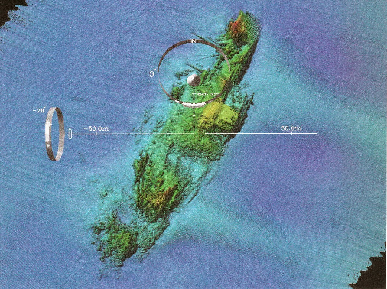
English: Naval Historical Center archeologists have just completed a three-year (2000-200) archeological remote-sensing survey of U.S. Navy shipwreck lost off France’s coastline during the World War II Normandy invasion. The survey focused on locating Navy losses and the temporary harbors used in Neptune, the naval portion of Operation Overlord, codename for the Allied invasion of Europe, (D-Day), June 6, 1944. Cooperative effort between the Naval Historical Center, RESON (an off shore technology company), FUGRO (a company that makes navigation products), and the Center for Coastal and Ocean Mapping and Joint Hydrographic Center (CCOM) produced very detailed multibeam images for the survey such as this overview of the USS Susan B. Anthony (AP-72). The Susan B. Anthony, a troop transport, struck a sea-mine and san on June 7, 1944. The booms and damage to the number one hole (at the bow) are easy to see in this image. U. S. Navy photo. |
|||
| 日付 | 撮影日:2003年4月11日 | |||
| 原典 |
|
|||
| 作者 | U.S. Navy photo |

.jpg?uselang=ja)
.jpg?uselang=ja)
.jpg?uselang=ja&action=history)
.jpg)
ライセンス
 | ||
| このファイルは著作権法の既知の制約(隣接権や関連する権利を含む)から自由であると特定されています。 | ||
ファイルの履歴
過去の版のファイルを表示するには、その版の日時をクリックしてください。
| 日付と時刻 | サムネイル | 寸法 | 利用者 | コメント | |
|---|---|---|---|---|---|
| 現在の版 | 2009年10月22日 (木) 07:42 | | 2,104 × 1,572 (2.21メガバイト) | BotMultichillT | == {{int:filedesc}} == {{Information |description={{en|1=Washington, D.C. (Apr. 11, 2003) -- Naval Historical Center archeologists have just completed a three-year (2000-200) archeological remote-sensing survey of U.S. Navy shipwreck lost off France&rsquo |
ファイルの使用状況
以下のページがこのファイルを使用しています:
グローバルなファイル使用状況
以下に挙げる他のウィキがこの画像を使っています:
- en.wikipedia.org での使用状況
- es.wikipedia.org での使用状況
- et.wikipedia.org での使用状況
- zh.wikipedia.org での使用状況
.jpg)