モジュール:Location map/data/Queensland
| 名称 | クイーンズランド州 | |||
|---|---|---|---|---|
| 境界の経緯 | ||||
| -9 | ||||
| 137.5 | ←↕→ | 154 | ||
| -29.5 | ||||
| 地図の中心 | 南緯19度15分 東経145度45分 / 南緯19.25度 東経145.75度 | |||
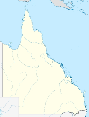
| 画像 | Australia Queensland location map.svg
| |||

| ||||
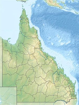
| 画像1 | Australia Queensland relief location map.jpg
| |||

| ||||
| 画像2 | Australia Queensland location map blank.svg
| |||

| ||||

モジュール:Location map/data/Queenslandはクイーンズランド州の正距円筒図法地図でオーバーレイのマーカー・ラベルを表示するのに使用する地点図のLuaモジュールです。マーカーは既定値の地図や同じような地図画像において緯度と経度の座標に基いて置かれます。
使用法
次のテンプレートで"Queensland"というパラメータを使用します:
{{Location map | Queensland | ...}}{{Location map many | Queensland | ...}}{{Location map+ | Queensland | ...}}{{Location map~ | Queensland | ...}}
地図パラメータ
name = クイーンズランド州- モジュール名は地図説明文の既定値になります
image = Australia Queensland location map.svg- 既定値の地図画像で"Image:"や"File:"は指定しません。
image1 = Australia Queensland relief location map.jpg- 代替地図画像で、通常は地形図をreliefかAlternativeMapというパラメータで指定して表示します。
image2 = Australia Queensland location map blank.svg- 2番目の代替地図画像でAlternativeMapというパラメータでしか表示できません。
top = -9
bottom = -29.5- 地図最南端の緯度を十進角で表記します。
left = 137.5- 地図最西端の経度を十進角で表記します。
right = 154- 地図最東端の経度を十進角で表記します。
代替地図
image1 (Australia Queensland relief location map.jpg)で定義された地図は{{Location map}}、{{Location map many}}、{{Location map+}}といったテンプレートの「relief」か「AlternativeMap」のパラメータを使って表示できます。
image2 (Australia Queensland location map blank.svg)で定義された地図は「AlternativeMap」というパラメータのみでしか表示できません。これら2つのパラメータは以下の使用例で示しています。さらなる使用例は次のテンプレートにあります。:
精度
経度: この地図は西から東まで16.5度です。
- 画像の幅が200ピクセルの場合は1ピクセルにつき0.0825度です。
- 画像の幅が1000ピクセルの場合は1ピクセルにつき0.0165度です。
緯度: この地図は北から南まで20.5度です。
- 画像の縦の長さが200ピクセルの場合は1ピクセルにつき0.1025度です。
- 画像の縦の長さが1000ピクセルの場合は1ピクセルにつき0.0205度です。== Location mapテンプレート使用例 ==
Location map, using default map (image)
{{Location map | Australia Queensland
| width = 200
| label = Brisbane
| lat_deg = 27  | lat_min = 28 | lat_sec = 04 | lat_dir = S
| lon_deg = 153 | lon_min = 01 | lon_sec = 40 | lon_dir = E
}}
Location map many, using relief map (image1)
{{Location map many | Australia Queensland
| relief   = yes
| width    = 200
| caption  = Locations in Queensland
| lat1 = -10.60 | long1 = 142.28 | label1 = Horn Island
| lat2 = -28.55 | long2 = 150.32 | label2 = Goondiwindi
| lat3 = -19.92 | long3 = 138.12 | label3 = Camooweal
| lat4 = -25.28 | long4 = 152.87 | label4 = Hervey Bay
}}
Location map+, using AlternativeMap
{{Location map+ | Australia Queensland
| AlternativeMap=Australia Queensland location map blank.svg
| width   = 200
| caption = Locations in Queensland
| places  =
  {{Location map~ | Australia Queensland
  | lat = -10.60 | long = 142.28 | label = Horn Island
  }}
  {{Location map~ | Australia Queensland
  | lat = -28.55 | long = 150.32 | label = Goondiwindi
  }}
  {{Location map~ | Australia Queensland
  | lat = -19.92 | long = 138.12 | label = Camooweal
  }}
  {{Location map~ | Australia Queensland
  | lat = -25.28 | long = 152.87 | label = Hervey Bay
  }}
}}
関連項目
Location mapテンプレート
- Template:Location map - 緯度と経度を使って1つのマークとラベルを表示します。
- Template:Location map many - 9つまでのマークとラベルを表示します。
- Template:Location map+ - 無制限にマークとラベルを表示できます。


