ファイル:Accreting coast Image6.svg

この SVG ファイルのこの PNG プレビューのサイズ: 800 × 377 ピクセル. その他の解像度: 320 × 151 ピクセル | 640 × 301 ピクセル | 1,024 × 482 ピクセル | 1,280 × 602 ピクセル | 2,560 × 1,205 ピクセル | 1,481 × 697 ピクセル。
元のファイル (SVG ファイル、1,481 × 697 ピクセル、ファイルサイズ: 15キロバイト)
ウィキメディア・コモンズのファイルページにある説明を、以下に表示します。
|
概要
| 解説 |
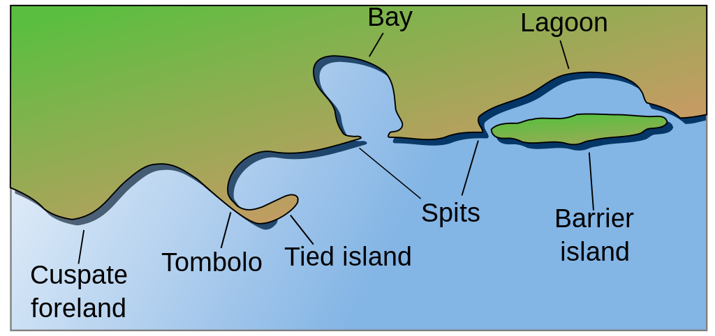
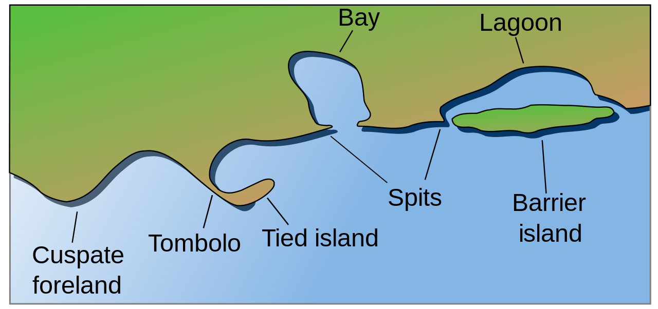
English: Coastal and oceanic landforms. Cuspate foreland, tombolo, spit, bay, lagoon, barrier island. |
| 日付 | |
| 原典 | self-made SVG, based on the public domain PNG Accreting coast Image6.png by Feydey |
| 作者 | Surachit |
| その他のバージョン |
このファイルの派生的著作物: Accreting coast Image6-ta.svg
|
| SVG 開発 |


ライセンス
| この著作物は、著作者であるFeydeyによって権利が放棄され、パブリックドメインとされました。これは全世界で適用されます。 一部の国では、これが法的に可能ではない場合があります。その場合は、次のように宣言します。 |
ファイルの履歴
過去の版のファイルを表示するには、その版の日時をクリックしてください。
| 日付と時刻 | サムネイル | 寸法 | 利用者 | コメント | |
|---|---|---|---|---|---|
| 現在の版 | 2022年5月16日 (月) 04:17 | | 1,481 × 697 (15キロバイト) | Bacon Noodles | Fixed background (water) alignment |
| 2018年2月12日 (月) 01:49 |  | 1,481 × 697 (15キロバイト) | Howpper | Added tied island. A Tombolo is what connects a Tied island to the mainland, so it would be exclusive to not include both features. | |
| 2007年8月16日 (木) 21:48 |  | 1,481 × 697 (13キロバイト) | Surachit | {{Information |Description=Coastal and oceanic landforms. Cuspate foreland, tombolo, spit, bay, lagoon, barrier island. |Source=self-made SVG, based on the public domain PNG [http://en.wikipedia.org/wiki/Image:Accreting_coast_Image6.png] by [http://en.wik |
ファイルの使用状況
グローバルなファイル使用状況
以下に挙げる他のウィキがこの画像を使っています:
- ar.wikipedia.org での使用状況
- az.wikipedia.org での使用状況
- bh.wikipedia.org での使用状況
- chr.wikipedia.org での使用状況
- cs.wikipedia.org での使用状況
- en.wikipedia.org での使用状況
- Archipelago
- Coast
- Dune
- Island
- Islands of the Clyde
- List of peninsulas
- Beach
- Fjord
- Atoll
- Strait
- Boulder
- Estuary
- Natural arch
- Lagoon
- Coral reef
- Firth
- Isthmus
- Argyll and Bute
- Firth of Clyde
- Gulf of California
- Coastal erosion
- Talk:Beach
- River delta
- Cliff
- Reef
- Islet
- Salt marsh
- Tombolo
- Stack (geology)
- Cove
- Shoal
- Spit (landform)
- Longshore drift
- Ria
- Barrier island
- Emergent coastline
- Submergent coastline
- Groyne
- Rip current
このファイルのグローバル使用状況を表示する。