並べて比較
{{Infobox Australian Place}}{{Infobox Australian Place/sandbox}}
Nelson Bay
ニューサウスウェールズ州
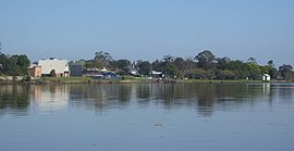
Looking north-east across d'Albora Marina
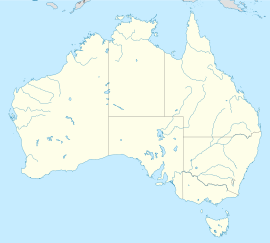
Nelson Bayの位置(ニューサウスウェールズ州内)
Nelson Bay
Nelson Bay
座標南緯32度42分54秒 東経152度9分4秒 / 南緯32.71500度 東経152.15111度 / -32.71500; 152.15111座標: 南緯32度42分54秒 東経152度9分4秒 / 南緯32.71500度 東経152.15111度 / -32.71500; 152.15111
人口5,396 (2011年国勢調査)[1]
 • 人口密度345.9/km2 (896/sq mi) [Note 1]
郵便番号2315
面積15.6 km2 (6.0 sq mi)[Note 2]
標準時AEST (UTC+10)
 • 夏時間 (DST)AEDT (UTC+11)
位置
  • SydneyよりNNE207km (129mi)
  • NewcastleよりNE60km (37mi)
  • Raymond TerraceよりENE45km (28mi)
地域自治体Port Stephens Council
地域Hunter
行政区画Gloucester[2]
教区Tomaree[2]
州選挙区Port Stephens
代議院選出地区Paterson
最高気温[3] 最低気温[3] 降雨量[3]
27.3 °C
81 °F
8.4 °C
47 °F
1,348.9mm
53.1 in
Nelson Bay周辺のサバーブ:
Port Stephens Port Stephens Port Stephens
Corlette, Salamander Bay Nelson Bay Shoal Bay, Fingal Bay
Anna Bay, One Mile One Mile, Fingal Bay Fingal Bay
Nelson Bay
ニューサウスウェールズ州
Looking north-east across d'Albora Marina
Nelson Bayの位置(ニューサウスウェールズ州内)
Nelson Bay
Nelson Bay
座標 南緯32度42分54秒 東経152度9分4秒 / 南緯32.71500度 東経152.15111度 / -32.71500; 152.15111座標: 南緯32度42分54秒 東経152度9分4秒 / 南緯32.71500度 東経152.15111度 / -32.71500; 152.15111
人口 5,396 (2011年国勢調査)[1]
 • 人口密度 345.9/km2 (896/sq mi) [Note 1]
郵便番号 2315
面積 15.6 km2 (6.0 sq mi)[Note 2]
標準時 AEST (UTC+10)
 • 夏時間 (DST) AEDT (UTC+11)
位置
  • SydneyよりNNE207km (129mi)
  • NewcastleよりNE60km (37mi)
  • Raymond TerraceよりENE45km (28mi)
地域自治体 Port Stephens Council
地域 Hunter
行政区画 Gloucester[2]
教区 Tomaree[2]
州選挙区 Port Stephens
代議院選出地区 Paterson
最高気温[3] 最低気温[3] 降雨量[3]
27.3 °C
81 °F
8.4 °C
47 °F
1,348.9 mm
53.1 in
Nelson Bay周辺の地域:
Port Stephens Port Stephens Port Stephens
Corlette, Salamander Bay Nelson Bay Shoal Bay, Fingal Bay
Anna Bay, One Mile One Mile, Fingal Bay Fingal Bay
並べて比較
{{Infobox Australian Place}}{{Infobox Australian Place/sandbox}}
Raymond Terrace
ニューサウスウェールズ州
Raymond Terrace foreshore from the Fitzgerald bridge
Raymond Terraceの位置(ニューサウスウェールズ州内)
Raymond Terrace
Raymond Terrace
座標南緯32度45分41.3秒 東経151度44分38.6秒 / 南緯32.761472度 東経151.744056度 / -32.761472; 151.744056座標: 南緯32度45分41.3秒 東経151度44分38.6秒 / 南緯32.761472度 東経151.744056度 / -32.761472; 151.744056
人口12,725 (2011)[4][Note 3]
 • 人口密度515.2/km2 (1,334/sq mi) [Note 4]
創立1837
郵便番号2324
海抜6 m (20 ft)[Note 5]
面積39.7 km2 (15.3 sq mi)[Note 6]
標準時AEST (UTC+10)
 • 夏時間 (DST)AEDT (UTC+11)
位置
地域自治体Port Stephens Council[6]
地域Hunter, Mid North Coast
行政区画Gloucester[5]
教区Eldon[5]
州選挙区
代議院選出地区
Raymond Terrace周辺のローカリティ:
Seaham, Nelsons Plains Eagleton Ferodale
Nelsons Plains, Millers Forest Raymond Terrace Ferodale, Campvale, Williamtown
Millers Forest Heatherbrae, Tomago Williamtown
Raymond Terrace
ニューサウスウェールズ州
Raymond Terrace foreshore from the Fitzgerald bridge
Raymond Terraceの位置(ニューサウスウェールズ州内)
Raymond Terrace
Raymond Terrace
座標 南緯32度45分41.3秒 東経151度44分38.6秒 / 南緯32.761472度 東経151.744056度 / -32.761472; 151.744056座標: 南緯32度45分41.3秒 東経151度44分38.6秒 / 南緯32.761472度 東経151.744056度 / -32.761472; 151.744056
人口 12,725 (2011)[4][Note 3]
 • 人口密度 515.2/km2 (1,334/sq mi) [Note 4]
創立 1837
郵便番号 2324
海抜 6 m (20 ft)[Note 5]
面積 39.7 km2 (15.3 sq mi)[Note 6]
標準時 AEST (UTC+10)
 • 夏時間 (DST) AEDT (UTC+11)
位置
地域自治体 Port Stephens Council[6]
地域 Hunter, Mid North Coast
行政区画 Gloucester[5]
教区 Eldon[5]
州選挙区
代議院選出地区
Raymond Terrace周辺のローカリティ:
Seaham, Nelsons Plains Eagleton Ferodale
Nelsons Plains, Millers Forest Raymond Terrace Ferodale, Campvale, Williamtown
Millers Forest Heatherbrae, Tomago Williamtown
並べて比較
{{Infobox Australian Place}}{{Infobox Australian Place/sandbox}}
National map
ニューサウスウェールズ州
National mapの位置(オーストラリア内)
National map
National map
座標南緯33度51分35.9秒 東経151度12分40秒 / 南緯33.859972度 東経151.21111度 / -33.859972; 151.21111座標: 南緯33度51分35.9秒 東経151度12分40秒 / 南緯33.859972度 東経151.21111度 / -33.859972; 151.21111
National map
ニューサウスウェールズ州
National mapの位置(オーストラリア内)
National map
National map
座標 南緯33度51分35.9秒 東経151度12分40秒 / 南緯33.859972度 東経151.21111度 / -33.859972; 151.21111座標: 南緯33度51分35.9秒 東経151度12分40秒 / 南緯33.859972度 東経151.21111度 / -33.859972; 151.21111
並べて比較
{{Infobox Australian Place}}{{Infobox Australian Place/sandbox}}
Cairns
クイーンズランド州
Cairnsの位置(クイーンズランド州内)
Cairns
Cairns
座標南緯16度55分32秒 東経145度46分31秒 / 南緯16.92556度 東経145.77528度 / -16.92556; 145.77528座標: 南緯16度55分32秒 東経145度46分31秒 / 南緯16.92556度 東経145.77528度 / -16.92556; 145.77528
Cairns
クイーンズランド州
Cairnsの位置(クイーンズランド州内)
Cairns
Cairns
座標 南緯16度55分32秒 東経145度46分31秒 / 南緯16.92556度 東経145.77528度 / -16.92556; 145.77528座標: 南緯16度55分32秒 東経145度46分31秒 / 南緯16.92556度 東経145.77528度 / -16.92556; 145.77528
並べて比較
{{Infobox Australian Place}}{{Infobox Australian Place/sandbox}}
Canberra
オーストラリア首都特別地域
Canberraの位置(オーストラリア首都特別地域内)
Canberra
Canberra
座標南緯35度18分27秒 東経149度07分27.9秒 / 南緯35.30750度 東経149.124417度 / -35.30750; 149.124417座標: 南緯35度18分27秒 東経149度07分27.9秒 / 南緯35.30750度 東経149.124417度 / -35.30750; 149.124417
Canberra
オーストラリア首都特別地域
Canberraの位置(オーストラリア首都特別地域内)
Canberra
Canberra
座標 南緯35度18分27秒 東経149度07分27.9秒 / 南緯35.30750度 東経149.124417度 / -35.30750; 149.124417座標: 南緯35度18分27秒 東経149度07分27.9秒 / 南緯35.30750度 東経149.124417度 / -35.30750; 149.124417
並べて比較
{{Infobox Australian Place}}{{Infobox Australian Place/sandbox}}
Wodonga
ビクトリア州
Wodongaの位置(ビクトリア州内)
Wodonga
Wodonga
Location in Victoria
座標南緯36度07分17秒 東経146度53分17秒 / 南緯36.12139度 東経146.88806度 / -36.12139; 146.88806座標: 南緯36度07分17秒 東経146度53分17秒 / 南緯36.12139度 東経146.88806度 / -36.12139; 146.88806
Wodonga
ビクトリア州
Wodongaの位置(ビクトリア州内)
Wodonga
Wodonga
Location in Victoria
座標 南緯36度07分17秒 東経146度53分17秒 / 南緯36.12139度 東経146.88806度 / -36.12139; 146.88806座標: 南緯36度07分17秒 東経146度53分17秒 / 南緯36.12139度 東経146.88806度 / -36.12139; 146.88806
並べて比較
{{Infobox Australian Place}}{{Infobox Australian Place/sandbox}}
Launceston
タスマニア州
Launcestonの位置(タスマニア州内)
Launceston
Launceston
座標南緯41度26分31秒 東経147度8分42秒 / 南緯41.44194度 東経147.14500度 / -41.44194; 147.14500座標: 南緯41度26分31秒 東経147度8分42秒 / 南緯41.44194度 東経147.14500度 / -41.44194; 147.14500
Launceston
タスマニア州
Launcestonの位置(タスマニア州内)
Launceston
Launceston
座標 南緯41度26分31秒 東経147度8分42秒 / 南緯41.44194度 東経147.14500度 / -41.44194; 147.14500座標: 南緯41度26分31秒 東経147度8分42秒 / 南緯41.44194度 東経147.14500度 / -41.44194; 147.14500
並べて比較
{{Infobox Australian Place}}{{Infobox Australian Place/sandbox}}
Coober Pedy
南オーストラリア州
Coober Pedyの位置(南オーストラリア州内)
Coober Pedy
Coober Pedy
座標南緯29度0分40秒 東経134度45分20秒 / 南緯29.01111度 東経134.75556度 / -29.01111; 134.75556座標: 南緯29度0分40秒 東経134度45分20秒 / 南緯29.01111度 東経134.75556度 / -29.01111; 134.75556
Coober Pedy
南オーストラリア州
Coober Pedyの位置(南オーストラリア州内)
Coober Pedy
Coober Pedy
座標 南緯29度0分40秒 東経134度45分20秒 / 南緯29.01111度 東経134.75556度 / -29.01111; 134.75556座標: 南緯29度0分40秒 東経134度45分20秒 / 南緯29.01111度 東経134.75556度 / -29.01111; 134.75556
並べて比較
{{Infobox Australian Place}}{{Infobox Australian Place/sandbox}}
Nyabing
西オーストラリア州
Nyabingの位置(西オーストラリア州内)
Nyabing
Nyabing
座標南緯33度32分31秒 東経118度09分00秒 / 南緯33.542度 東経118.15度 / -33.542; 118.15座標: 南緯33度32分31秒 東経118度09分00秒 / 南緯33.542度 東経118.15度 / -33.542; 118.15
Nyabing
西オーストラリア州
Nyabingの位置(西オーストラリア州内)
Nyabing
Nyabing
座標 南緯33度32分31秒 東経118度09分00秒 / 南緯33.542度 東経118.15度 / -33.542; 118.15座標: 南緯33度32分31秒 東経118度09分00秒 / 南緯33.542度 東経118.15度 / -33.542; 118.15
並べて比較
{{Infobox Australian Place}}{{Infobox Australian Place/sandbox}}
Katherine
ノーザンテリトリー
Katherineの位置(ノーザンテリトリー内)
Katherine
Katherine
座標南緯14度28分0秒 東経132度16分0秒 / 南緯14.46667度 東経132.26667度 / -14.46667; 132.26667座標: 南緯14度28分0秒 東経132度16分0秒 / 南緯14.46667度 東経132.26667度 / -14.46667; 132.26667
Katherine
ノーザンテリトリー
Katherineの位置(ノーザンテリトリー内)
Katherine
Katherine
座標 南緯14度28分0秒 東経132度16分0秒 / 南緯14.46667度 東経132.26667度 / -14.46667; 132.26667座標: 南緯14度28分0秒 東経132度16分0秒 / 南緯14.46667度 東経132.26667度 / -14.46667; 132.26667
並べて比較
{{Infobox Australian Place}}{{Infobox Australian Place/sandbox}}
Jervis Bay Village
ジャービス湾特別地域
Jervis Bay Villageの位置(ジャービス湾特別地域内)
Jervis Bay Village
Jervis Bay Village
座標南緯35度7分30.9秒 東経150度42分28.6秒 / 南緯35.125250度 東経150.707944度 / -35.125250; 150.707944座標: 南緯35度7分30.9秒 東経150度42分28.6秒 / 南緯35.125250度 東経150.707944度 / -35.125250; 150.707944
Jervis Bay Village
ジャービス湾特別地域
Jervis Bay Villageの位置(ジャービス湾特別地域内)
Jervis Bay Village
Jervis Bay Village
座標 南緯35度7分30.9秒 東経150度42分28.6秒 / 南緯35.125250度 東経150.707944度 / -35.125250; 150.707944座標: 南緯35度7分30.9秒 東経150度42分28.6秒 / 南緯35.125250度 東経150.707944度 / -35.125250; 150.707944
並べて比較
{{Infobox Australian Place}}{{Infobox Australian Place/sandbox}}
Kingston
ノーフォーク島
Kingstonの位置(ノーフォーク島内)
Kingston
Kingston
座標南緯29度3分 東経167度58分 / 南緯29.050度 東経167.967度 / -29.050; 167.967座標: 南緯29度3分 東経167度58分 / 南緯29.050度 東経167.967度 / -29.050; 167.967
Kingston
ノーフォーク島
Kingstonの位置(ノーフォーク島内)
Kingston
Kingston
座標 南緯29度3分 東経167度58分 / 南緯29.050度 東経167.967度 / -29.050; 167.967座標: 南緯29度3分 東経167度58分 / 南緯29.050度 東経167.967度 / -29.050; 167.967
並べて比較
{{Infobox Australian Place}}{{Infobox Australian Place/sandbox}}
Woy Woy
ニューサウスウェールズ州
Woy Woyの位置(ニューサウスウェールズ州内)
Woy Woy
Woy Woy
座標南緯33度29分 東経151度19分 / 南緯33.49度 東経151.32度 / -33.49; 151.32座標: 南緯33度29分 東経151度19分 / 南緯33.49度 東経151.32度 / -33.49; 151.32
Woy Woy
ニューサウスウェールズ州
Woy Woyの位置(ニューサウスウェールズ州内)
Woy Woy
Woy Woy
座標 南緯33度29分 東経151度19分 / 南緯33.49度 東経151.32度 / -33.49; 151.32座標: 南緯33度29分 東経151度19分 / 南緯33.49度 東経151.32度 / -33.49; 151.32

Notes 編集

  1. ^ The density figure provided is that for the whole of Nelson Bay. However, the population listed in the ABS data reside in only about 3.9平方キロメートル (1.5 sq mi) (approximately 25%) of the suburb, the remainder being uninhabited for various reasons including that a large portion of the suburb is part of Tomaree National Park. The density in the inhabited area is approximately 1,383.6/km2 (3,584/sq mi).
  2. ^ Area calculations are based on 1:100000 map 9232 NEWCASTLE.
  3. ^ This is the population figure for most of the suburb. It excludes residents living along Newline Road in the north of the suburb. These are included in the ABS figures for Eagleton
  4. ^ This is the population density for the area covered by ABS data, which includes rural areas around the town. The population density for the actual township, which covers an area of only 10.6 km2 (4.1 sq mi) is considerably higher.
  5. ^ Raymond Terrace is primarily flat however it does have some elevated areas. The figure presented represents the average elevation in the most populous area of the town as shown in 1:100000 map 9232 NEWCASTLE.
  6. ^ Area calculation is based on 1:100000 map 9232 NEWCASTLE.

References 編集

  1. ^ Australian Bureau of Statistics (2012年10月31日). “Nelson Bay (State Suburb)”. 2011 Census QuickStats. 2012年10月16日閲覧。
  2. ^ a b "Nelson Bay (suburb)". Geographical Names Register (GNR) of NSW. Geographical Names Board of New South Wales. 2008年5月31日閲覧
  3. ^ a b c "Nelson Bay (Nelson Head)". Climate statistics for Australian locations. Bureau of Meteorology. 2008年6月2日閲覧
  4. ^ Australian Bureau of Statistics (2012年10月31日). “Raymond Terrace (State Suburb)”. 2011 Census QuickStats. 2012年10月1日閲覧。
  5. ^ a b "Raymond Terrace". Geographical Names Register (GNR) of NSW. Geographical Names Board of New South Wales. 2008年6月8日閲覧
  6. ^ Suburb Search - Local Council Boundaries - Hunter (HT) - Port Stephens”. New South Wales Division of Local Government. 2008年6月8日閲覧。
  7. ^ Port Stephens”. New South Wales Electoral Commission (2012年9月24日). 2012年10月1日閲覧。
  8. ^ Maitland”. New South Wales Electoral Commission (2012年9月24日). 2012年10月1日閲覧。
  9. ^ Paterson”. Australian Electoral Commission (2012年7月26日). 2012年10月1日閲覧。
  10. ^ Newcastle”. Australian Electoral Commission (2012年7月26日). 2012年10月1日閲覧。